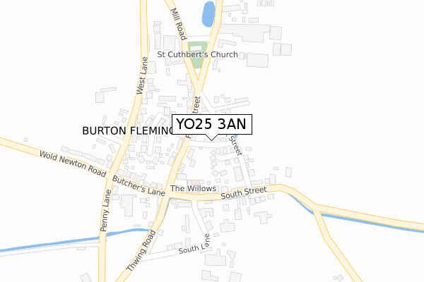
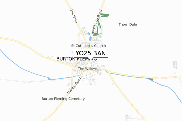
YO25 3AN is located in the East Wolds and Coastal electoral ward, within the unitary authority of East Riding of Yorkshire and the English Parliamentary constituency of East Yorkshire. The Sub Integrated Care Board (ICB) Location is NHS Humber and North Yorkshire ICB - 02Y and the police force is Humberside. This postcode has been in use since August 2018.


GetTheData
Source: OS Open Zoomstack (Ordnance Survey)
Licence: Open Government Licence (requires attribution)
Attribution: Contains OS data © Crown copyright and database right 2024
Source: Open Postcode Geo
Licence: Open Government Licence (requires attribution)
Attribution: Contains OS data © Crown copyright and database right 2024; Contains Royal Mail data © Royal Mail copyright and database right 2024; Source: Office for National Statistics licensed under the Open Government Licence v.3.0
| Easting | 508385 |
| Northing | 472147 |
| Latitude | 54.133768 |
| Longitude | -0.342682 |
GetTheData
Source: Open Postcode Geo
Licence: Open Government Licence
| Country | England |
| Postcode District | YO25 |
| ➜ YO25 open data dashboard ➜ See where YO25 is on a map ➜ Where is Burton Fleming? | |
GetTheData
Source: Land Registry Price Paid Data
Licence: Open Government Licence
| Ward | East Wolds And Coastal |
| Constituency | East Yorkshire |
GetTheData
Source: ONS Postcode Database
Licence: Open Government Licence
HAWTHORN COTTAGE, MILSONS LANE, BURTON FLEMING, DRIFFIELD, YO25 3AN 2020 14 DEC £246,000 |
GetTheData
Source: HM Land Registry Price Paid Data
Licence: Contains HM Land Registry data © Crown copyright and database right 2024. This data is licensed under the Open Government Licence v3.0.
| May 2022 | Vehicle crime | On or near Chapel Court | 54m |
| May 2022 | Violence and sexual offences | On or near School Lane | 93m |
| May 2022 | Violence and sexual offences | On or near School Lane | 93m |
| ➜ Get more crime data in our Crime section | |||
GetTheData
Source: data.police.uk
Licence: Open Government Licence
| Burton Fleming Front Street (Front Street) | Burton Fleming | 118m |
| Hunmanby Station | 4.8km |
GetTheData
Source: NaPTAN
Licence: Open Government Licence
| Percentage of properties with Next Generation Access | 100.0% |
| Percentage of properties with Superfast Broadband | 100.0% |
| Percentage of properties with Ultrafast Broadband | 0.0% |
| Percentage of properties with Full Fibre Broadband | 0.0% |
Superfast Broadband is between 30Mbps and 300Mbps
Ultrafast Broadband is > 300Mbps
| Percentage of properties unable to receive 2Mbps | 0.0% |
| Percentage of properties unable to receive 5Mbps | 0.0% |
| Percentage of properties unable to receive 10Mbps | 0.0% |
| Percentage of properties unable to receive 30Mbps | 0.0% |
GetTheData
Source: Ofcom
Licence: Ofcom Terms of Use (requires attribution)
GetTheData
Source: ONS Postcode Database
Licence: Open Government Licence


➜ Get more ratings from the Food Standards Agency
GetTheData
Source: Food Standards Agency
Licence: FSA terms & conditions
| Last Collection | |||
|---|---|---|---|
| Location | Mon-Fri | Sat | Distance |
| Burton Fleming Post Office | 16:00 | 10:00 | 48m |
| Wold Newton Village | 16:00 | 10:00 | 3,890m |
| Thwing Post Office | 16:00 | 10:00 | 4,078m |
GetTheData
Source: Dracos
Licence: Creative Commons Attribution-ShareAlike
| Facility | Distance |
|---|---|
| Wold Newton Cricket Club Laking Lane, Wold Newton Grass Pitches | 3.6km |
| Wold Newton Foundation School Back Street, Wold Newton, Driffield Grass Pitches | 3.8km |
| Rudston Playing Field Rudston, Driffield Grass Pitches, Outdoor Tennis Courts | 4.3km |
GetTheData
Source: Active Places
Licence: Open Government Licence
| School | Phase of Education | Distance |
|---|---|---|
| Wold Newton Foundation School Back Street, Wold Newton, Driffield, YO25 3YJ | Primary | 3.8km |
GetTheData
Source: Edubase
Licence: Open Government Licence
The below table lists the International Territorial Level (ITL) codes (formerly Nomenclature of Territorial Units for Statistics (NUTS) codes) and Local Administrative Units (LAU) codes for YO25 3AN:
| ITL 1 Code | Name |
|---|---|
| TLE | Yorkshire and The Humber |
| ITL 2 Code | Name |
| TLE1 | East Yorkshire and Northern Lincolnshire |
| ITL 3 Code | Name |
| TLE12 | East Riding of Yorkshire |
| LAU 1 Code | Name |
| E06000011 | East Riding of Yorkshire |
GetTheData
Source: ONS Postcode Directory
Licence: Open Government Licence
The below table lists the Census Output Area (OA), Lower Layer Super Output Area (LSOA), and Middle Layer Super Output Area (MSOA) for YO25 3AN:
| Code | Name | |
|---|---|---|
| OA | E00065511 | |
| LSOA | E01012990 | East Riding of Yorkshire 006B |
| MSOA | E02002689 | East Riding of Yorkshire 006 |
GetTheData
Source: ONS Postcode Directory
Licence: Open Government Licence
| YO25 3PB | Chapel Court | 61m |
| YO25 3PR | Front Street | 70m |
| YO25 3QB | Church Farm Court | 73m |
| YO25 3PD | Back Street | 86m |
| YO25 3PX | School Lane | 112m |
| YO25 3PE | Bridlington Road | 121m |
| YO25 3QA | Byre Way | 124m |
| YO25 3PP | The Crescent | 133m |
| YO25 3NZ | South Street | 174m |
| YO25 3PW | West Lane | 179m |
GetTheData
Source: Open Postcode Geo; Land Registry Price Paid Data
Licence: Open Government Licence