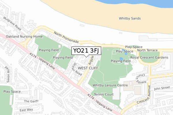
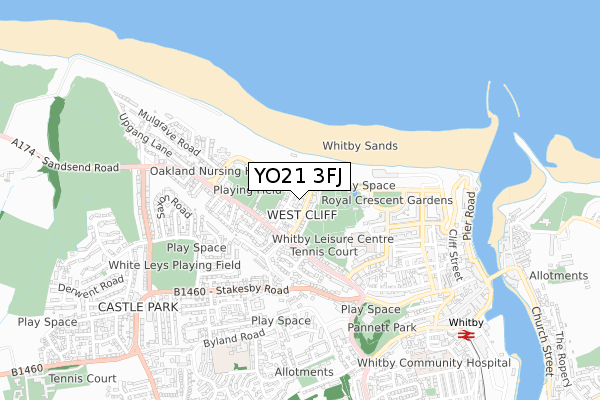
YO21 3FJ is located in the Whitby West electoral ward, within the unitary authority of North Yorkshire and the English Parliamentary constituency of Scarborough and Whitby. The Sub Integrated Care Board (ICB) Location is NHS Humber and North Yorkshire ICB - 42D and the police force is North Yorkshire. This postcode has been in use since January 2020.


GetTheData
Source: OS Open Zoomstack (Ordnance Survey)
Licence: Open Government Licence (requires attribution)
Attribution: Contains OS data © Crown copyright and database right 2024
Source: Open Postcode Geo
Licence: Open Government Licence (requires attribution)
Attribution: Contains OS data © Crown copyright and database right 2024; Contains Royal Mail data © Royal Mail copyright and database right 2024; Source: Office for National Statistics licensed under the Open Government Licence v.3.0
| Easting | 489127 |
| Northing | 511380 |
| Latitude | 54.489952 |
| Longitude | -0.625630 |
GetTheData
Source: Open Postcode Geo
Licence: Open Government Licence
| Country | England |
| Postcode District | YO21 |
| ➜ YO21 open data dashboard ➜ See where YO21 is on a map ➜ Where is Whitby? | |
GetTheData
Source: Land Registry Price Paid Data
Licence: Open Government Licence
| Ward | Whitby West |
| Constituency | Scarborough And Whitby |
GetTheData
Source: ONS Postcode Database
Licence: Open Government Licence
| January 2024 | Vehicle crime | On or near Crescent Avenue | 360m |
| August 2023 | Criminal damage and arson | On or near Park/Open Space | 202m |
| May 2023 | Burglary | On or near Crescent Avenue | 360m |
| ➜ Get more crime data in our Crime section | |||
GetTheData
Source: data.police.uk
Licence: Open Government Licence
| Argyle Road | West Cliff | 125m |
| Argyle Road | West Cliff | 131m |
| North Terrace | West Cliff | 132m |
| North Terrace | West Cliff | 133m |
| Westgate Roundabout (Upgang Lane) | West Cliff | 198m |
| Whitby Station | 0.9km |
| Ruswarp Station | 2.2km |
| Sleights Station | 4km |
GetTheData
Source: NaPTAN
Licence: Open Government Licence
GetTheData
Source: ONS Postcode Database
Licence: Open Government Licence


➜ Get more ratings from the Food Standards Agency
GetTheData
Source: Food Standards Agency
Licence: FSA terms & conditions
| Last Collection | |||
|---|---|---|---|
| Location | Mon-Fri | Sat | Distance |
| North Promenade | 17:15 | 12:15 | 110m |
| 46 Upgang Lane Whitby | 17:15 | 12:15 | 159m |
| 1 Church Square Whitby | 17:30 | 12:45 | 371m |
GetTheData
Source: Dracos
Licence: Creative Commons Attribution-ShareAlike
| Facility | Distance |
|---|---|
| Whitby Cricket Club Upgang Lane, Whitby Grass Pitches | 170m |
| Turnbull Ground Upgang Lane, Whitby Grass Pitches | 178m |
| Whitby Leisure Centre West Cliff, Whitby Sports Hall, Swimming Pool, Health and Fitness Gym, Outdoor Tennis Courts, Studio | 256m |
GetTheData
Source: Active Places
Licence: Open Government Licence
| School | Phase of Education | Distance |
|---|---|---|
| West Cliff Primary School Church Square, Whitby, YO21 3EG | Primary | 343m |
| International Christian Language School for Functional English 5 Chubb Hill Road, High Stakesby, Whitby, YO21 1JU | Not applicable | 578m |
| Stakesby Primary Academy Byland Road, Whitby, YO21 1HY | Primary | 694m |
GetTheData
Source: Edubase
Licence: Open Government Licence
The below table lists the International Territorial Level (ITL) codes (formerly Nomenclature of Territorial Units for Statistics (NUTS) codes) and Local Administrative Units (LAU) codes for YO21 3FJ:
| ITL 1 Code | Name |
|---|---|
| TLE | Yorkshire and The Humber |
| ITL 2 Code | Name |
| TLE2 | North Yorkshire |
| ITL 3 Code | Name |
| TLE22 | North Yorkshire CC |
| LAU 1 Code | Name |
| E07000168 | Scarborough |
GetTheData
Source: ONS Postcode Directory
Licence: Open Government Licence
The below table lists the Census Output Area (OA), Lower Layer Super Output Area (LSOA), and Middle Layer Super Output Area (MSOA) for YO21 3FJ:
| Code | Name | |
|---|---|---|
| OA | E00141988 | |
| LSOA | E01027871 | Scarborough 001E |
| MSOA | E02005795 | Scarborough 001 |
GetTheData
Source: ONS Postcode Directory
Licence: Open Government Licence
| YO21 3HX | Ladysmith Avenue | 29m |
| YO21 3HU | Argyle Road | 42m |
| YO21 3JZ | Welton Court | 52m |
| YO21 3HN | North Promenade | 56m |
| YO21 3HS | Argyle Road | 64m |
| YO21 3HY | Ocean Road | 75m |
| YO21 3HT | Argyle Road | 84m |
| YO21 3HZ | Upgang Lane | 162m |
| YO21 3JX | North Promenade | 166m |
| YO21 3EB | Station Avenue | 235m |
GetTheData
Source: Open Postcode Geo; Land Registry Price Paid Data
Licence: Open Government Licence