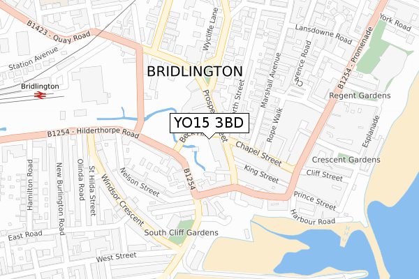
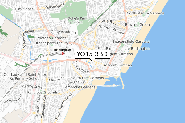
YO15 3BD is located in the Bridlington South electoral ward, within the unitary authority of East Riding of Yorkshire and the English Parliamentary constituency of East Yorkshire. The Sub Integrated Care Board (ICB) Location is NHS Humber and North Yorkshire ICB - 02Y and the police force is Humberside. This postcode has been in use since August 2017.


GetTheData
Source: OS Open Zoomstack (Ordnance Survey)
Licence: Open Government Licence (requires attribution)
Attribution: Contains OS data © Crown copyright and database right 2024
Source: Open Postcode Geo
Licence: Open Government Licence (requires attribution)
Attribution: Contains OS data © Crown copyright and database right 2024; Contains Royal Mail data © Royal Mail copyright and database right 2024; Source: Office for National Statistics licensed under the Open Government Licence v.3.0
| Easting | 518328 |
| Northing | 466737 |
| Latitude | 54.082981 |
| Longitude | -0.192700 |
GetTheData
Source: Open Postcode Geo
Licence: Open Government Licence
| Country | England |
| Postcode District | YO15 |
| ➜ YO15 open data dashboard ➜ See where YO15 is on a map ➜ Where is Bridlington? | |
GetTheData
Source: Land Registry Price Paid Data
Licence: Open Government Licence
| Ward | Bridlington South |
| Constituency | East Yorkshire |
GetTheData
Source: ONS Postcode Database
Licence: Open Government Licence
| January 2024 | Public order | On or near Parking Area | 66m |
| January 2024 | Violence and sexual offences | On or near Parking Area | 142m |
| January 2024 | Violence and sexual offences | On or near Parking Area | 205m |
| ➜ Get more crime data in our Crime section | |||
GetTheData
Source: data.police.uk
Licence: Open Government Licence
| Bridlington Prospect Street (Prospect Street) | Bridlington | 39m |
| Bridlington Hilderthorpe Rd (Hilderthorpe Road) | Bridlington | 92m |
| Bridlington Hilderthorpe Road (Hilderthorpe Road) | Bridlington | 120m |
| Bridlington Queen Street (Queen Street) | Bridlington | 146m |
| Bridlington Prospect Street (Prospect Street) | Bridlington | 148m |
| Bridlington Station | 0.4km |
| Bempton Station | 5km |
GetTheData
Source: NaPTAN
Licence: Open Government Licence
GetTheData
Source: ONS Postcode Database
Licence: Open Government Licence


➜ Get more ratings from the Food Standards Agency
GetTheData
Source: Food Standards Agency
Licence: FSA terms & conditions
| Last Collection | |||
|---|---|---|---|
| Location | Mon-Fri | Sat | Distance |
| Beck Hill | 16:00 | 11:15 | 82m |
| Queen Street | 17:30 | 11:45 | 118m |
| Bridlington Delivery Office | 18:00 | 13:00 | 222m |
GetTheData
Source: Dracos
Licence: Creative Commons Attribution-ShareAlike
| Facility | Distance |
|---|---|
| Elite Muscle And Fitness (Closed) Chapel Street, Bridlington Health and Fitness Gym | 59m |
| Bridlington Leisure World (Closed) Promenade, Bridlington Swimming Pool, Health and Fitness Gym, Studio, Squash Courts, Sports Hall | 458m |
| East Riding Leisure Bridlington Promenade, Bridlington Sports Hall, Health and Fitness Gym, Studio, Squash Courts, Swimming Pool | 458m |
GetTheData
Source: Active Places
Licence: Open Government Licence
| School | Phase of Education | Distance |
|---|---|---|
| Quay Academy Oxford Street, Bridlington, YO16 4LB | Primary | 533m |
| Our Lady and St Peter Catholic Primary School A Catholic Voluntary Academy George Street, Bridlington, YO15 3PS | Primary | 1km |
| Bridlington Nursery School Butts Close, Butts Close, Bridlington, YO16 7BS | Nursery | 1.2km |
GetTheData
Source: Edubase
Licence: Open Government Licence
The below table lists the International Territorial Level (ITL) codes (formerly Nomenclature of Territorial Units for Statistics (NUTS) codes) and Local Administrative Units (LAU) codes for YO15 3BD:
| ITL 1 Code | Name |
|---|---|
| TLE | Yorkshire and The Humber |
| ITL 2 Code | Name |
| TLE1 | East Yorkshire and Northern Lincolnshire |
| ITL 3 Code | Name |
| TLE12 | East Riding of Yorkshire |
| LAU 1 Code | Name |
| E06000011 | East Riding of Yorkshire |
GetTheData
Source: ONS Postcode Directory
Licence: Open Government Licence
The below table lists the Census Output Area (OA), Lower Layer Super Output Area (LSOA), and Middle Layer Super Output Area (MSOA) for YO15 3BD:
| Code | Name | |
|---|---|---|
| OA | E00065303 | |
| LSOA | E01012948 | East Riding of Yorkshire 005C |
| MSOA | E02002688 | East Riding of Yorkshire 005 |
GetTheData
Source: ONS Postcode Directory
Licence: Open Government Licence
| YO15 2AL | Prospect Street | 86m |
| YO15 3AY | Hilderthorpe Road | 110m |
| YO15 3AJ | Bridge Street | 113m |
| YO15 3AZ | Hilderthorpe Road | 128m |
| YO15 3AH | Bridge Street | 137m |
| YO15 2DP | Chapel Street | 144m |
| YO15 2QY | Rope Walk | 149m |
| YO15 2DN | King Street | 154m |
| YO15 2DY | North Street | 155m |
| YO15 2DZ | North Street | 161m |
GetTheData
Source: Open Postcode Geo; Land Registry Price Paid Data
Licence: Open Government Licence