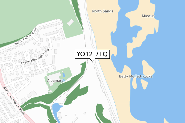
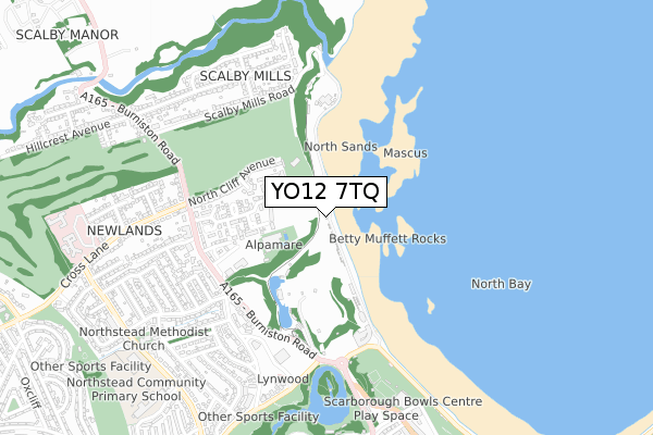
YO12 7TQ is located in the Northstead electoral ward, within the unitary authority of North Yorkshire and the English Parliamentary constituency of Scarborough and Whitby. The Sub Integrated Care Board (ICB) Location is NHS Humber and North Yorkshire ICB - 42D and the police force is North Yorkshire. This postcode has been in use since August 2019.


GetTheData
Source: OS Open Zoomstack (Ordnance Survey)
Licence: Open Government Licence (requires attribution)
Attribution: Contains OS data © Crown copyright and database right 2025
Source: Open Postcode Geo
Licence: Open Government Licence (requires attribution)
Attribution: Contains OS data © Crown copyright and database right 2025; Contains Royal Mail data © Royal Mail copyright and database right 2025; Source: Office for National Statistics licensed under the Open Government Licence v.3.0
| Easting | 503578 |
| Northing | 490226 |
| Latitude | 54.297176 |
| Longitude | -0.409997 |
GetTheData
Source: Open Postcode Geo
Licence: Open Government Licence
| Country | England |
| Postcode District | YO12 |
➜ See where YO12 is on a map ➜ Where is Scarborough? | |
GetTheData
Source: Land Registry Price Paid Data
Licence: Open Government Licence
| Ward | Northstead |
| Constituency | Scarborough And Whitby |
GetTheData
Source: ONS Postcode Database
Licence: Open Government Licence
| Weydale Avenue (Burniston Road) | Peasholm Park | 458m |
| Corner Cafe (Royal Albert Drive) | Peasholm Park | 506m |
| Green Howard's Drive (A165) | Peasholm Park | 519m |
| Cross Lane (Burniston Road) | Peasholm Park | 522m |
| Corner Cafe (Peasholm Gap) | Peasholm Park | 533m |
| Scarborough Station | 2km |
GetTheData
Source: NaPTAN
Licence: Open Government Licence
GetTheData
Source: ONS Postcode Database
Licence: Open Government Licence


➜ Get more ratings from the Food Standards Agency
GetTheData
Source: Food Standards Agency
Licence: FSA terms & conditions
| Last Collection | |||
|---|---|---|---|
| Location | Mon-Fri | Sat | Distance |
| Oakville Avenue | 17:45 | 13:00 | 1,196m |
| 9 Broadway Scarborough | 17:40 | 12:40 | 1,230m |
| Dean Road Post Office | 17:45 | 12:00 | 1,279m |
GetTheData
Source: Dracos
Licence: Creative Commons Attribution-ShareAlike
| Risk of YO12 7TQ flooding from rivers and sea | Low |
| ➜ YO12 7TQ flood map | |
GetTheData
Source: Open Flood Risk by Postcode
Licence: Open Government Licence
The below table lists the International Territorial Level (ITL) codes (formerly Nomenclature of Territorial Units for Statistics (NUTS) codes) and Local Administrative Units (LAU) codes for YO12 7TQ:
| ITL 1 Code | Name |
|---|---|
| TLE | Yorkshire and The Humber |
| ITL 2 Code | Name |
| TLE2 | North Yorkshire |
| ITL 3 Code | Name |
| TLE22 | North Yorkshire CC |
| LAU 1 Code | Name |
| E07000168 | Scarborough |
GetTheData
Source: ONS Postcode Directory
Licence: Open Government Licence
The below table lists the Census Output Area (OA), Lower Layer Super Output Area (LSOA), and Middle Layer Super Output Area (MSOA) for YO12 7TQ:
| Code | Name | |
|---|---|---|
| OA | E00141870 | |
| LSOA | E01027846 | Scarborough 006C |
| MSOA | E02005800 | Scarborough 006 |
GetTheData
Source: ONS Postcode Directory
Licence: Open Government Licence
| YO12 6PE | Green Howards Drive | 209m |
| YO12 6QS | Grenadier Court | 211m |
| YO12 6QR | Guards Court | 253m |
| YO12 6QB | North Cliff Avenue | 275m |
| YO12 6PD | Green Howards Drive | 277m |
| YO12 6QA | North Cliff Avenue | 284m |
| YO12 6PZ | North Cliff Avenue | 299m |
| YO12 6PR | North Cliff Gardens | 303m |
| YO12 6QF | Hussars Court | 310m |
| YO12 6QQ | Cavalry Court | 355m |
GetTheData
Source: Open Postcode Geo; Land Registry Price Paid Data
Licence: Open Government Licence