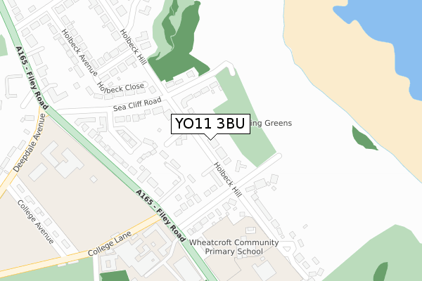
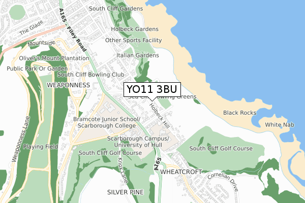
YO11 3BU is located in the Weaponness & Ramshill electoral ward, within the unitary authority of North Yorkshire and the English Parliamentary constituency of Scarborough and Whitby. The Sub Integrated Care Board (ICB) Location is NHS Humber and North Yorkshire ICB - 42D and the police force is North Yorkshire. This postcode has been in use since September 2019.


GetTheData
Source: OS Open Zoomstack (Ordnance Survey)
Licence: Open Government Licence (requires attribution)
Attribution: Contains OS data © Crown copyright and database right 2024
Source: Open Postcode Geo
Licence: Open Government Licence (requires attribution)
Attribution: Contains OS data © Crown copyright and database right 2024; Contains Royal Mail data © Royal Mail copyright and database right 2024; Source: Office for National Statistics licensed under the Open Government Licence v.3.0
| Easting | 504858 |
| Northing | 486680 |
| Latitude | 54.265059 |
| Longitude | -0.391579 |
GetTheData
Source: Open Postcode Geo
Licence: Open Government Licence
| Country | England |
| Postcode District | YO11 |
| ➜ YO11 open data dashboard ➜ See where YO11 is on a map ➜ Where is Scarborough? | |
GetTheData
Source: Land Registry Price Paid Data
Licence: Open Government Licence
| Ward | Weaponness & Ramshill |
| Constituency | Scarborough And Whitby |
GetTheData
Source: ONS Postcode Database
Licence: Open Government Licence
| June 2022 | Violence and sexual offences | On or near Wheatcroft Avenue | 129m |
| June 2022 | Possession of weapons | On or near Chandlers Court | 177m |
| June 2022 | Possession of weapons | On or near Chandlers Court | 177m |
| ➜ Get more crime data in our Crime section | |||
GetTheData
Source: data.police.uk
Licence: Open Government Licence
| Wheatcroft Avenue (Filey Road) | Weaponness | 233m |
| Wheatcroft Avenue (A165) | Weaponness | 235m |
| Wheatcroft School (Holbeck Hill) | Weaponness | 269m |
| Seacliff (Sea Cliff Crescent) | Weaponness | 305m |
| Holbeck Avenue | Weaponness | 311m |
| Scarborough Station | 1.9km |
| Seamer Station | 3.2km |
GetTheData
Source: NaPTAN
Licence: Open Government Licence
| Percentage of properties with Next Generation Access | 100.0% |
| Percentage of properties with Superfast Broadband | 100.0% |
| Percentage of properties with Ultrafast Broadband | 0.0% |
| Percentage of properties with Full Fibre Broadband | 0.0% |
Superfast Broadband is between 30Mbps and 300Mbps
Ultrafast Broadband is > 300Mbps
| Percentage of properties unable to receive 2Mbps | 0.0% |
| Percentage of properties unable to receive 5Mbps | 0.0% |
| Percentage of properties unable to receive 10Mbps | 0.0% |
| Percentage of properties unable to receive 30Mbps | 0.0% |
GetTheData
Source: Ofcom
Licence: Ofcom Terms of Use (requires attribution)
GetTheData
Source: ONS Postcode Database
Licence: Open Government Licence


➜ Get more ratings from the Food Standards Agency
GetTheData
Source: Food Standards Agency
Licence: FSA terms & conditions
| Last Collection | |||
|---|---|---|---|
| Location | Mon-Fri | Sat | Distance |
| College Filey Road | 17:30 | 13:00 | 322m |
| Holbeck Hill | 17:45 | 12:50 | 341m |
| Wheatcroft Post Office | 17:30 | 13:15 | 448m |
GetTheData
Source: Dracos
Licence: Creative Commons Attribution-ShareAlike
| Facility | Distance |
|---|---|
| Wheatcroft Community Primary School Holbeck Hill, Scarborough Grass Pitches | 260m |
| Scarborough Tec Filey Road, Scarborough Grass Pitches, Artificial Grass Pitch | 331m |
| Scarborough College Filey Road, Scarborough Grass Pitches, Sports Hall, Artificial Grass Pitch, Outdoor Tennis Courts | 345m |
GetTheData
Source: Active Places
Licence: Open Government Licence
| School | Phase of Education | Distance |
|---|---|---|
| Wheatcroft Community Primary School Holbeck Hill, Scarborough, YO11 3BW | Primary | 260m |
| St Martin's Church of England Voluntary Aided Primary School, Scarborough Holbeck Hill, Scarborough, YO11 3BW | Primary | 334m |
| Scarborough College Filey Road, Scarborough, YO11 3BA | Not applicable | 343m |
GetTheData
Source: Edubase
Licence: Open Government Licence
The below table lists the International Territorial Level (ITL) codes (formerly Nomenclature of Territorial Units for Statistics (NUTS) codes) and Local Administrative Units (LAU) codes for YO11 3BU:
| ITL 1 Code | Name |
|---|---|
| TLE | Yorkshire and The Humber |
| ITL 2 Code | Name |
| TLE2 | North Yorkshire |
| ITL 3 Code | Name |
| TLE22 | North Yorkshire CC |
| LAU 1 Code | Name |
| E07000168 | Scarborough |
GetTheData
Source: ONS Postcode Directory
Licence: Open Government Licence
The below table lists the Census Output Area (OA), Lower Layer Super Output Area (LSOA), and Middle Layer Super Output Area (MSOA) for YO11 3BU:
| Code | Name | |
|---|---|---|
| OA | E00141977 | |
| LSOA | E01027868 | Scarborough 010E |
| MSOA | E02005804 | Scarborough 010 |
GetTheData
Source: ONS Postcode Directory
Licence: Open Government Licence
| YO11 3BL | Holbeck Hill | 39m |
| YO11 3BJ | Holbeck Hill | 67m |
| YO11 3YE | Abrams View | 113m |
| YO11 2XU | Sea Cliff Road | 149m |
| YO11 2YB | Chandlers Court | 152m |
| YO11 3BN | Wheatcroft Avenue | 160m |
| YO11 2XP | Holbeck Hill | 184m |
| YO11 2YA | Sea Cliff Crescent | 188m |
| YO11 2XZ | Sea Cliff Crescent | 199m |
| YO11 3AY | Filey Road | 200m |
GetTheData
Source: Open Postcode Geo; Land Registry Price Paid Data
Licence: Open Government Licence