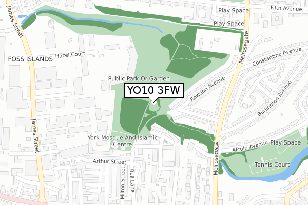
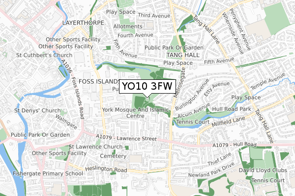
YO10 3FW is located in the Guildhall electoral ward, within the unitary authority of York and the English Parliamentary constituency of York Central. The Sub Integrated Care Board (ICB) Location is NHS Humber and North Yorkshire ICB - 03Q and the police force is North Yorkshire. This postcode has been in use since December 2019.


GetTheData
Source: OS Open Zoomstack (Ordnance Survey)
Licence: Open Government Licence (requires attribution)
Attribution: Contains OS data © Crown copyright and database right 2024
Source: Open Postcode Geo
Licence: Open Government Licence (requires attribution)
Attribution: Contains OS data © Crown copyright and database right 2024; Contains Royal Mail data © Royal Mail copyright and database right 2024; Source: Office for National Statistics licensed under the Open Government Licence v.3.0
| Easting | 461647 |
| Northing | 451678 |
| Latitude | 53.957545 |
| Longitude | -1.062003 |
GetTheData
Source: Open Postcode Geo
Licence: Open Government Licence
| Country | England |
| Postcode District | YO10 |
| ➜ YO10 open data dashboard ➜ See where YO10 is on a map ➜ Where is York? | |
GetTheData
Source: Land Registry Price Paid Data
Licence: Open Government Licence
| Ward | Guildhall |
| Constituency | York Central |
GetTheData
Source: ONS Postcode Database
Licence: Open Government Licence
| January 2024 | Other theft | On or near Olympian Court | 220m |
| January 2024 | Violence and sexual offences | On or near Petrol Station | 413m |
| December 2023 | Shoplifting | On or near Petrol Station | 413m |
| ➜ Get more crime data in our Crime section | |||
GetTheData
Source: data.police.uk
Licence: Open Government Licence
| St Nicholas Fields (Melrosegate) | Tang Hall | 250m |
| St Nicholas Fields (Melrosegate) | Tang Hall | 251m |
| Rawdon Avenue (Melrosegate) | Tang Hall | 259m |
| Rawdon Avenue (Melrosegate) | Tang Hall | 272m |
| Hull Road Park (Alcuin Avenue) | Tang Hall | 293m |
| York Station | 2km |
GetTheData
Source: NaPTAN
Licence: Open Government Licence
GetTheData
Source: ONS Postcode Database
Licence: Open Government Licence


➜ Get more ratings from the Food Standards Agency
GetTheData
Source: Food Standards Agency
Licence: FSA terms & conditions
| Last Collection | |||
|---|---|---|---|
| Location | Mon-Fri | Sat | Distance |
| Melrosegate Post Office | 17:30 | 12:00 | 221m |
| James Street Ind Estate | 17:30 | 421m | |
| 61 Lawrence Street York | 17:30 | 12:00 | 455m |
GetTheData
Source: Dracos
Licence: Creative Commons Attribution-ShareAlike
| Facility | Distance |
|---|---|
| Tang Hall Community Centre Fifth Avenue, York Sports Hall | 376m |
| Hull Road Park Alcuin Avenue, York Outdoor Tennis Courts | 394m |
| Eighth Avenue Playing Fields Eighth Avenue, York Grass Pitches | 510m |
GetTheData
Source: Active Places
Licence: Open Government Licence
| School | Phase of Education | Distance |
|---|---|---|
| St Lawrence's Church of England Primary School Heslington Road, York, YO10 5BW | Primary | 604m |
| Tang Hall Primary Academy Sixth Avenue, York, YO31 0UT | Primary | 633m |
| Heworth Church of England Primary School 53 Heworth Road, York, YO31 0AA | Primary | 1.1km |
GetTheData
Source: Edubase
Licence: Open Government Licence
The below table lists the International Territorial Level (ITL) codes (formerly Nomenclature of Territorial Units for Statistics (NUTS) codes) and Local Administrative Units (LAU) codes for YO10 3FW:
| ITL 1 Code | Name |
|---|---|
| TLE | Yorkshire and The Humber |
| ITL 2 Code | Name |
| TLE2 | North Yorkshire |
| ITL 3 Code | Name |
| TLE21 | York |
| LAU 1 Code | Name |
| E06000014 | York |
GetTheData
Source: ONS Postcode Directory
Licence: Open Government Licence
The below table lists the Census Output Area (OA), Lower Layer Super Output Area (LSOA), and Middle Layer Super Output Area (MSOA) for YO10 3FW:
| Code | Name | |
|---|---|---|
| OA | E00170133 | |
| LSOA | E01033067 | York 013F |
| MSOA | E02002784 | York 013 |
GetTheData
Source: ONS Postcode Directory
Licence: Open Government Licence
| YO10 3SU | Harington Avenue | 139m |
| YO10 3UL | Olympian Court | 153m |
| YO10 3ST | Rawdon Avenue | 155m |
| YO10 3UG | Olympian Court | 172m |
| YO10 3EN | Bull Lane | 193m |
| YO10 3UP | Olympian Court | 205m |
| YO10 3UN | Olympian Court | 206m |
| YO10 3SP | Melrosegate | 215m |
| YO10 3UE | Olympian Court | 216m |
| YO10 3EW | Bull Lane | 219m |
GetTheData
Source: Open Postcode Geo; Land Registry Price Paid Data
Licence: Open Government Licence