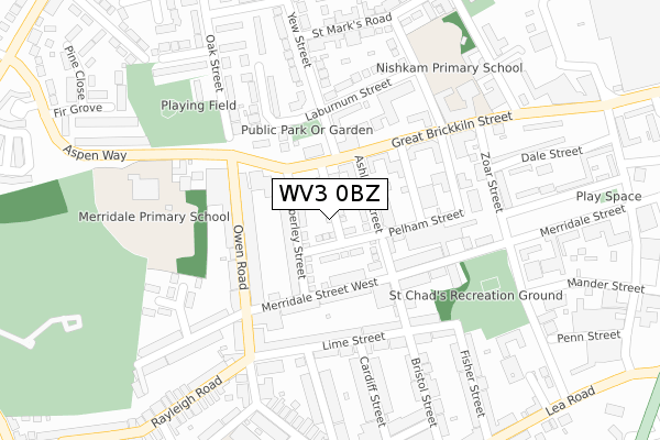
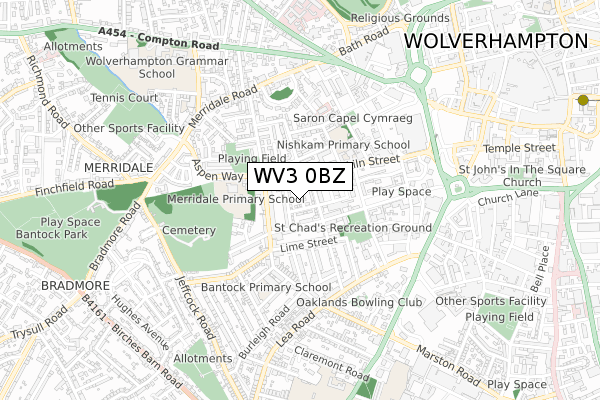
WV3 0BZ is located in the Graiseley electoral ward, within the metropolitan district of Wolverhampton and the English Parliamentary constituency of Wolverhampton South West. The Sub Integrated Care Board (ICB) Location is NHS Black Country ICB - D2P2L and the police force is West Midlands. This postcode has been in use since October 2019.


GetTheData
Source: OS Open Zoomstack (Ordnance Survey)
Licence: Open Government Licence (requires attribution)
Attribution: Contains OS data © Crown copyright and database right 2024
Source: Open Postcode Geo
Licence: Open Government Licence (requires attribution)
Attribution: Contains OS data © Crown copyright and database right 2024; Contains Royal Mail data © Royal Mail copyright and database right 2024; Source: Office for National Statistics licensed under the Open Government Licence v.3.0
| Easting | 390477 |
| Northing | 298054 |
| Latitude | 52.580228 |
| Longitude | -2.141963 |
GetTheData
Source: Open Postcode Geo
Licence: Open Government Licence
| Country | England |
| Postcode District | WV3 |
| ➜ WV3 open data dashboard ➜ See where WV3 is on a map ➜ Where is Wolverhampton? | |
GetTheData
Source: Land Registry Price Paid Data
Licence: Open Government Licence
| Ward | Graiseley |
| Constituency | Wolverhampton South West |
GetTheData
Source: ONS Postcode Database
Licence: Open Government Licence
26, ELIAS MATTU AVENUE, WOLVERHAMPTON, WV3 0BZ 2020 15 JAN £225,000 |
16, ELIAS MATTU AVENUE, WOLVERHAMPTON, WV3 0BZ 2019 6 DEC £235,000 |
21, ELIAS MATTU AVENUE, WOLVERHAMPTON, WV3 0BZ 2019 7 NOV £232,500 |
GetTheData
Source: HM Land Registry Price Paid Data
Licence: Contains HM Land Registry data © Crown copyright and database right 2024. This data is licensed under the Open Government Licence v3.0.
| November 2023 | Criminal damage and arson | On or near Russell Street | 356m |
| November 2023 | Robbery | On or near Russell Street | 356m |
| November 2023 | Public order | On or near Oak Street | 400m |
| ➜ Get more crime data in our Crime section | |||
GetTheData
Source: data.police.uk
Licence: Open Government Licence
| Kimberley St (Great Brickiln St) | Bradmore | 109m |
| Kimberley St (Great Brickiln St) | Bradmore | 119m |
| Ashland St (Great Brickiln St) | Bradmore | 128m |
| Merridale Primary School (Owen Rd) | Bradmore | 168m |
| Ashland St (Great Brickiln St) | Bradmore | 176m |
| Wolverhampton St George's (Midland Metro Stop) (Bilston St) | Wolverhampton | 1,276m |
| Wolverhampton Station | 1.7km |
| Coseley Station | 5.5km |
| Bilbrook Station | 5.7km |
GetTheData
Source: NaPTAN
Licence: Open Government Licence
| Percentage of properties with Next Generation Access | 100.0% |
| Percentage of properties with Superfast Broadband | 100.0% |
| Percentage of properties with Ultrafast Broadband | 100.0% |
| Percentage of properties with Full Fibre Broadband | 0.0% |
Superfast Broadband is between 30Mbps and 300Mbps
Ultrafast Broadband is > 300Mbps
| Percentage of properties unable to receive 2Mbps | 0.0% |
| Percentage of properties unable to receive 5Mbps | 0.0% |
| Percentage of properties unable to receive 10Mbps | 0.0% |
| Percentage of properties unable to receive 30Mbps | 0.0% |
GetTheData
Source: Ofcom
Licence: Ofcom Terms of Use (requires attribution)
GetTheData
Source: ONS Postcode Database
Licence: Open Government Licence


➜ Get more ratings from the Food Standards Agency
GetTheData
Source: Food Standards Agency
Licence: FSA terms & conditions
| Last Collection | |||
|---|---|---|---|
| Location | Mon-Fri | Sat | Distance |
| Great Brickkiln Street | 17:30 | 13:00 | 109m |
| St Marks Road | 17:30 | 12:00 | 332m |
| Oak Street | 17:30 | 12:00 | 495m |
GetTheData
Source: Dracos
Licence: Creative Commons Attribution-ShareAlike
| Facility | Distance |
|---|---|
| Firewalker Fitness And Martial Arts Salisbury Street, Wolverhampton Health and Fitness Gym, Studio | 227m |
| Merridale Primary School Aspen Way, Aspen Way, Wolverhampton Grass Pitches | 286m |
| Wolverhampton Electricity Sport & Social Club St. Marks Road, Wolverhampton Sports Hall | 494m |
GetTheData
Source: Active Places
Licence: Open Government Licence
| School | Phase of Education | Distance |
|---|---|---|
| Nishkam Primary School Wolverhampton Great Brickkiln Street, Wolverhampton, WV3 0PR | Primary | 241m |
| Merridale Primary School Aspen Way, Wolverhampton, WV3 0UP | Primary | 286m |
| Bantock Primary School Aston Street, Penn Fields, Wolverhampton, WV3 0HY | Primary | 376m |
GetTheData
Source: Edubase
Licence: Open Government Licence
The below table lists the International Territorial Level (ITL) codes (formerly Nomenclature of Territorial Units for Statistics (NUTS) codes) and Local Administrative Units (LAU) codes for WV3 0BZ:
| ITL 1 Code | Name |
|---|---|
| TLG | West Midlands (England) |
| ITL 2 Code | Name |
| TLG3 | West Midlands |
| ITL 3 Code | Name |
| TLG39 | Wolverhampton |
| LAU 1 Code | Name |
| E08000031 | Wolverhampton |
GetTheData
Source: ONS Postcode Directory
Licence: Open Government Licence
The below table lists the Census Output Area (OA), Lower Layer Super Output Area (LSOA), and Middle Layer Super Output Area (MSOA) for WV3 0BZ:
| Code | Name | |
|---|---|---|
| OA | E00052867 | |
| LSOA | E01010470 | Wolverhampton 020E |
| MSOA | E02002168 | Wolverhampton 020 |
GetTheData
Source: ONS Postcode Directory
Licence: Open Government Licence
| WV3 0BP | Kimberley Street | 74m |
| WV3 0BN | Ashland Street | 94m |
| WV3 0PU | Great Brickkiln Street | 115m |
| WV3 0RW | Merridale Street West | 124m |
| WV3 0AJ | Owen Road | 128m |
| WV3 0DF | Melbury Close | 149m |
| WV3 0BJ | Pelham Street | 152m |
| WV3 0AL | Owen Road | 157m |
| WV3 0RJ | Merridale Street West | 170m |
| WV3 0EX | Lime Street | 177m |
GetTheData
Source: Open Postcode Geo; Land Registry Price Paid Data
Licence: Open Government Licence