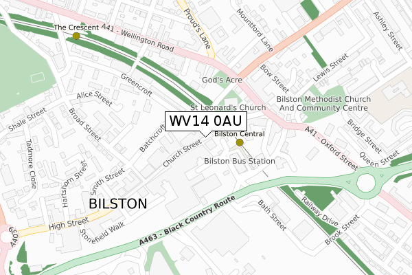
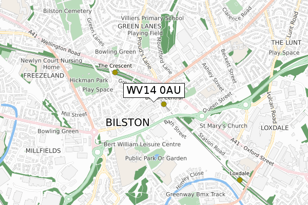
WV14 0AU is located in the Bilston South electoral ward, within the metropolitan district of Wolverhampton and the English Parliamentary constituency of Wolverhampton South East. The Sub Integrated Care Board (ICB) Location is NHS Black Country ICB - D2P2L and the police force is West Midlands. This postcode has been in use since September 2019.


GetTheData
Source: OS Open Zoomstack (Ordnance Survey)
Licence: Open Government Licence (requires attribution)
Attribution: Contains OS data © Crown copyright and database right 2024
Source: Open Postcode Geo
Licence: Open Government Licence (requires attribution)
Attribution: Contains OS data © Crown copyright and database right 2024; Contains Royal Mail data © Royal Mail copyright and database right 2024; Source: Office for National Statistics licensed under the Open Government Licence v.3.0
| Easting | 394997 |
| Northing | 295847 |
| Latitude | 52.560449 |
| Longitude | -2.075225 |
GetTheData
Source: Open Postcode Geo
Licence: Open Government Licence
| Country | England |
| Postcode District | WV14 |
| ➜ WV14 open data dashboard ➜ See where WV14 is on a map ➜ Where is Bilston? | |
GetTheData
Source: Land Registry Price Paid Data
Licence: Open Government Licence
| Ward | Bilston South |
| Constituency | Wolverhampton South East |
GetTheData
Source: ONS Postcode Database
Licence: Open Government Licence
| January 2024 | Criminal damage and arson | On or near Carder Crescent | 247m |
| December 2023 | Violence and sexual offences | On or near Carder Crescent | 247m |
| December 2023 | Criminal damage and arson | On or near Carder Crescent | 247m |
| ➜ Get more crime data in our Crime section | |||
GetTheData
Source: data.police.uk
Licence: Open Government Licence
| Carder Crescent (Dudley St) | Bilston | 62m |
| Carder Crescent (Dudley St) | Bilston | 66m |
| Bankfield Road (Nettlefolds Way) | Bilston | 218m |
| Bankfield Road (Nettlefolds Way) | Bilston | 239m |
| Pickwick Place (Dudley St) | Bradley | 288m |
| Bilston Central (Midland Metro Stop) (Church St) | Bilston | 599m |
| Loxdale (Midland Metro Stop) (Loxdale St) | Bradley | 663m |
| The Crescent (Midland Metro Stop) (The Crescent) | Bilston | 915m |
| Bradley Lane (Midland Metro Stop) (Bradley Lane) | Lower Bradley | 1,326m |
| Coseley Station | 1.9km |
| Tipton Station | 3.4km |
| Wolverhampton Station | 4.3km |
GetTheData
Source: NaPTAN
Licence: Open Government Licence
GetTheData
Source: ONS Postcode Database
Licence: Open Government Licence


➜ Get more ratings from the Food Standards Agency
GetTheData
Source: Food Standards Agency
Licence: FSA terms & conditions
| Last Collection | |||
|---|---|---|---|
| Location | Mon-Fri | Sat | Distance |
| High Street Post Office | 19:00 | 11:45 | 526m |
| Mount Pleasant | 18:30 | 11:30 | 886m |
| Wellington Road | 16:45 | 11:15 | 887m |
GetTheData
Source: Dracos
Licence: Creative Commons Attribution-ShareAlike
| Facility | Distance |
|---|---|
| Loxdale Primary School Dudley Street, Bilston Grass Pitches | 0m |
| Ormiston Swb Academy Dudley Street, Bilston Studio, Artificial Grass Pitch, Grass Pitches | 256m |
| Wv Active Bilston (Bert Williams Leisure Centre) Nettlefolds Way, Bilston Health and Fitness Gym, Swimming Pool, Squash Courts, Sports Hall, Studio | 320m |
GetTheData
Source: Active Places
Licence: Open Government Licence
| School | Phase of Education | Distance |
|---|---|---|
| Loxdale Primary School Dudley Street, Bilston, WV14 0AU | Primary | 80m |
| Ormiston SWB Academy Dudley Street, Bilston, WV14 0LN | Secondary | 270m |
| Bilston Nursery School Wolverhampton Street, Bilston, WV14 0LT | Nursery | 743m |
GetTheData
Source: Edubase
Licence: Open Government Licence
The below table lists the International Territorial Level (ITL) codes (formerly Nomenclature of Territorial Units for Statistics (NUTS) codes) and Local Administrative Units (LAU) codes for WV14 0AU:
| ITL 1 Code | Name |
|---|---|
| TLG | West Midlands (England) |
| ITL 2 Code | Name |
| TLG3 | West Midlands |
| ITL 3 Code | Name |
| TLG39 | Wolverhampton |
| LAU 1 Code | Name |
| E08000031 | Wolverhampton |
GetTheData
Source: ONS Postcode Directory
Licence: Open Government Licence
The below table lists the Census Output Area (OA), Lower Layer Super Output Area (LSOA), and Middle Layer Super Output Area (MSOA) for WV14 0AU:
| Code | Name | |
|---|---|---|
| OA | E00052584 | |
| LSOA | E01010410 | Wolverhampton 033A |
| MSOA | E02002181 | Wolverhampton 033 |
GetTheData
Source: ONS Postcode Directory
Licence: Open Government Licence
| WV14 0JS | Carder Crescent | 194m |
| WV14 0LJ | Himley Close | 196m |
| WV14 0JR | Carder Crescent | 207m |
| WV14 0LA | Dudley Street | 224m |
| WV14 0LL | Himley Close | 255m |
| WV14 0LB | Pickwick Place | 293m |
| WV14 0JT | Carder Crescent | 306m |
| WV14 0AL | Greenway Road | 337m |
| WV14 0LG | Highfields Avenue | 344m |
| WV14 0QE | Linton Croft | 356m |
GetTheData
Source: Open Postcode Geo; Land Registry Price Paid Data
Licence: Open Government Licence