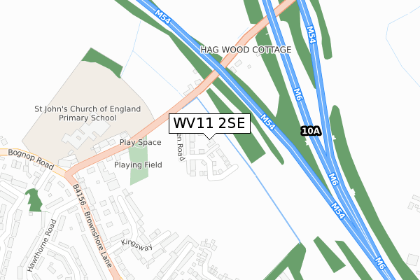
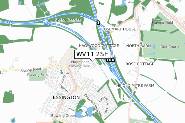
WV11 2SE is located in the Essington electoral ward, within the local authority district of South Staffordshire and the English Parliamentary constituency of South Staffordshire. The Sub Integrated Care Board (ICB) Location is NHS Staffordshire and Stoke-on-Trent ICB - 04Y and the police force is Staffordshire. This postcode has been in use since December 2019.


GetTheData
Source: OS Open Zoomstack (Ordnance Survey)
Licence: Open Government Licence (requires attribution)
Attribution: Contains OS data © Crown copyright and database right 2024
Source: Open Postcode Geo
Licence: Open Government Licence (requires attribution)
Attribution: Contains OS data © Crown copyright and database right 2024; Contains Royal Mail data © Royal Mail copyright and database right 2024; Source: Office for National Statistics licensed under the Open Government Licence v.3.0
| Easting | 396448 |
| Northing | 303790 |
| Latitude | 52.631867 |
| Longitude | -2.053909 |
GetTheData
Source: Open Postcode Geo
Licence: Open Government Licence
| Country | England |
| Postcode District | WV11 |
| ➜ WV11 open data dashboard ➜ See where WV11 is on a map ➜ Where is Essington? | |
GetTheData
Source: Land Registry Price Paid Data
Licence: Open Government Licence
| Ward | Essington |
| Constituency | South Staffordshire |
GetTheData
Source: ONS Postcode Database
Licence: Open Government Licence
| October 2023 | Violence and sexual offences | On or near Hollybank Avenue | 488m |
| August 2022 | Violence and sexual offences | On or near Hollybank Avenue | 488m |
| June 2022 | Vehicle crime | On or near The Gables | 333m |
| ➜ Get more crime data in our Crime section | |||
GetTheData
Source: data.police.uk
Licence: Open Government Licence
| St Johns Primary School (Hobnock Rd) | Essington | 229m |
| St Johns Primary School (Hobnock Rd) | Essington | 231m |
| The Gables (Brownshore Lane) | Essington | 344m |
| The Gables (Brownshore Lane) | Essington | 350m |
| Hill Street (Hawthorne Road Link) | Essington | 551m |
| Bloxwich North Station | 2.6km |
| Bloxwich Station | 3.2km |
| Landywood Station | 3.5km |
GetTheData
Source: NaPTAN
Licence: Open Government Licence
GetTheData
Source: ONS Postcode Database
Licence: Open Government Licence


➜ Get more ratings from the Food Standards Agency
GetTheData
Source: Food Standards Agency
Licence: FSA terms & conditions
| Last Collection | |||
|---|---|---|---|
| Location | Mon-Fri | Sat | Distance |
| Ashmore Park Post Office | 17:15 | 12:00 | 2,056m |
| Pershore Road | 16:00 | 11:30 | 2,297m |
| New Invention Post Office | 17:15 | 12:00 | 2,456m |
GetTheData
Source: Dracos
Licence: Creative Commons Attribution-ShareAlike
| Facility | Distance |
|---|---|
| St John's Primary Academy Hobnock Road, Essington, Wolverhampton Grass Pitches | 291m |
| Willenhall Rufc Bognop Road, Bognop Road, Essington, Wolverhampton Grass Pitches | 708m |
| Essington Rufc High Hill, High Hill, Essington, Wolverhampton Grass Pitches | 969m |
GetTheData
Source: Active Places
Licence: Open Government Licence
| School | Phase of Education | Distance |
|---|---|---|
| St John's Primary Academy Hobnock Road, Essington, Wolverhampton, WV11 2RF | Primary | 292m |
| St Alban's Church of England Primary Academy St. Albans Close, Ashmore Park, Wolverhampton, WV11 2PF | Primary | 1.8km |
| Corpus Christi Catholic Primary Academy Ashmore Avenue, Ashmore Park, Wednesfield, Wolverhampton, WV11 2LT | Primary | 1.9km |
GetTheData
Source: Edubase
Licence: Open Government Licence
The below table lists the International Territorial Level (ITL) codes (formerly Nomenclature of Territorial Units for Statistics (NUTS) codes) and Local Administrative Units (LAU) codes for WV11 2SE:
| ITL 1 Code | Name |
|---|---|
| TLG | West Midlands (England) |
| ITL 2 Code | Name |
| TLG2 | Shropshire and Staffordshire |
| ITL 3 Code | Name |
| TLG24 | Staffordshire CC |
| LAU 1 Code | Name |
| E07000196 | South Staffordshire |
GetTheData
Source: ONS Postcode Directory
Licence: Open Government Licence
The below table lists the Census Output Area (OA), Lower Layer Super Output Area (LSOA), and Middle Layer Super Output Area (MSOA) for WV11 2SE:
| Code | Name | |
|---|---|---|
| OA | E00150981 | |
| LSOA | E01029633 | South Staffordshire 007B |
| MSOA | E02006180 | South Staffordshire 007 |
GetTheData
Source: ONS Postcode Directory
Licence: Open Government Licence
| WV11 2RF | Hobnock Road | 203m |
| WV11 2AJ | Forrest Avenue | 277m |
| WV11 2AH | Kingsway | 291m |
| WV11 2BF | The Gables | 309m |
| WV11 2AL | Brownshore Lane | 325m |
| WV11 2AX | Kingsway Terrace | 327m |
| WV11 2BR | Hough Way | 336m |
| WV11 2DH | Elmwood Avenue | 355m |
| WV11 2DT | Birchwood Close | 427m |
| WV11 2DJ | Rowan Drive | 438m |
GetTheData
Source: Open Postcode Geo; Land Registry Price Paid Data
Licence: Open Government Licence