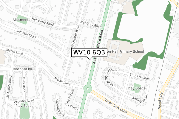
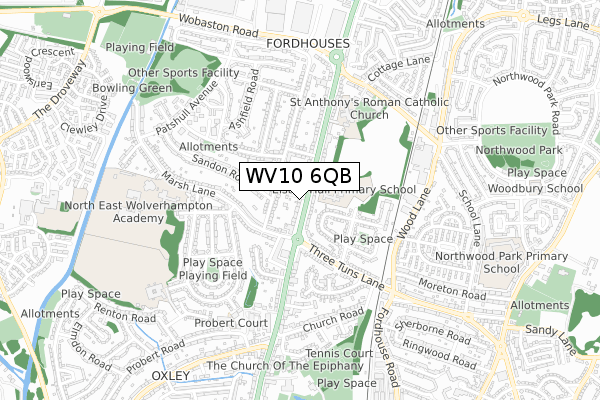
WV10 6QB is located in the Bushbury North electoral ward, within the metropolitan district of Wolverhampton and the English Parliamentary constituency of Wolverhampton North East. The Sub Integrated Care Board (ICB) Location is NHS Black Country ICB - D2P2L and the police force is West Midlands. This postcode has been in use since September 2018.


GetTheData
Source: OS Open Zoomstack (Ordnance Survey)
Licence: Open Government Licence (requires attribution)
Attribution: Contains OS data © Crown copyright and database right 2024
Source: Open Postcode Geo
Licence: Open Government Licence (requires attribution)
Attribution: Contains OS data © Crown copyright and database right 2024; Contains Royal Mail data © Royal Mail copyright and database right 2024; Source: Office for National Statistics licensed under the Open Government Licence v.3.0
| Easting | 391351 |
| Northing | 302771 |
| Latitude | 52.622648 |
| Longitude | -2.129191 |
GetTheData
Source: Open Postcode Geo
Licence: Open Government Licence
| Country | England |
| Postcode District | WV10 |
| ➜ WV10 open data dashboard ➜ See where WV10 is on a map | |
GetTheData
Source: Land Registry Price Paid Data
Licence: Open Government Licence
| Ward | Bushbury North |
| Constituency | Wolverhampton North East |
GetTheData
Source: ONS Postcode Database
Licence: Open Government Licence
| December 2023 | Violence and sexual offences | On or near Parking Area | 180m |
| December 2023 | Violence and sexual offences | On or near Parking Area | 223m |
| November 2023 | Anti-social behaviour | On or near Parking Area | 180m |
| ➜ Get more crime data in our Crime section | |||
GetTheData
Source: data.police.uk
Licence: Open Government Licence
| St Annes Rd (Marsh Lane) | Oxley | 224m |
| Newbury Rd (Stafford Rd) | Fordhouses | 225m |
| Stafford Rd (Three Tuns Lane) | Oxley | 230m |
| St Annes Rd (Marsh Lane) | Oxley | 245m |
| Stafford Rd (Three Tuns Lane) | Oxley | 248m |
| Bilbrook Station | 3.9km |
| Wolverhampton Station | 3.9km |
| Codsall Station | 4.9km |
GetTheData
Source: NaPTAN
Licence: Open Government Licence
GetTheData
Source: ONS Postcode Database
Licence: Open Government Licence


➜ Get more ratings from the Food Standards Agency
GetTheData
Source: Food Standards Agency
Licence: FSA terms & conditions
| Last Collection | |||
|---|---|---|---|
| Location | Mon-Fri | Sat | Distance |
| Hampton Road | 17:15 | 12:15 | 158m |
| Marsh Lane | 17:00 | 13:00 | 295m |
| Oxley Post Office | 18:00 | 12:15 | 386m |
GetTheData
Source: Dracos
Licence: Creative Commons Attribution-ShareAlike
| Facility | Distance |
|---|---|
| Bee Lane Playing Field Bee Lane, Wolverhampton Grass Pitches | 422m |
| Ormiston New Academy Marsh Lane, Wolverhampton Sports Hall, Grass Pitches, Outdoor Tennis Courts, Artificial Grass Pitch | 694m |
| Rakegate Primary School Rakegate Close, Wolverhampton Grass Pitches | 701m |
GetTheData
Source: Active Places
Licence: Open Government Licence
| School | Phase of Education | Distance |
|---|---|---|
| Elston Hall Primary School Stafford Road, Fordhouses, Wolverhampton, WV10 6NN | Primary | 124m |
| St Anthony's Catholic Primary Academy Stafford Road, Fordhouses, Wolverhampton, WV10 6NW | Primary | 418m |
| Ormiston NEW Academy Marsh Lane, Fordhouses, Wolverhampton, WV10 6SE | Secondary | 565m |
GetTheData
Source: Edubase
Licence: Open Government Licence
The below table lists the International Territorial Level (ITL) codes (formerly Nomenclature of Territorial Units for Statistics (NUTS) codes) and Local Administrative Units (LAU) codes for WV10 6QB:
| ITL 1 Code | Name |
|---|---|
| TLG | West Midlands (England) |
| ITL 2 Code | Name |
| TLG3 | West Midlands |
| ITL 3 Code | Name |
| TLG39 | Wolverhampton |
| LAU 1 Code | Name |
| E08000031 | Wolverhampton |
GetTheData
Source: ONS Postcode Directory
Licence: Open Government Licence
The below table lists the Census Output Area (OA), Lower Layer Super Output Area (LSOA), and Middle Layer Super Output Area (MSOA) for WV10 6QB:
| Code | Name | |
|---|---|---|
| OA | E00053027 | |
| LSOA | E01010499 | Wolverhampton 002C |
| MSOA | E02002150 | Wolverhampton 002 |
GetTheData
Source: ONS Postcode Directory
Licence: Open Government Licence
| WV10 6QE | Stafford Road | 0m |
| WV10 6QH | Penkridge Gardens | 67m |
| WV10 6NN | Stafford Road | 88m |
| WV10 6EJ | Winchester Road | 94m |
| WV10 6EW | Winchester Road | 142m |
| WV10 6EH | Winchester Road | 147m |
| WV10 6BQ | Browning Crescent | 170m |
| WV10 6BB | Three Tuns Lane | 212m |
| WV10 6BA | Three Tuns Parade | 213m |
| WV10 6ED | Danbury Gardens | 214m |
GetTheData
Source: Open Postcode Geo; Land Registry Price Paid Data
Licence: Open Government Licence