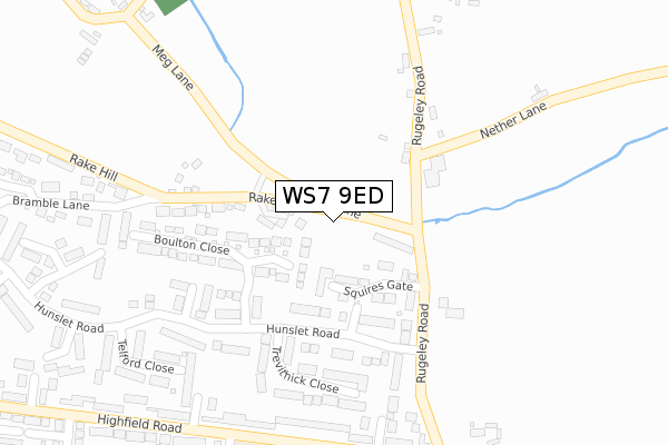
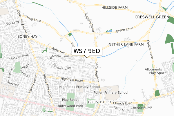
WS7 9ED is located in the Highfield electoral ward, within the local authority district of Lichfield and the English Parliamentary constituency of Lichfield. The Sub Integrated Care Board (ICB) Location is NHS Staffordshire and Stoke-on-Trent ICB - 05Q and the police force is Staffordshire. This postcode has been in use since April 2020.


GetTheData
Source: OS Open Zoomstack (Ordnance Survey)
Licence: Open Government Licence (requires attribution)
Attribution: Contains OS data © Crown copyright and database right 2024
Source: Open Postcode Geo
Licence: Open Government Licence (requires attribution)
Attribution: Contains OS data © Crown copyright and database right 2024; Contains Royal Mail data © Royal Mail copyright and database right 2024; Source: Office for National Statistics licensed under the Open Government Licence v.3.0
| Easting | 406319 |
| Northing | 309738 |
| Latitude | 52.685315 |
| Longitude | -1.907952 |
GetTheData
Source: Open Postcode Geo
Licence: Open Government Licence
| Country | England |
| Postcode District | WS7 |
| ➜ WS7 open data dashboard ➜ See where WS7 is on a map ➜ Where is Burntwood? | |
GetTheData
Source: Land Registry Price Paid Data
Licence: Open Government Licence
| Ward | Highfield |
| Constituency | Lichfield |
GetTheData
Source: ONS Postcode Database
Licence: Open Government Licence
2, FALLOW DRIVE, BURNTWOOD, WS7 9ED 2021 21 SEP £777,500 |
3, FALLOW DRIVE, BURNTWOOD, WS7 9ED 2021 18 JUN £650,000 |
1, FALLOW DRIVE, BURNTWOOD, WS7 9ED 2021 2 MAR £775,000 |
4, FALLOW DRIVE, BURNTWOOD, WS7 9ED 2021 29 JAN £760,000 |
5, FALLOW DRIVE, BURNTWOOD, WS7 9ED 2020 11 DEC £775,000 |
6, FALLOW DRIVE, BURNTWOOD, WS7 9ED 2020 27 NOV £765,000 |
BLACKWOOD COTTAGE, 8, FALLOW DRIVE, BURNTWOOD, WS7 9ED 2020 1 OCT £765,000 |
7, FALLOW DRIVE, BURNTWOOD, WS7 9ED 2020 17 SEP £795,000 |
GetTheData
Source: HM Land Registry Price Paid Data
Licence: Contains HM Land Registry data © Crown copyright and database right 2024. This data is licensed under the Open Government Licence v3.0.
| June 2022 | Burglary | On or near Boulton Close | 201m |
| May 2022 | Violence and sexual offences | On or near Squires Gate | 87m |
| May 2022 | Anti-social behaviour | On or near Browning Road | 470m |
| ➜ Get more crime data in our Crime section | |||
GetTheData
Source: data.police.uk
Licence: Open Government Licence
| Keble Close (Highfield Road) | Burntwood | 323m |
| Keble Close (Highfield Road) | Burntwood | 368m |
| Hunter Avenue (Highfield Road) | Burntwood | 426m |
| Hunter Avenue (Highfield Road) | Burntwood | 458m |
| Highfields (Highfield Road) | Burntwood | 600m |
GetTheData
Source: NaPTAN
Licence: Open Government Licence
GetTheData
Source: ONS Postcode Database
Licence: Open Government Licence


➜ Get more ratings from the Food Standards Agency
GetTheData
Source: Food Standards Agency
Licence: FSA terms & conditions
| Last Collection | |||
|---|---|---|---|
| Location | Mon-Fri | Sat | Distance |
| Chase Road | 17:00 | 11:00 | 839m |
| Lichfield Road | 16:30 | 10:45 | 1,642m |
| Sankeys Corner Post Office | 18:00 | 11:45 | 1,889m |
GetTheData
Source: Dracos
Licence: Creative Commons Attribution-ShareAlike
| Facility | Distance |
|---|---|
| Fulfen Primary School Rugeley Road, Burntwood Grass Pitches | 526m |
| Burntwood Memorial Park Rugeley Road, Burntwood Grass Pitches | 606m |
| Springhill Academy Mossbank Avenue, Burntwood Grass Pitches | 1.2km |
GetTheData
Source: Active Places
Licence: Open Government Licence
| School | Phase of Education | Distance |
|---|---|---|
| Highfields Primary Academy Elder Lane, Burntwood, WS7 9BT | Primary | 447m |
| Fulfen Primary School Rugeley Road, Fulfen Cp School, Burntwood, WS7 9BJ | Primary | 523m |
| Springhill Primary Academy Mossbank Avenue, Chasetown, Burntwood, WS7 4UN | Primary | 1.2km |
GetTheData
Source: Edubase
Licence: Open Government Licence
The below table lists the International Territorial Level (ITL) codes (formerly Nomenclature of Territorial Units for Statistics (NUTS) codes) and Local Administrative Units (LAU) codes for WS7 9ED:
| ITL 1 Code | Name |
|---|---|
| TLG | West Midlands (England) |
| ITL 2 Code | Name |
| TLG2 | Shropshire and Staffordshire |
| ITL 3 Code | Name |
| TLG24 | Staffordshire CC |
| LAU 1 Code | Name |
| E07000194 | Lichfield |
GetTheData
Source: ONS Postcode Directory
Licence: Open Government Licence
The below table lists the Census Output Area (OA), Lower Layer Super Output Area (LSOA), and Middle Layer Super Output Area (MSOA) for WS7 9ED:
| Code | Name | |
|---|---|---|
| OA | E00150356 | |
| LSOA | E01029507 | Lichfield 003B |
| MSOA | E02006148 | Lichfield 003 |
GetTheData
Source: ONS Postcode Directory
Licence: Open Government Licence
| WS7 9DG | Squires Gate | 67m |
| WS7 9DQ | Rake Hill | 167m |
| WS7 9BN | Rugeley Road | 177m |
| WS7 9LD | Boulton Close | 187m |
| WS7 9BW | Rugeley Road | 204m |
| WS7 9LB | Trevithick Close | 208m |
| WS7 9HA | Rugeley Road | 226m |
| WS7 9LH | Metcalf Close | 254m |
| WS7 9BP | Wentworth Close | 280m |
| WS7 9BS | Highfield Road | 287m |
GetTheData
Source: Open Postcode Geo; Land Registry Price Paid Data
Licence: Open Government Licence