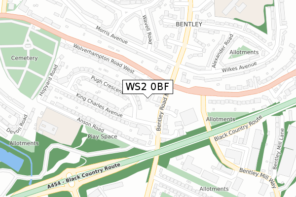
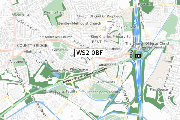
WS2 0BF is located in the Bentley and Darlaston North electoral ward, within the metropolitan district of Walsall and the English Parliamentary constituency of Walsall South. The Sub Integrated Care Board (ICB) Location is NHS Black Country ICB - D2P2L and the police force is West Midlands. This postcode has been in use since July 2018.


GetTheData
Source: OS Open Zoomstack (Ordnance Survey)
Licence: Open Government Licence (requires attribution)
Attribution: Contains OS data © Crown copyright and database right 2024
Source: Open Postcode Geo
Licence: Open Government Licence (requires attribution)
Attribution: Contains OS data © Crown copyright and database right 2024; Contains Royal Mail data © Royal Mail copyright and database right 2024; Source: Office for National Statistics licensed under the Open Government Licence v.3.0
| Easting | 398462 |
| Northing | 298546 |
| Latitude | 52.584735 |
| Longitude | -2.024127 |
GetTheData
Source: Open Postcode Geo
Licence: Open Government Licence
| Country | England |
| Postcode District | WS2 |
| ➜ WS2 open data dashboard ➜ See where WS2 is on a map ➜ Where is Willenhall? | |
GetTheData
Source: Land Registry Price Paid Data
Licence: Open Government Licence
| Ward | Bentley And Darlaston North |
| Constituency | Walsall South |
GetTheData
Source: ONS Postcode Database
Licence: Open Government Licence
1, LANE ARMS WAY, WALSALL, WS2 0BF 2019 5 APR £215,000 |
2, LANE ARMS WAY, WALSALL, WS2 0BF 2018 30 MAY £230,000 |
GetTheData
Source: HM Land Registry Price Paid Data
Licence: Contains HM Land Registry data © Crown copyright and database right 2024. This data is licensed under the Open Government Licence v3.0.
| June 2022 | Violence and sexual offences | On or near Ridgeway Court | 82m |
| June 2022 | Violence and sexual offences | On or near Ridgeway Court | 82m |
| June 2022 | Violence and sexual offences | On or near Wolverhampton Road West | 101m |
| ➜ Get more crime data in our Crime section | |||
GetTheData
Source: data.police.uk
Licence: Open Government Licence
| County Bridge (Bentley Rd North) | County Bridge | 59m |
| Bentley Rd North (Wolverhampton Road W) | County Bridge | 73m |
| County Bridge (Bentley Rd North) | County Bridge | 124m |
| Bentley Rd North (Wolverhampton Road W) | County Bridge | 138m |
| Morris Ave (Queen Elizabeth Ave) | County Bridge | 167m |
| Walsall Station | 2.7km |
| Bescot Stadium Station | 3.3km |
| Bloxwich Station | 3.8km |
GetTheData
Source: NaPTAN
Licence: Open Government Licence
| Percentage of properties with Next Generation Access | 100.0% |
| Percentage of properties with Superfast Broadband | 100.0% |
| Percentage of properties with Ultrafast Broadband | 0.0% |
| Percentage of properties with Full Fibre Broadband | 0.0% |
Superfast Broadband is between 30Mbps and 300Mbps
Ultrafast Broadband is > 300Mbps
| Percentage of properties unable to receive 2Mbps | 0.0% |
| Percentage of properties unable to receive 5Mbps | 0.0% |
| Percentage of properties unable to receive 10Mbps | 0.0% |
| Percentage of properties unable to receive 30Mbps | 0.0% |
GetTheData
Source: Ofcom
Licence: Ofcom Terms of Use (requires attribution)
GetTheData
Source: ONS Postcode Database
Licence: Open Government Licence


➜ Get more ratings from the Food Standards Agency
GetTheData
Source: Food Standards Agency
Licence: FSA terms & conditions
| Last Collection | |||
|---|---|---|---|
| Location | Mon-Fri | Sat | Distance |
| Morris Avenue | 17:15 | 12:00 | 457m |
| Queen Elizabeth Avenue | 17:15 | 12:00 | 513m |
| Attlee Road | 17:15 | 12:00 | 818m |
GetTheData
Source: Dracos
Licence: Creative Commons Attribution-ShareAlike
| Facility | Distance |
|---|---|
| Simply Gym (Walsall) Wolverhampton Road West, Walsall Health and Fitness Gym | 208m |
| The Paycare Stadium Bentley Road North, Walsall Grass Pitches | 410m |
| Bentley Youth Sports Ground Bentley Road South, Wednesbury Grass Pitches | 529m |
GetTheData
Source: Active Places
Licence: Open Government Licence
| School | Phase of Education | Distance |
|---|---|---|
| County Bridge Primary School Anson Road, Bentley, Walsall, WS2 0DH | Primary | 350m |
| King Charles Primary School Wilkes Avenue, Bentley, Walsall, WS2 0JN | Primary | 484m |
| Bentley West Primary School Monmouth Road, Bentley, Walsall, WS2 0EQ | Primary | 704m |
GetTheData
Source: Edubase
Licence: Open Government Licence
The below table lists the International Territorial Level (ITL) codes (formerly Nomenclature of Territorial Units for Statistics (NUTS) codes) and Local Administrative Units (LAU) codes for WS2 0BF:
| ITL 1 Code | Name |
|---|---|
| TLG | West Midlands (England) |
| ITL 2 Code | Name |
| TLG3 | West Midlands |
| ITL 3 Code | Name |
| TLG38 | Walsall |
| LAU 1 Code | Name |
| E08000030 | Walsall |
GetTheData
Source: ONS Postcode Directory
Licence: Open Government Licence
The below table lists the Census Output Area (OA), Lower Layer Super Output Area (LSOA), and Middle Layer Super Output Area (MSOA) for WS2 0BF:
| Code | Name | |
|---|---|---|
| OA | E00051850 | |
| LSOA | E01010261 | Walsall 033A |
| MSOA | E02002142 | Walsall 033 |
GetTheData
Source: ONS Postcode Directory
Licence: Open Government Licence
| WS2 0DU | Wolverhampton Road West | 66m |
| WS2 0PA | Bentley Road North | 76m |
| WS2 0BZ | Pendlebury Close | 99m |
| WS2 0DX | Beacon View | 104m |
| WS2 0BE | Pendlebury Close | 130m |
| WS2 0AF | Pendlebury Close | 144m |
| WS2 0DP | Pugh Crescent | 150m |
| WS2 0EB | Morris Avenue | 155m |
| WS2 0DR | Pugh Crescent | 160m |
| WS2 0DL | King Charles Avenue | 162m |
GetTheData
Source: Open Postcode Geo; Land Registry Price Paid Data
Licence: Open Government Licence