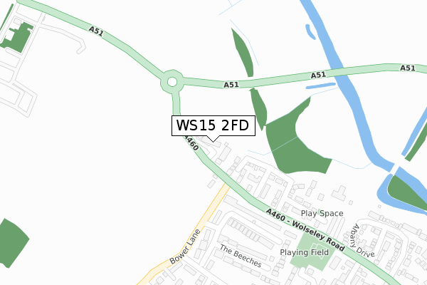
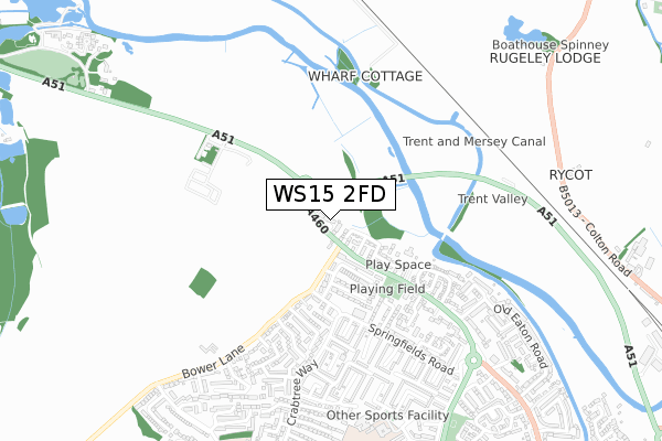
WS15 2FD is located in the Haywood & Hixon electoral ward, within the local authority district of Stafford and the English Parliamentary constituency of Stafford. The Sub Integrated Care Board (ICB) Location is NHS Staffordshire and Stoke-on-Trent ICB - 05V and the police force is Staffordshire. This postcode has been in use since October 2018.


GetTheData
Source: OS Open Zoomstack (Ordnance Survey)
Licence: Open Government Licence (requires attribution)
Attribution: Contains OS data © Crown copyright and database right 2024
Source: Open Postcode Geo
Licence: Open Government Licence (requires attribution)
Attribution: Contains OS data © Crown copyright and database right 2024; Contains Royal Mail data © Royal Mail copyright and database right 2024; Source: Office for National Statistics licensed under the Open Government Licence v.3.0
| Easting | 403505 |
| Northing | 319607 |
| Latitude | 52.774059 |
| Longitude | -1.949480 |
GetTheData
Source: Open Postcode Geo
Licence: Open Government Licence
| Country | England |
| Postcode District | WS15 |
| ➜ WS15 open data dashboard ➜ See where WS15 is on a map ➜ Where is Rugeley? | |
GetTheData
Source: Land Registry Price Paid Data
Licence: Open Government Licence
| Ward | Haywood & Hixon |
| Constituency | Stafford |
GetTheData
Source: ONS Postcode Database
Licence: Open Government Licence
2021 6 SEP £400,000 |
2020 10 JUL £380,000 |
MUNSTEAD HOUSE, HATHORN GROVE, RUGELEY, WS15 2FD 2019 13 DEC £399,995 |
BOSCOBEL HOUSE, HATHORN GROVE, RUGELEY, WS15 2FD 2019 18 JUL £420,000 |
MAYFLOWER HOUSE, HATHORN GROVE, RUGELEY, WS15 2FD 2019 30 MAY £365,000 |
CORDELIA HOUSE, HATHORN GROVE, RUGELEY, WS15 2FD 2019 26 APR £365,000 |
BRAITHWAITE HOUSE, HATHORN GROVE, RUGELEY, WS15 2FD 2019 8 APR £489,995 |
2019 5 APR £390,000 |
HARLOW HOUSE, HATHORN GROVE, RUGELEY, WS15 2FD 2019 29 MAR £365,000 |
HAMILTON HOUSE, HATHORN GROVE, RUGELEY, WS15 2FD 2019 29 MAR £500,000 |
GetTheData
Source: HM Land Registry Price Paid Data
Licence: Contains HM Land Registry data © Crown copyright and database right 2024. This data is licensed under the Open Government Licence v3.0.
| January 2024 | Vehicle crime | On or near Jeffery Close | 398m |
| January 2024 | Other theft | On or near Jeffery Close | 398m |
| December 2023 | Robbery | On or near Jeffery Close | 398m |
| ➜ Get more crime data in our Crime section | |||
GetTheData
Source: data.police.uk
Licence: Open Government Licence
| Bower Lane (Wolseley Road) | Springfields | 64m |
| Bower Lane (Wolseley Rd) | Springfields | 67m |
| Bower Lane (Wolseley Road) | Springfields | 137m |
| Cocketts Nook (Shugbough Road) | Springfields | 291m |
| Cocketts Nook (Shugborough Road) | Springfields | 297m |
| Rugeley Trent Valley Station | 1.4km |
| Rugeley Town Station | 2.3km |
GetTheData
Source: NaPTAN
Licence: Open Government Licence
➜ Broadband speed and availability dashboard for WS15 2FD
| Percentage of properties with Next Generation Access | 100.0% |
| Percentage of properties with Superfast Broadband | 100.0% |
| Percentage of properties with Ultrafast Broadband | 0.0% |
| Percentage of properties with Full Fibre Broadband | 0.0% |
Superfast Broadband is between 30Mbps and 300Mbps
Ultrafast Broadband is > 300Mbps
| Median download speed | 55.0Mbps |
| Average download speed | 50.8Mbps |
| Maximum download speed | 80.00Mbps |
| Median upload speed | 16.8Mbps |
| Average upload speed | 12.6Mbps |
| Maximum upload speed | 20.00Mbps |
| Percentage of properties unable to receive 2Mbps | 0.0% |
| Percentage of properties unable to receive 5Mbps | 0.0% |
| Percentage of properties unable to receive 10Mbps | 0.0% |
| Percentage of properties unable to receive 30Mbps | 0.0% |
➜ Broadband speed and availability dashboard for WS15 2FD
GetTheData
Source: Ofcom
Licence: Ofcom Terms of Use (requires attribution)
GetTheData
Source: ONS Postcode Database
Licence: Open Government Licence


➜ Get more ratings from the Food Standards Agency
GetTheData
Source: Food Standards Agency
Licence: FSA terms & conditions
| Last Collection | |||
|---|---|---|---|
| Location | Mon-Fri | Sat | Distance |
| Armitage Road | 17:30 | 07:30 | 1,736m |
| Rugeley Post Office | 18:00 | 11:00 | 1,938m |
| Wolseley Bridge Post Office | 16:45 | 11:30 | 2,082m |
GetTheData
Source: Dracos
Licence: Creative Commons Attribution-ShareAlike
| Facility | Distance |
|---|---|
| Forest Hills Primary School Springfields Estate, Rugeley Grass Pitches | 812m |
| Etching Hill Primary Academy Penk Drive North, Rugeley Grass Pitches | 992m |
| Green Lane Playing Field Green Lane, Rugeley Grass Pitches | 1.1km |
GetTheData
Source: Active Places
Licence: Open Government Licence
| School | Phase of Education | Distance |
|---|---|---|
| Forest Hills Primary School School Road, Rugeley, WS15 2PD | Primary | 812m |
| Etching Hill CofE Primary Academy Penk Drive, Etching Hill, Rugeley, WS15 2XY | Primary | 992m |
| The John Bamford Primary School Crabtree Way, Etching Hill, Rugeley, WS15 2PA | Primary | 1.2km |
GetTheData
Source: Edubase
Licence: Open Government Licence
The below table lists the International Territorial Level (ITL) codes (formerly Nomenclature of Territorial Units for Statistics (NUTS) codes) and Local Administrative Units (LAU) codes for WS15 2FD:
| ITL 1 Code | Name |
|---|---|
| TLG | West Midlands (England) |
| ITL 2 Code | Name |
| TLG2 | Shropshire and Staffordshire |
| ITL 3 Code | Name |
| TLG24 | Staffordshire CC |
| LAU 1 Code | Name |
| E07000197 | Stafford |
GetTheData
Source: ONS Postcode Directory
Licence: Open Government Licence
The below table lists the Census Output Area (OA), Lower Layer Super Output Area (LSOA), and Middle Layer Super Output Area (MSOA) for WS15 2FD:
| Code | Name | |
|---|---|---|
| OA | E00151388 | |
| LSOA | E01029711 | Stafford 008C |
| MSOA | E02006195 | Stafford 008 |
GetTheData
Source: ONS Postcode Directory
Licence: Open Government Licence
| WS15 2QX | Bower Lane | 100m |
| WS15 2QY | The Beeches | 192m |
| WS15 2FB | Levett Grange | 194m |
| WS15 2QZ | The Beeches | 277m |
| WS15 2YA | Shugborough Road | 303m |
| WS15 2BF | Hampton Court | 322m |
| WS15 2RB | Cocketts Nook | 371m |
| WS15 2NG | Allen Birt Walk | 382m |
| WS15 2RD | Bower Lane | 398m |
| WS15 2RA | William Morris Court | 406m |
GetTheData
Source: Open Postcode Geo; Land Registry Price Paid Data
Licence: Open Government Licence