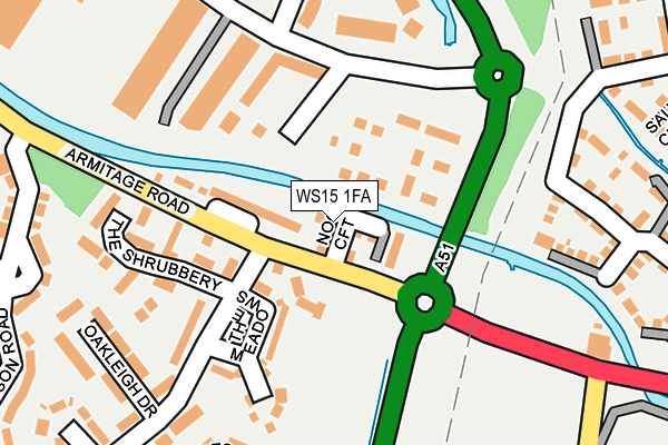
WS15 1FA is located in the Armitage with Handsacre electoral ward, within the local authority district of Lichfield and the English Parliamentary constituency of Lichfield. The Sub Integrated Care Board (ICB) Location is NHS Staffordshire and Stoke-on-Trent ICB - 04Y and the police force is Staffordshire. This postcode has been in use since July 2017.


GetTheData
Source: OS OpenMap – Local (Ordnance Survey)
Source: OS VectorMap District (Ordnance Survey)
Licence: Open Government Licence (requires attribution)
| Easting | 405961 |
| Northing | 316632 |
| Latitude | 52.747294 |
| Longitude | -1.913127 |
GetTheData
Source: Open Postcode Geo
Licence: Open Government Licence
| Country | England |
| Postcode District | WS15 |
| ➜ WS15 open data dashboard ➜ See where WS15 is on a map ➜ Where is Rugeley? | |
GetTheData
Source: Land Registry Price Paid Data
Licence: Open Government Licence
| Ward | Armitage With Handsacre |
| Constituency | Lichfield |
GetTheData
Source: ONS Postcode Database
Licence: Open Government Licence
21, NOOKS CROFT, RUGELEY, WS15 1FA 2017 24 AUG £209,995 |
5, NOOKS CROFT, RUGELEY, WS15 1FA 2017 7 JUL £209,995 |
GetTheData
Source: HM Land Registry Price Paid Data
Licence: Contains HM Land Registry data © Crown copyright and database right 2024. This data is licensed under the Open Government Licence v3.0.
| June 2022 | Violence and sexual offences | On or near Wheelhouse Road | 153m |
| June 2022 | Anti-social behaviour | On or near Wheelhouse Road | 153m |
| June 2022 | Violence and sexual offences | On or near Wheelhouse Road | 153m |
| ➜ Get more crime data in our Crime section | |||
GetTheData
Source: data.police.uk
Licence: Open Government Licence
| Ash Tree Ph (Armitage Rd) | Brereton | 277m |
| Ash Tree Ph (Armitage Rd) | Brereton | 282m |
| Thompson Road (Lodge Road) | Brereton | 471m |
| Walnut Crescent (Lodge Road) | Brereton | 493m |
| Main Road (Lodge Road) | Brereton | 616m |
| Rugeley Town Station | 1.8km |
| Rugeley Trent Valley Station | 2.7km |
GetTheData
Source: NaPTAN
Licence: Open Government Licence
➜ Broadband speed and availability dashboard for WS15 1FA
| Percentage of properties with Next Generation Access | 100.0% |
| Percentage of properties with Superfast Broadband | 100.0% |
| Percentage of properties with Ultrafast Broadband | 0.0% |
| Percentage of properties with Full Fibre Broadband | 0.0% |
Superfast Broadband is between 30Mbps and 300Mbps
Ultrafast Broadband is > 300Mbps
| Median download speed | 66.6Mbps |
| Average download speed | 51.5Mbps |
| Maximum download speed | 80.00Mbps |
| Median upload speed | 14.8Mbps |
| Average upload speed | 12.6Mbps |
| Maximum upload speed | 20.00Mbps |
| Percentage of properties unable to receive 2Mbps | 0.0% |
| Percentage of properties unable to receive 5Mbps | 0.0% |
| Percentage of properties unable to receive 10Mbps | 0.0% |
| Percentage of properties unable to receive 30Mbps | 0.0% |
➜ Broadband speed and availability dashboard for WS15 1FA
GetTheData
Source: Ofcom
Licence: Ofcom Terms of Use (requires attribution)
GetTheData
Source: ONS Postcode Database
Licence: Open Government Licence


➜ Get more ratings from the Food Standards Agency
GetTheData
Source: Food Standards Agency
Licence: FSA terms & conditions
| Last Collection | |||
|---|---|---|---|
| Location | Mon-Fri | Sat | Distance |
| Rugeley Post Office | 18:00 | 11:00 | 1,981m |
| Armitage Road | 17:30 | 07:30 | 2,160m |
| Mavesyn Ridware | 16:30 | 08:30 | 2,206m |
GetTheData
Source: Dracos
Licence: Creative Commons Attribution-ShareAlike
| Facility | Distance |
|---|---|
| Future Bodies (Closed) Waterside Business Park, Wheelhouse Road, Rugeley Studio, Health and Fitness Gym | 590m |
| Brereton Sports And Social Club Armitage Lane, Brereton, Rugeley Grass Pitches | 608m |
| Ravenhill Park Main Road, Brereton, Rugeley Grass Pitches, Outdoor Tennis Courts | 646m |
GetTheData
Source: Active Places
Licence: Open Government Licence
| School | Phase of Education | Distance |
|---|---|---|
| Hob Hill CE/Methodist (VC) Primary School Armitage Lane, Brereton, Rugeley, WS15 1ED | Primary | 486m |
| Redbrook Hayes Community Primary School Talbot Road, Brereton, Rugeley, WS15 1AU | Primary | 1.1km |
| St Joseph's Catholic Primary School Newman Grove, Rugeley, WS15 1BN | Primary | 1.6km |
GetTheData
Source: Edubase
Licence: Open Government Licence
The below table lists the International Territorial Level (ITL) codes (formerly Nomenclature of Territorial Units for Statistics (NUTS) codes) and Local Administrative Units (LAU) codes for WS15 1FA:
| ITL 1 Code | Name |
|---|---|
| TLG | West Midlands (England) |
| ITL 2 Code | Name |
| TLG2 | Shropshire and Staffordshire |
| ITL 3 Code | Name |
| TLG24 | Staffordshire CC |
| LAU 1 Code | Name |
| E07000194 | Lichfield |
GetTheData
Source: ONS Postcode Directory
Licence: Open Government Licence
The below table lists the Census Output Area (OA), Lower Layer Super Output Area (LSOA), and Middle Layer Super Output Area (MSOA) for WS15 1FA:
| Code | Name | |
|---|---|---|
| OA | E00150204 | |
| LSOA | E01029481 | Lichfield 001B |
| MSOA | E02006146 | Lichfield 001 |
GetTheData
Source: ONS Postcode Directory
Licence: Open Government Licence
| WS15 1NY | Hollow Oak Meadows | 87m |
| WS15 1PF | Armitage Gardens | 105m |
| WS15 1JH | The Meadows | 108m |
| WS15 1JQ | Leahall Lane | 158m |
| WS15 1PE | Armitage Road | 169m |
| WS15 1GU | Chestnut Grove | 178m |
| WS15 1JJ | The Shrubbery | 188m |
| WS15 1QT | Horseley Croft | 212m |
| WS15 1JG | Oakleigh Drive | 239m |
| WS15 1JE | Leahall Lane | 260m |
GetTheData
Source: Open Postcode Geo; Land Registry Price Paid Data
Licence: Open Government Licence