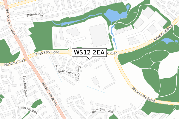
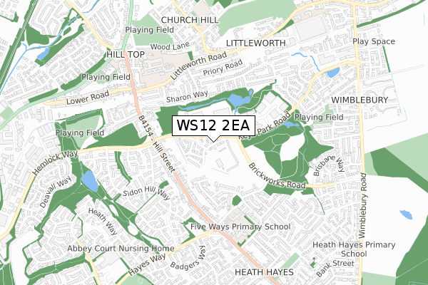
WS12 2EA is located in the Hednesford South electoral ward, within the local authority district of Cannock Chase and the English Parliamentary constituency of Cannock Chase. The Sub Integrated Care Board (ICB) Location is NHS Staffordshire and Stoke-on-Trent ICB - 04Y and the police force is Staffordshire. This postcode has been in use since April 2019.


GetTheData
Source: OS Open Zoomstack (Ordnance Survey)
Licence: Open Government Licence (requires attribution)
Attribution: Contains OS data © Crown copyright and database right 2025
Source: Open Postcode Geo
Licence: Open Government Licence (requires attribution)
Attribution: Contains OS data © Crown copyright and database right 2025; Contains Royal Mail data © Royal Mail copyright and database right 2025; Source: Office for National Statistics licensed under the Open Government Licence v.3.0
| Easting | 400761 |
| Northing | 311194 |
| Latitude | 52.698439 |
| Longitude | -1.990172 |
GetTheData
Source: Open Postcode Geo
Licence: Open Government Licence
| Country | England |
| Postcode District | WS12 |
➜ See where WS12 is on a map ➜ Where is Cannock? | |
GetTheData
Source: Land Registry Price Paid Data
Licence: Open Government Licence
| Ward | Hednesford South |
| Constituency | Cannock Chase |
GetTheData
Source: ONS Postcode Database
Licence: Open Government Licence
2024 30 JAN £290,000 |
2023 31 MAR £315,000 |
2021 26 NOV £255,000 |
7, PITMEN WAY, HEDNESFORD, CANNOCK, WS12 2EA 2021 23 FEB £257,950 |
1, PITMEN WAY, HEDNESFORD, CANNOCK, WS12 2EA 2021 15 JAN £259,995 |
8, PITMEN WAY, HEDNESFORD, CANNOCK, WS12 2EA 2020 23 DEC £304,950 |
27, PITMEN WAY, HEDNESFORD, CANNOCK, WS12 2EA 2019 16 AUG £294,500 |
73, PITMEN WAY, HEDNESFORD, CANNOCK, WS12 2EA 2019 27 JUN £246,995 |
2019 21 JUN £234,995 |
25, PITMEN WAY, HEDNESFORD, CANNOCK, WS12 2EA 2019 24 APR £243,995 |
GetTheData
Source: HM Land Registry Price Paid Data
Licence: Contains HM Land Registry data © Crown copyright and database right 2025. This data is licensed under the Open Government Licence v3.0.
| Brickworks Road (Keyspark Road) | Hawks Green | 33m |
| Brickworks Road (Keyspark Road) | Hawks Green | 57m |
| Levetts Hollow (Hill Street) | Hawks Green | 283m |
| Levetts Hollow (Hill Street) | Hawks Green | 306m |
| Hayes Way (Hill Street) | Wimblebury | 419m |
| Hednesford Station | 1.5km |
| Cannock Station | 2.6km |
| Landywood Station | 5.1km |
GetTheData
Source: NaPTAN
Licence: Open Government Licence
| Percentage of properties with Next Generation Access | 100.0% |
| Percentage of properties with Superfast Broadband | 100.0% |
| Percentage of properties with Ultrafast Broadband | 96.8% |
| Percentage of properties with Full Fibre Broadband | 96.8% |
Superfast Broadband is between 30Mbps and 300Mbps
Ultrafast Broadband is > 300Mbps
| Percentage of properties unable to receive 2Mbps | 0.0% |
| Percentage of properties unable to receive 5Mbps | 0.0% |
| Percentage of properties unable to receive 10Mbps | 0.0% |
| Percentage of properties unable to receive 30Mbps | 0.0% |
GetTheData
Source: Ofcom
Licence: Ofcom Terms of Use (requires attribution)
GetTheData
Source: ONS Postcode Database
Licence: Open Government Licence


➜ Get more ratings from the Food Standards Agency
GetTheData
Source: Food Standards Agency
Licence: FSA terms & conditions
| Last Collection | |||
|---|---|---|---|
| Location | Mon-Fri | Sat | Distance |
| Cannock Delivery Office | 18:30 | 12:00 | 794m |
| Cannock Post Office | 18:30 | 12:15 | 922m |
| Wimblebury Road | 17:00 | 10:45 | 1,012m |
GetTheData
Source: Dracos
Licence: Creative Commons Attribution-ShareAlike
The below table lists the International Territorial Level (ITL) codes (formerly Nomenclature of Territorial Units for Statistics (NUTS) codes) and Local Administrative Units (LAU) codes for WS12 2EA:
| ITL 1 Code | Name |
|---|---|
| TLG | West Midlands (England) |
| ITL 2 Code | Name |
| TLG2 | Shropshire and Staffordshire |
| ITL 3 Code | Name |
| TLG24 | Staffordshire CC |
| LAU 1 Code | Name |
| E07000192 | Cannock Chase |
GetTheData
Source: ONS Postcode Directory
Licence: Open Government Licence
The below table lists the Census Output Area (OA), Lower Layer Super Output Area (LSOA), and Middle Layer Super Output Area (MSOA) for WS12 2EA:
| Code | Name | |
|---|---|---|
| OA | E00149761 | |
| LSOA | E01029392 | Cannock Chase 009E |
| MSOA | E02006126 | Cannock Chase 009 |
GetTheData
Source: ONS Postcode Directory
Licence: Open Government Licence
| WS12 2AW | Levetts Hollow | 234m |
| WS12 2DW | Hill Street | 275m |
| WS12 2UL | Sweetbriar Way | 295m |
| WS11 7FZ | Turquoise Grove | 327m |
| WS12 2NQ | Sharon Way | 328m |
| WS12 2NF | Sharon Way | 332m |
| WS12 2DR | Hill Street | 335m |
| WS12 2US | Sweetbriar Way | 356m |
| WS12 2NJ | Leafdown Close | 357m |
| WS12 2NH | Charlemonte Close | 363m |
GetTheData
Source: Open Postcode Geo; Land Registry Price Paid Data
Licence: Open Government Licence