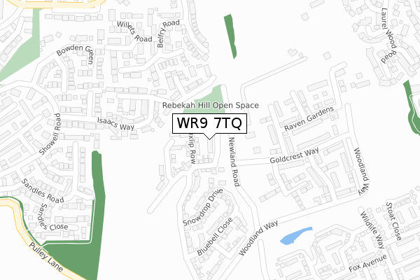
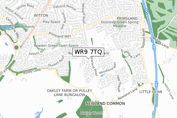
WR9 7TQ is located in the Droitwich South East electoral ward, within the local authority district of Wychavon and the English Parliamentary constituency of Mid Worcestershire. The Sub Integrated Care Board (ICB) Location is NHS Herefordshire and Worcestershire ICB - 18C and the police force is West Mercia. This postcode has been in use since November 2019.


GetTheData
Source: OS Open Zoomstack (Ordnance Survey)
Licence: Open Government Licence (requires attribution)
Attribution: Contains OS data © Crown copyright and database right 2024
Source: Open Postcode Geo
Licence: Open Government Licence (requires attribution)
Attribution: Contains OS data © Crown copyright and database right 2024; Contains Royal Mail data © Royal Mail copyright and database right 2024; Source: Office for National Statistics licensed under the Open Government Licence v.3.0
| Easting | 390025 |
| Northing | 261407 |
| Latitude | 52.250761 |
| Longitude | -2.147527 |
GetTheData
Source: Open Postcode Geo
Licence: Open Government Licence
| Country | England |
| Postcode District | WR9 |
| ➜ WR9 open data dashboard ➜ See where WR9 is on a map ➜ Where is Droitwich Spa? | |
GetTheData
Source: Land Registry Price Paid Data
Licence: Open Government Licence
| Ward | Droitwich South East |
| Constituency | Mid Worcestershire |
GetTheData
Source: ONS Postcode Database
Licence: Open Government Licence
1, COWSLIP GARDENS, DROITWICH, WR9 7TQ 2019 11 NOV £282,000 |
GetTheData
Source: HM Land Registry Price Paid Data
Licence: Contains HM Land Registry data © Crown copyright and database right 2024. This data is licensed under the Open Government Licence v3.0.
| September 2023 | Vehicle crime | On or near Rebekah Gardens | 143m |
| September 2023 | Violence and sexual offences | On or near Isaacs Way | 254m |
| June 2023 | Anti-social behaviour | On or near Isaacs Way | 254m |
| ➜ Get more crime data in our Crime section | |||
GetTheData
Source: data.police.uk
Licence: Open Government Licence
| Isaacs Way (Showell Road) | The Ridings | 363m |
| Chestnut Spinney (Primsland Way) | Primsland | 420m |
| Sandles Road (Showell Road) | The Ridings | 424m |
| Chestnut Spinney (Primsland Way) | Primsland | 434m |
| Primsland Fields (Primsland Way) | Primsland | 450m |
| Droitwich Spa Station | 2.1km |
GetTheData
Source: NaPTAN
Licence: Open Government Licence
GetTheData
Source: ONS Postcode Database
Licence: Open Government Licence


➜ Get more ratings from the Food Standards Agency
GetTheData
Source: Food Standards Agency
Licence: FSA terms & conditions
| Last Collection | |||
|---|---|---|---|
| Location | Mon-Fri | Sat | Distance |
| Maytree Hill | 17:00 | 10:30 | 527m |
| Windsor Road | 17:00 | 10:30 | 585m |
| Newland Common | 16:15 | 07:00 | 691m |
GetTheData
Source: Dracos
Licence: Creative Commons Attribution-ShareAlike
| Facility | Distance |
|---|---|
| Droitwich Tennis Club St Peters Church Lane, Droitwich Spa Outdoor Tennis Courts | 1.1km |
| St Peter's Playing Field St Peters Church Lane, Droitwich Spa Grass Pitches | 1.1km |
| Copcut Golf Centre Copcut Lane, Copcut, Droitwich Golf | 1.3km |
GetTheData
Source: Active Places
Licence: Open Government Licence
| School | Phase of Education | Distance |
|---|---|---|
| St Peter's Droitwich CofE Academy Church Lane, The Holloway, Droitwich Spa, WR9 7AN | Primary | 1.1km |
| Witton Middle School Old Coach Road, Droitwich Spa, WR9 8BD | Middle deemed primary | 1.3km |
| Chawson First School Wych Road, Droitwich, WR9 8BW | Primary | 1.4km |
GetTheData
Source: Edubase
Licence: Open Government Licence
The below table lists the International Territorial Level (ITL) codes (formerly Nomenclature of Territorial Units for Statistics (NUTS) codes) and Local Administrative Units (LAU) codes for WR9 7TQ:
| ITL 1 Code | Name |
|---|---|
| TLG | West Midlands (England) |
| ITL 2 Code | Name |
| TLG1 | Herefordshire, Worcestershire and Warwickshire |
| ITL 3 Code | Name |
| TLG12 | Worcestershire CC |
| LAU 1 Code | Name |
| E07000238 | Wychavon |
GetTheData
Source: ONS Postcode Directory
Licence: Open Government Licence
The below table lists the Census Output Area (OA), Lower Layer Super Output Area (LSOA), and Middle Layer Super Output Area (MSOA) for WR9 7TQ:
| Code | Name | |
|---|---|---|
| OA | E00165067 | |
| LSOA | E01032362 | Wychavon 005A |
| MSOA | E02006752 | Wychavon 005 |
GetTheData
Source: ONS Postcode Directory
Licence: Open Government Licence
| WR9 8UG | Rebekah Gardens | 165m |
| WR9 8UZ | Isaacs Way | 231m |
| WR9 7QL | Cedar Close | 246m |
| WR9 7QX | Belfry Road | 253m |
| WR9 8US | Sarai Close | 283m |
| WR9 7QJ | Hazel Close | 295m |
| WR9 7QQ | Yew Tree Hill | 319m |
| WR9 7QY | Willets Road | 321m |
| WR9 8WZ | Bowden Green | 370m |
| WR9 7JQ | Newland Road | 379m |
GetTheData
Source: Open Postcode Geo; Land Registry Price Paid Data
Licence: Open Government Licence