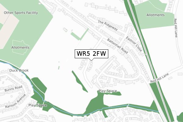
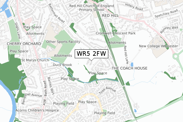
WR5 2FW is located in the Battenhall electoral ward, within the local authority district of Worcester and the English Parliamentary constituency of Worcester. The Sub Integrated Care Board (ICB) Location is NHS Herefordshire and Worcestershire ICB - 18C and the police force is West Mercia. This postcode has been in use since November 2018.


GetTheData
Source: OS Open Zoomstack (Ordnance Survey)
Licence: Open Government Licence (requires attribution)
Attribution: Contains OS data © Crown copyright and database right 2025
Source: Open Postcode Geo
Licence: Open Government Licence (requires attribution)
Attribution: Contains OS data © Crown copyright and database right 2025; Contains Royal Mail data © Royal Mail copyright and database right 2025; Source: Office for National Statistics licensed under the Open Government Licence v.3.0
| Easting | 386179 |
| Northing | 253138 |
| Latitude | 52.176334 |
| Longitude | -2.203526 |
GetTheData
Source: Open Postcode Geo
Licence: Open Government Licence
| Country | England |
| Postcode District | WR5 |
➜ See where WR5 is on a map ➜ Where is Worcester? | |
GetTheData
Source: Land Registry Price Paid Data
Licence: Open Government Licence
| Ward | Battenhall |
| Constituency | Worcester |
GetTheData
Source: ONS Postcode Database
Licence: Open Government Licence
2024 23 APR £600,000 |
2023 19 MAY £550,000 |
2023 10 MAY £590,000 |
2023 8 MAR £585,000 |
2022 22 JUL £540,000 |
26, BIRCH MEADOW, WORCESTER, WR5 2FW 2022 8 JUN £530,000 |
24, BIRCH MEADOW, WORCESTER, WR5 2FW 2022 4 MAR £580,000 |
2021 22 NOV £540,000 |
32, BIRCH MEADOW, WORCESTER, WR5 2FW 2021 29 OCT £540,000 |
27, BIRCH MEADOW, WORCESTER, WR5 2FW 2021 22 OCT £390,000 |
GetTheData
Source: HM Land Registry Price Paid Data
Licence: Contains HM Land Registry data © Crown copyright and database right 2025. This data is licensed under the Open Government Licence v3.0.
| Chase End Close (Battenhall Road) | Battenhall | 200m |
| Chase End Close (Battenhall Road) | Battenhall | 207m |
| The Ridgeway Steps (Battenhall Road) | Battenhall | 219m |
| The Ridgeway Steps (Battenhall Road) | Battenhall | 233m |
| Battenhall Rise (Red Hill Lane) | Battenhall | 303m |
| Worcester Shrub Hill Station | 2.1km |
| Worcester Foregate Street Station | 2.4km |
GetTheData
Source: NaPTAN
Licence: Open Government Licence
GetTheData
Source: ONS Postcode Database
Licence: Open Government Licence


➜ Get more ratings from the Food Standards Agency
GetTheData
Source: Food Standards Agency
Licence: FSA terms & conditions
| Last Collection | |||
|---|---|---|---|
| Location | Mon-Fri | Sat | Distance |
| Upper Battenhall | 16:00 | 11:30 | 199m |
| St Peters Centre P.o. | 17:30 | 12:00 | 531m |
| Camphill Road | 17:15 | 11:30 | 711m |
GetTheData
Source: Dracos
Licence: Creative Commons Attribution-ShareAlike
The below table lists the International Territorial Level (ITL) codes (formerly Nomenclature of Territorial Units for Statistics (NUTS) codes) and Local Administrative Units (LAU) codes for WR5 2FW:
| ITL 1 Code | Name |
|---|---|
| TLG | West Midlands (England) |
| ITL 2 Code | Name |
| TLG1 | Herefordshire, Worcestershire and Warwickshire |
| ITL 3 Code | Name |
| TLG12 | Worcestershire CC |
| LAU 1 Code | Name |
| E07000237 | Worcester |
GetTheData
Source: ONS Postcode Directory
Licence: Open Government Licence
The below table lists the Census Output Area (OA), Lower Layer Super Output Area (LSOA), and Middle Layer Super Output Area (MSOA) for WR5 2FW:
| Code | Name | |
|---|---|---|
| OA | E00164653 | |
| LSOA | E01032284 | Worcester 013B |
| MSOA | E02006746 | Worcester 013 |
GetTheData
Source: ONS Postcode Directory
Licence: Open Government Licence
| WR5 2DE | Battenhall Rise | 136m |
| WR5 2BT | Battenhall Road | 182m |
| WR5 2BU | Battenhall Road | 219m |
| WR5 2DA | The Ridgeway | 257m |
| WR5 3UT | Bowood Lane | 271m |
| WR5 3UP | Malham Place | 274m |
| WR5 2BZ | Eastnor Close | 282m |
| WR5 3QY | Leven Drive | 296m |
| WR5 2BY | Chase End Close | 299m |
| WR5 3UU | Kinord Close | 320m |
GetTheData
Source: Open Postcode Geo; Land Registry Price Paid Data
Licence: Open Government Licence