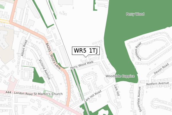
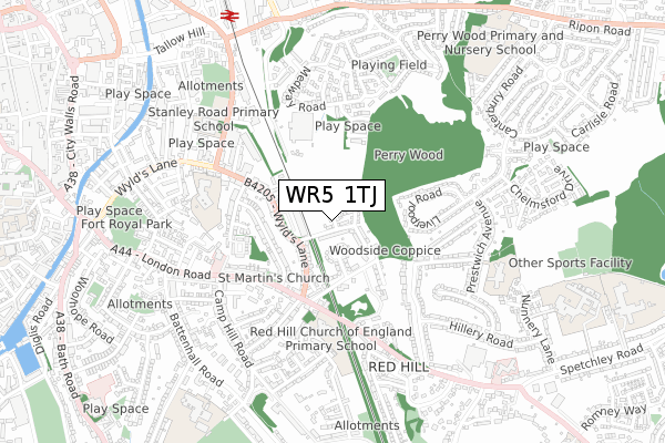
WR5 1TJ is located in the Nunnery electoral ward, within the local authority district of Worcester and the English Parliamentary constituency of Worcester. The Sub Integrated Care Board (ICB) Location is NHS Herefordshire and Worcestershire ICB - 18C and the police force is West Mercia. This postcode has been in use since November 2018.


GetTheData
Source: OS Open Zoomstack (Ordnance Survey)
Licence: Open Government Licence (requires attribution)
Attribution: Contains OS data © Crown copyright and database right 2024
Source: Open Postcode Geo
Licence: Open Government Licence (requires attribution)
Attribution: Contains OS data © Crown copyright and database right 2024; Contains Royal Mail data © Royal Mail copyright and database right 2024; Source: Office for National Statistics licensed under the Open Government Licence v.3.0
| Easting | 386220 |
| Northing | 254375 |
| Latitude | 52.187457 |
| Longitude | -2.202977 |
GetTheData
Source: Open Postcode Geo
Licence: Open Government Licence
| Country | England |
| Postcode District | WR5 |
| ➜ WR5 open data dashboard ➜ See where WR5 is on a map ➜ Where is Worcester? | |
GetTheData
Source: Land Registry Price Paid Data
Licence: Open Government Licence
| Ward | Nunnery |
| Constituency | Worcester |
GetTheData
Source: ONS Postcode Database
Licence: Open Government Licence
5, CRANBOURNE GROVE, WORCESTER, WR5 1TJ 2022 26 MAY £323,000 |
2, CRANBOURNE GROVE, WORCESTER, WR5 1TJ 2021 26 NOV £353,000 |
7, CRANBOURNE GROVE, WORCESTER, WR5 1TJ 2021 15 JAN £290,000 |
11, CRANBOURNE GROVE, WORCESTER, WR5 1TJ 2020 21 DEC £325,000 |
13, CRANBOURNE GROVE, WORCESTER, WR5 1TJ 2020 16 DEC £322,995 |
8, CRANBOURNE GROVE, WORCESTER, WR5 1TJ 2020 11 DEC £355,040 |
9, CRANBOURNE GROVE, WORCESTER, WR5 1TJ 2020 2 DEC £372,995 |
6, CRANBOURNE GROVE, WORCESTER, WR5 1TJ 2020 3 NOV £320,995 |
4, CRANBOURNE GROVE, WORCESTER, WR5 1TJ 2020 27 AUG £349,995 |
3, CRANBOURNE GROVE, WORCESTER, WR5 1TJ 2020 27 MAR £281,995 |
GetTheData
Source: HM Land Registry Price Paid Data
Licence: Contains HM Land Registry data © Crown copyright and database right 2024. This data is licensed under the Open Government Licence v3.0.
| September 2023 | Other crime | On or near Liverpool Road | 456m |
| August 2023 | Burglary | On or near Liverpool Road | 456m |
| April 2023 | Criminal damage and arson | On or near Liverpool Road | 456m |
| ➜ Get more crime data in our Crime section | |||
GetTheData
Source: data.police.uk
Licence: Open Government Licence
| Liverpool Road Top (Liverpool Road) | Ronkswood | 268m |
| Sebright (A44) | Battenhall | 329m |
| Albert Road (Wyld's Lane (B4485)) | Worcester | 335m |
| Sebright (London Road) | Battenhall | 343m |
| Albert Road (B4485) | Worcester | 345m |
| Worcester Shrub Hill Station | 0.9km |
| Worcester Foregate Street Station | 1.5km |
GetTheData
Source: NaPTAN
Licence: Open Government Licence
GetTheData
Source: ONS Postcode Database
Licence: Open Government Licence


➜ Get more ratings from the Food Standards Agency
GetTheData
Source: Food Standards Agency
Licence: FSA terms & conditions
| Last Collection | |||
|---|---|---|---|
| Location | Mon-Fri | Sat | Distance |
| London Road P.o. | 17:30 | 12:00 | 322m |
| Ribble Close | 16:15 | 11:30 | 372m |
| Liverpool Road | 16:45 | 11:30 | 534m |
GetTheData
Source: Dracos
Licence: Creative Commons Attribution-ShareAlike
| Facility | Distance |
|---|---|
| Stanley Road Primary School Stanley Road, Worcester Grass Pitches | 615m |
| Nunnery Wood Primary School Prestwich Avenue, Worcester Grass Pitches | 645m |
| St. Mary's Convent School (Closed) Battenhall Avenue, Worcester Sports Hall, Grass Pitches | 796m |
GetTheData
Source: Active Places
Licence: Open Government Licence
| School | Phase of Education | Distance |
|---|---|---|
| Red Hill CofE Primary School Midhurst Close, Worcester, WR5 2HX | Primary | 404m |
| Fort Royal Wyld's Lane, Worcester, WR5 1DR | Not applicable | 490m |
| Newbridge School Midland Road, Worcester, WR5 1DS | Not applicable | 578m |
GetTheData
Source: Edubase
Licence: Open Government Licence
The below table lists the International Territorial Level (ITL) codes (formerly Nomenclature of Territorial Units for Statistics (NUTS) codes) and Local Administrative Units (LAU) codes for WR5 1TJ:
| ITL 1 Code | Name |
|---|---|
| TLG | West Midlands (England) |
| ITL 2 Code | Name |
| TLG1 | Herefordshire, Worcestershire and Warwickshire |
| ITL 3 Code | Name |
| TLG12 | Worcestershire CC |
| LAU 1 Code | Name |
| E07000237 | Worcester |
GetTheData
Source: ONS Postcode Directory
Licence: Open Government Licence
The below table lists the Census Output Area (OA), Lower Layer Super Output Area (LSOA), and Middle Layer Super Output Area (MSOA) for WR5 1TJ:
| Code | Name | |
|---|---|---|
| OA | E00164778 | |
| LSOA | E01032309 | Worcester 010D |
| MSOA | E02006743 | Worcester 010 |
GetTheData
Source: ONS Postcode Directory
Licence: Open Government Licence
| WR5 1EH | Perry Wood Walk | 71m |
| WR5 1EJ | Perrywood Close | 130m |
| WR5 1EL | Wylds Lane | 160m |
| WR5 2EG | Woodside Road | 173m |
| WR5 2DG | Woodside Gardens | 180m |
| WR5 1EF | Wylds Lane | 197m |
| WR5 2EF | Lark Hill Road | 217m |
| WR5 1EU | Sawmill Close | 246m |
| WR5 2EQ | Lark Hill | 255m |
| WR5 1EE | Victoria Avenue | 256m |
GetTheData
Source: Open Postcode Geo; Land Registry Price Paid Data
Licence: Open Government Licence