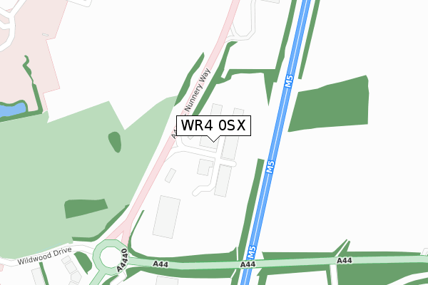
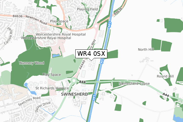
WR4 0SX is located in the Warndon Parish South electoral ward, within the local authority district of Worcester and the English Parliamentary constituency of Worcester. The Sub Integrated Care Board (ICB) Location is NHS Herefordshire and Worcestershire ICB - 18C and the police force is West Mercia. This postcode has been in use since October 2017.


GetTheData
Source: OS Open Zoomstack (Ordnance Survey)
Licence: Open Government Licence (requires attribution)
Attribution: Contains OS data © Crown copyright and database right 2024
Source: Open Postcode Geo
Licence: Open Government Licence (requires attribution)
Attribution: Contains OS data © Crown copyright and database right 2024; Contains Royal Mail data © Royal Mail copyright and database right 2024; Source: Office for National Statistics licensed under the Open Government Licence v.3.0
| Easting | 388340 |
| Northing | 254426 |
| Latitude | 52.187965 |
| Longitude | -2.171969 |
GetTheData
Source: Open Postcode Geo
Licence: Open Government Licence
| Country | England |
| Postcode District | WR4 |
| ➜ WR4 open data dashboard ➜ See where WR4 is on a map | |
GetTheData
Source: Land Registry Price Paid Data
Licence: Open Government Licence
| Ward | Warndon Parish South |
| Constituency | Worcester |
GetTheData
Source: ONS Postcode Database
Licence: Open Government Licence
| June 2022 | Criminal damage and arson | On or near A44 | 239m |
| June 2022 | Vehicle crime | On or near Swinesherd Way | 421m |
| June 2022 | Violence and sexual offences | On or near Swinesherd Way | 421m |
| ➜ Get more crime data in our Crime section | |||
GetTheData
Source: data.police.uk
Licence: Open Government Licence
| Wild Wood Drive | Nunnery Wood | 448m |
| Wild Wood Drive | Nunnery Wood | 507m |
| Swinesherd (A422 Spetchley Road) | Spetchley | 565m |
| County Hall Boiler House (Approach Road) | Nunnery Wood | 627m |
| A & E Unit (Charles Hastings Way) | Worcestershire Royal Hospital | 659m |
| Worcester Shrub Hill Station | 2.7km |
| Worcester Foregate Street Station | 3.5km |
GetTheData
Source: NaPTAN
Licence: Open Government Licence
GetTheData
Source: ONS Postcode Database
Licence: Open Government Licence


➜ Get more ratings from the Food Standards Agency
GetTheData
Source: Food Standards Agency
Licence: FSA terms & conditions
| Last Collection | |||
|---|---|---|---|
| Location | Mon-Fri | Sat | Distance |
| Swinsherd | 16:45 | 09:15 | 432m |
| Dugdale Drive | 17:00 | 11:30 | 973m |
| Kilbury Drive | 17:15 | 11:30 | 1,079m |
GetTheData
Source: Dracos
Licence: Creative Commons Attribution-ShareAlike
| Facility | Distance |
|---|---|
| Ronkswood Carlisle Road, Worcester Grass Pitches | 1.1km |
| Spetchley Park Spetchley, Worcester Grass Pitches | 1.1km |
| Nunnery Wood Sports Complex Spetchley Road, Worcester Sports Hall, Athletics, Health and Fitness Gym, Artificial Grass Pitch, Grass Pitches, Studio, Squash Courts | 1.1km |
GetTheData
Source: Active Places
Licence: Open Government Licence
| School | Phase of Education | Distance |
|---|---|---|
| Worcester Sixth Form College Spetchley Road, Worcester, WR5 2LU | 16 plus | 1.1km |
| Nunnery Wood High School Spetchley Road, Worcester, WR5 2LT | Secondary | 1.3km |
| The Lyppard Grange Primary School Ankerage Green, Worcester, WR4 0DZ | Primary | 1.4km |
GetTheData
Source: Edubase
Licence: Open Government Licence
The below table lists the International Territorial Level (ITL) codes (formerly Nomenclature of Territorial Units for Statistics (NUTS) codes) and Local Administrative Units (LAU) codes for WR4 0SX:
| ITL 1 Code | Name |
|---|---|
| TLG | West Midlands (England) |
| ITL 2 Code | Name |
| TLG1 | Herefordshire, Worcestershire and Warwickshire |
| ITL 3 Code | Name |
| TLG12 | Worcestershire CC |
| LAU 1 Code | Name |
| E07000237 | Worcester |
GetTheData
Source: ONS Postcode Directory
Licence: Open Government Licence
The below table lists the Census Output Area (OA), Lower Layer Super Output Area (LSOA), and Middle Layer Super Output Area (MSOA) for WR4 0SX:
| Code | Name | |
|---|---|---|
| OA | E00164946 | |
| LSOA | E01032339 | Worcester 008C |
| MSOA | E02006741 | Worcester 008 |
GetTheData
Source: ONS Postcode Directory
Licence: Open Government Licence
| WR5 1RU | 343m | |
| WR5 1RZ | Spetchley Road | 505m |
| WR4 0SB | Rowntree Gardens | 539m |
| WR4 0SD | Fry Close | 576m |
| WR4 0RF | Bentham Avenue | 606m |
| WR4 0NJ | Wilberforce Place | 642m |
| WR5 1JR | Kings Court Business Park | 645m |
| WR4 0LZ | Nightingale Avenue | 658m |
| WR4 0SA | Shaftesbury Green | 664m |
| WR4 0LN | Fels Avenue | 665m |
GetTheData
Source: Open Postcode Geo; Land Registry Price Paid Data
Licence: Open Government Licence