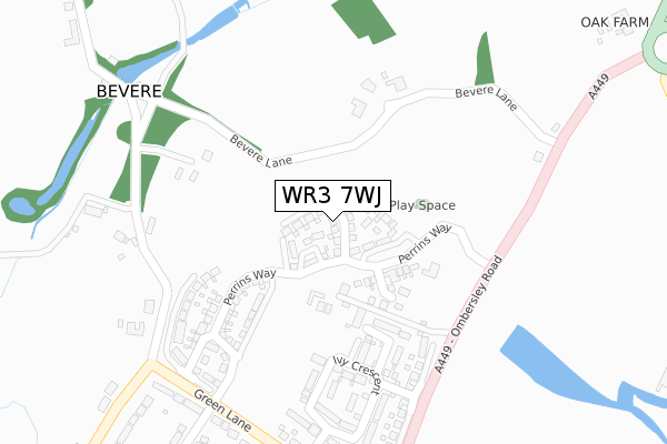
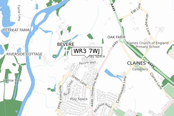
WR3 7WJ is located in the North Claines & Salwarpe electoral ward, within the local authority district of Wychavon and the English Parliamentary constituency of Mid Worcestershire. The Sub Integrated Care Board (ICB) Location is NHS Herefordshire and Worcestershire ICB - 18C and the police force is West Mercia. This postcode has been in use since September 2018.


GetTheData
Source: OS Open Zoomstack (Ordnance Survey)
Licence: Open Government Licence (requires attribution)
Attribution: Contains OS data © Crown copyright and database right 2024
Source: Open Postcode Geo
Licence: Open Government Licence (requires attribution)
Attribution: Contains OS data © Crown copyright and database right 2024; Contains Royal Mail data © Royal Mail copyright and database right 2024; Source: Office for National Statistics licensed under the Open Government Licence v.3.0
| Easting | 384449 |
| Northing | 258969 |
| Latitude | 52.228712 |
| Longitude | -2.229094 |
GetTheData
Source: Open Postcode Geo
Licence: Open Government Licence
| Country | England |
| Postcode District | WR3 |
| ➜ WR3 open data dashboard ➜ See where WR3 is on a map ➜ Where is Worcester? | |
GetTheData
Source: Land Registry Price Paid Data
Licence: Open Government Licence
| Ward | North Claines & Salwarpe |
| Constituency | Mid Worcestershire |
GetTheData
Source: ONS Postcode Database
Licence: Open Government Licence
24, COALBROOKDALE ROAD, BEVERE, WORCESTER, WR3 7WJ 2020 29 MAY £699,995 |
15, COALBROOKDALE ROAD, BEVERE, WORCESTER, WR3 7WJ 2019 9 OCT £669,500 |
5, COALBROOKDALE ROAD, BEVERE, WORCESTER, WR3 7WJ 2019 6 SEP £410,995 |
9, COALBROOKDALE ROAD, BEVERE, WORCESTER, WR3 7WJ 2019 26 JUL £392,250 |
22, COALBROOKDALE ROAD, BEVERE, WORCESTER, WR3 7WJ 2019 14 JUN £664,995 |
19, COALBROOKDALE ROAD, BEVERE, WORCESTER, WR3 7WJ 2019 7 JUN £666,500 |
17, COALBROOKDALE ROAD, BEVERE, WORCESTER, WR3 7WJ 2019 31 MAY £664,995 |
2, COALBROOKDALE ROAD, BEVERE, WORCESTER, WR3 7WJ 2019 3 MAY £340,000 |
11, COALBROOKDALE ROAD, BEVERE, WORCESTER, WR3 7WJ 2019 15 MAR £593,750 |
16, COALBROOKDALE ROAD, BEVERE, WORCESTER, WR3 7WJ 2019 31 JAN £658,995 |
GetTheData
Source: HM Land Registry Price Paid Data
Licence: Contains HM Land Registry data © Crown copyright and database right 2024. This data is licensed under the Open Government Licence v3.0.
| June 2022 | Anti-social behaviour | On or near Bevere Lane | 103m |
| June 2022 | Anti-social behaviour | On or near Bevere Lane | 103m |
| June 2022 | Anti-social behaviour | On or near Bevere Lane | 103m |
| ➜ Get more crime data in our Crime section | |||
GetTheData
Source: data.police.uk
Licence: Open Government Licence
| Bevere Lane (A449) | Bevere | 309m |
| Bevere Lane (A449) | Bevere | 356m |
| Green Lane Terminus (Ombersley Road) | Northwick | 424m |
| Green Lane (Ombersley Road) | Northwick | 450m |
| Green Lane (Ombersley Road) | Northwick | 486m |
| Worcester Foregate Street Station | 3.8km |
| Worcester Shrub Hill Station | 4km |
| Droitwich Spa Station | 6.5km |
GetTheData
Source: NaPTAN
Licence: Open Government Licence
| Percentage of properties with Next Generation Access | 100.0% |
| Percentage of properties with Superfast Broadband | 100.0% |
| Percentage of properties with Ultrafast Broadband | 100.0% |
| Percentage of properties with Full Fibre Broadband | 100.0% |
Superfast Broadband is between 30Mbps and 300Mbps
Ultrafast Broadband is > 300Mbps
| Percentage of properties unable to receive 2Mbps | 0.0% |
| Percentage of properties unable to receive 5Mbps | 0.0% |
| Percentage of properties unable to receive 10Mbps | 0.0% |
| Percentage of properties unable to receive 30Mbps | 0.0% |
GetTheData
Source: Ofcom
Licence: Ofcom Terms of Use (requires attribution)
GetTheData
Source: ONS Postcode Database
Licence: Open Government Licence


➜ Get more ratings from the Food Standards Agency
GetTheData
Source: Food Standards Agency
Licence: FSA terms & conditions
| Last Collection | |||
|---|---|---|---|
| Location | Mon-Fri | Sat | Distance |
| Bevere Green | 17:30 | 07:15 | 176m |
| Green Lane | 16:45 | 11:30 | 360m |
| Common Hill | 16:45 | 11:30 | 678m |
GetTheData
Source: Dracos
Licence: Creative Commons Attribution-ShareAlike
| Facility | Distance |
|---|---|
| Cornmeadow Recreation Ground Cornmeadow Lane, Worcester Grass Pitches | 921m |
| King's Hawford School Hawford Lock Lane, Claines, Worcester Sports Hall, Swimming Pool, Grass Pitches | 1km |
| County Sports Ground Claines Lane, Claines, Worcester Grass Pitches, Artificial Grass Pitch | 1.3km |
GetTheData
Source: Active Places
Licence: Open Government Licence
| School | Phase of Education | Distance |
|---|---|---|
| Claines CofE Primary School School Bank, Claines, Worcester, WR3 7RW | Primary | 858m |
| The River School Oakfield House, Droitwich Road, Worcester, WR3 7ST | Not applicable | 1.4km |
| North Worcester Primary School John Comyn Drive, Worcester, WR3 7NS | Primary | 1.6km |
GetTheData
Source: Edubase
Licence: Open Government Licence
The below table lists the International Territorial Level (ITL) codes (formerly Nomenclature of Territorial Units for Statistics (NUTS) codes) and Local Administrative Units (LAU) codes for WR3 7WJ:
| ITL 1 Code | Name |
|---|---|
| TLG | West Midlands (England) |
| ITL 2 Code | Name |
| TLG1 | Herefordshire, Worcestershire and Warwickshire |
| ITL 3 Code | Name |
| TLG12 | Worcestershire CC |
| LAU 1 Code | Name |
| E07000238 | Wychavon |
GetTheData
Source: ONS Postcode Directory
Licence: Open Government Licence
The below table lists the Census Output Area (OA), Lower Layer Super Output Area (LSOA), and Middle Layer Super Output Area (MSOA) for WR3 7WJ:
| Code | Name | |
|---|---|---|
| OA | E00165250 | |
| LSOA | E01032399 | Wychavon 006A |
| MSOA | E02006753 | Wychavon 006 |
GetTheData
Source: ONS Postcode Directory
Licence: Open Government Licence
| WR3 7RQ | Bevere Lane | 188m |
| WR3 7DP | Ivy Crescent | 277m |
| WR3 7RH | Ombersley Road | 296m |
| WR3 7EN | Hawthorne Drive | 309m |
| WR3 7EP | Holly Grove | 328m |
| WR3 7QQ | Green Lane | 374m |
| WR3 7QG | Green Lane | 384m |
| WR3 7FA | Sycamore Place | 397m |
| WR3 7YB | Wadley Drive | 436m |
| WR3 7QF | Green Lane | 440m |
GetTheData
Source: Open Postcode Geo; Land Registry Price Paid Data
Licence: Open Government Licence