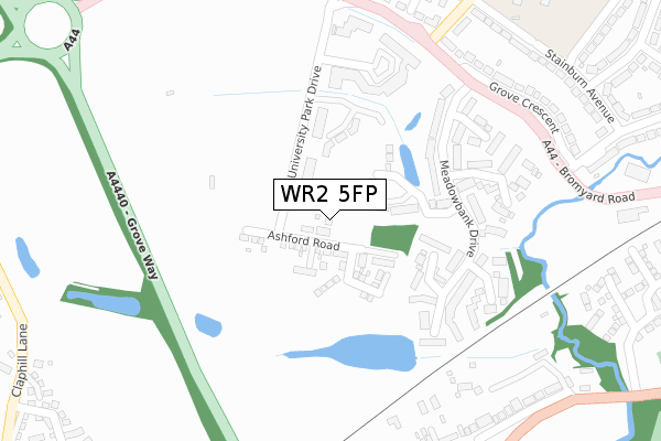
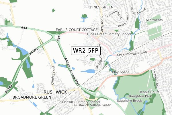
WR2 5FP is located in the Alfrick, Leigh & Rushwick electoral ward, within the local authority district of Malvern Hills and the English Parliamentary constituency of West Worcestershire. The Sub Integrated Care Board (ICB) Location is NHS Herefordshire and Worcestershire ICB - 18C and the police force is West Mercia. This postcode has been in use since January 2020.


GetTheData
Source: OS Open Zoomstack (Ordnance Survey)
Licence: Open Government Licence (requires attribution)
Attribution: Contains OS data © Crown copyright and database right 2024
Source: Open Postcode Geo
Licence: Open Government Licence (requires attribution)
Attribution: Contains OS data © Crown copyright and database right 2024; Contains Royal Mail data © Royal Mail copyright and database right 2024; Source: Office for National Statistics licensed under the Open Government Licence v.3.0
| Easting | 382145 |
| Northing | 254269 |
| Latitude | 52.186386 |
| Longitude | -2.262578 |
GetTheData
Source: Open Postcode Geo
Licence: Open Government Licence
| Country | England |
| Postcode District | WR2 |
| ➜ WR2 open data dashboard ➜ See where WR2 is on a map ➜ Where is Worcester? | |
GetTheData
Source: Land Registry Price Paid Data
Licence: Open Government Licence
| Ward | Alfrick, Leigh & Rushwick |
| Constituency | West Worcestershire |
GetTheData
Source: ONS Postcode Database
Licence: Open Government Licence
9, ASHFORD ROAD, WORCESTER, WR2 5FP 2022 29 APR £329,000 |
13, ASHFORD ROAD, WORCESTER, WR2 5FP 2022 28 FEB £375,000 |
15, ASHFORD ROAD, WORCESTER, WR2 5FP 2022 28 FEB £375,000 |
GetTheData
Source: HM Land Registry Price Paid Data
Licence: Contains HM Land Registry data © Crown copyright and database right 2024. This data is licensed under the Open Government Licence v3.0.
| June 2022 | Anti-social behaviour | On or near Grove Way | 218m |
| June 2022 | Criminal damage and arson | On or near Harrow Croft | 309m |
| June 2022 | Violence and sexual offences | On or near Harrow Croft | 309m |
| ➜ Get more crime data in our Crime section | |||
GetTheData
Source: data.police.uk
Licence: Open Government Licence
| Tudor Way (Bromyard Road) | Dines Green | 383m |
| Tudor Way (A44) | Dines Green | 407m |
| Grove Crescent (Bromyard Road (A44)) | Dines Green | 449m |
| Broadway Grove (A44) | St John's | 532m |
| Broadway Grove (A44) | St John's | 542m |
| Worcester Foregate Street Station | 3km |
| Worcester Shrub Hill Station | 3.8km |
GetTheData
Source: NaPTAN
Licence: Open Government Licence
GetTheData
Source: ONS Postcode Database
Licence: Open Government Licence


➜ Get more ratings from the Food Standards Agency
GetTheData
Source: Food Standards Agency
Licence: FSA terms & conditions
| Last Collection | |||
|---|---|---|---|
| Location | Mon-Fri | Sat | Distance |
| Rushwick P.o. | 17:30 | 10:30 | 552m |
| Grove Crescent | 16:45 | 11:30 | 558m |
| Christine Avenue | 17:45 | 08:45 | 730m |
GetTheData
Source: Dracos
Licence: Creative Commons Attribution-ShareAlike
| Facility | Distance |
|---|---|
| Dines Green Community Primary School Tudor Way, Worcester Grass Pitches, Sports Hall | 599m |
| Playscape Playing Field Upper Wick Lane, Rushwick, Worcester Grass Pitches | 784m |
| The Alf Tolley Memorial Ground Upper Wick Lane, Rushwick Grass Pitches | 1km |
GetTheData
Source: Active Places
Licence: Open Government Licence
| School | Phase of Education | Distance |
|---|---|---|
| Honeywell Primary School Tudor Way, Worcester, WR2 5QH | Primary | 599m |
| Rushwick CofE Primary School Upper Wick Lane, Rushwick, Rushwick Ce Primary School, Upper Wick Lane, Worcester, WR2 5SU | Primary | 697m |
| Pitmaston Primary School Malvern Road, Worcester, WR2 4ZF | Primary | 1.7km |
GetTheData
Source: Edubase
Licence: Open Government Licence
The below table lists the International Territorial Level (ITL) codes (formerly Nomenclature of Territorial Units for Statistics (NUTS) codes) and Local Administrative Units (LAU) codes for WR2 5FP:
| ITL 1 Code | Name |
|---|---|
| TLG | West Midlands (England) |
| ITL 2 Code | Name |
| TLG1 | Herefordshire, Worcestershire and Warwickshire |
| ITL 3 Code | Name |
| TLG12 | Worcestershire CC |
| LAU 1 Code | Name |
| E07000235 | Malvern Hills |
GetTheData
Source: ONS Postcode Directory
Licence: Open Government Licence
The below table lists the Census Output Area (OA), Lower Layer Super Output Area (LSOA), and Middle Layer Super Output Area (MSOA) for WR2 5FP:
| Code | Name | |
|---|---|---|
| OA | E00164151 | |
| LSOA | E01032182 | Malvern Hills 003C |
| MSOA | E02006712 | Malvern Hills 003 |
GetTheData
Source: ONS Postcode Directory
Licence: Open Government Licence
| WR2 5JG | Harrow Croft | 264m |
| WR2 5UG | Farmbrook Close | 324m |
| WR2 5GB | Rodgers Close | 379m |
| WR2 5UH | Westlea Close | 380m |
| WR2 5TP | Claphill Lane | 391m |
| WR2 5GD | Fernywood Close | 406m |
| WR2 5GA | Howburyfield Avenue | 418m |
| WR2 5UB | Meadowbank Drive | 421m |
| WR2 5GU | Callows Orchard | 423m |
| WR2 5GE | Harewood Close | 425m |
GetTheData
Source: Open Postcode Geo; Land Registry Price Paid Data
Licence: Open Government Licence