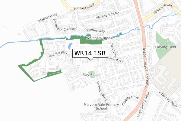
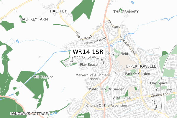
WR14 1SR is located in the West electoral ward, within the local authority district of Malvern Hills and the English Parliamentary constituency of West Worcestershire. The Sub Integrated Care Board (ICB) Location is NHS Herefordshire and Worcestershire ICB - 18C and the police force is West Mercia. This postcode has been in use since November 2017.


GetTheData
Source: OS Open Zoomstack (Ordnance Survey)
Licence: Open Government Licence (requires attribution)
Attribution: Contains OS data © Crown copyright and database right 2024
Source: Open Postcode Geo
Licence: Open Government Licence (requires attribution)
Attribution: Contains OS data © Crown copyright and database right 2024; Contains Royal Mail data © Royal Mail copyright and database right 2024; Source: Office for National Statistics licensed under the Open Government Licence v.3.0
| Easting | 377176 |
| Northing | 248424 |
| Latitude | 52.133652 |
| Longitude | -2.334863 |
GetTheData
Source: Open Postcode Geo
Licence: Open Government Licence
| Country | England |
| Postcode District | WR14 |
| ➜ WR14 open data dashboard ➜ See where WR14 is on a map ➜ Where is Great Malvern? | |
GetTheData
Source: Land Registry Price Paid Data
Licence: Open Government Licence
| Ward | West |
| Constituency | West Worcestershire |
GetTheData
Source: ONS Postcode Database
Licence: Open Government Licence
| January 2024 | Violence and sexual offences | On or near End Hill Way | 175m |
| December 2023 | Criminal damage and arson | On or near End Hill Way | 175m |
| September 2023 | Other crime | On or near End Hill Way | 175m |
| ➜ Get more crime data in our Crime section | |||
GetTheData
Source: data.police.uk
Licence: Open Government Licence
| Jubilee Way (Swinyard Road) | Malvern Vale | 65m |
| Halfkey Road | Upper Howsell | 307m |
| Richard's Close (Leigh Sinton Road) | Upper Howsell | 327m |
| Tanhouse Lane (Leigh Sinton Road) | Upper Howsell | 343m |
| Sayers Avenue | Upper Howsell | 372m |
| Malvern Link Station | 1.4km |
| Great Malvern Station | 2.9km |
GetTheData
Source: NaPTAN
Licence: Open Government Licence
➜ Broadband speed and availability dashboard for WR14 1SR
| Percentage of properties with Next Generation Access | 100.0% |
| Percentage of properties with Superfast Broadband | 100.0% |
| Percentage of properties with Ultrafast Broadband | 0.0% |
| Percentage of properties with Full Fibre Broadband | 0.0% |
Superfast Broadband is between 30Mbps and 300Mbps
Ultrafast Broadband is > 300Mbps
| Median download speed | 65.1Mbps |
| Average download speed | 52.7Mbps |
| Maximum download speed | 80.00Mbps |
| Median upload speed | 19.5Mbps |
| Average upload speed | 13.5Mbps |
| Maximum upload speed | 20.00Mbps |
| Percentage of properties unable to receive 2Mbps | 0.0% |
| Percentage of properties unable to receive 5Mbps | 0.0% |
| Percentage of properties unable to receive 10Mbps | 0.0% |
| Percentage of properties unable to receive 30Mbps | 0.0% |
➜ Broadband speed and availability dashboard for WR14 1SR
GetTheData
Source: Ofcom
Licence: Ofcom Terms of Use (requires attribution)
GetTheData
Source: ONS Postcode Database
Licence: Open Government Licence


➜ Get more ratings from the Food Standards Agency
GetTheData
Source: Food Standards Agency
Licence: FSA terms & conditions
| Last Collection | |||
|---|---|---|---|
| Location | Mon-Fri | Sat | Distance |
| Leigh Sinton Road | 17:30 | 11:30 | 384m |
| Half Key Lane | 17:30 | 11:30 | 485m |
| Tanhouse Lane | 17:30 | 11:30 | 555m |
GetTheData
Source: Dracos
Licence: Creative Commons Attribution-ShareAlike
| Facility | Distance |
|---|---|
| Malvern Vale Community Centre Swinyard Road, Malvern Grass Pitches | 228m |
| Sport Dyson Perrins Leisure Centre Yates Hay Road, Malvern Studio, Grass Pitches, Artificial Grass Pitch, Sports Hall, Health and Fitness Gym, Outdoor Tennis Courts | 391m |
| Northleigh C.e. Primary School St. Peters Road, Malvern Grass Pitches | 931m |
GetTheData
Source: Active Places
Licence: Open Government Licence
| School | Phase of Education | Distance |
|---|---|---|
| Dyson Perrins CofE Academy Yates Hay Road, Malvern, WR14 1WD | Secondary | 391m |
| Somers Park Primary School Somers Park Avenue, Malvern, WR14 1SE | Primary | 829m |
| Northleigh CofE Primary School St. Peters Road, Cowleigh Bank, Malvern, WR14 1QS | Primary | 931m |
GetTheData
Source: Edubase
Licence: Open Government Licence
The below table lists the International Territorial Level (ITL) codes (formerly Nomenclature of Territorial Units for Statistics (NUTS) codes) and Local Administrative Units (LAU) codes for WR14 1SR:
| ITL 1 Code | Name |
|---|---|
| TLG | West Midlands (England) |
| ITL 2 Code | Name |
| TLG1 | Herefordshire, Worcestershire and Warwickshire |
| ITL 3 Code | Name |
| TLG12 | Worcestershire CC |
| LAU 1 Code | Name |
| E07000235 | Malvern Hills |
GetTheData
Source: ONS Postcode Directory
Licence: Open Government Licence
The below table lists the Census Output Area (OA), Lower Layer Super Output Area (LSOA), and Middle Layer Super Output Area (MSOA) for WR14 1SR:
| Code | Name | |
|---|---|---|
| OA | E00172256 | |
| LSOA | E01032189 | Malvern Hills 006B |
| MSOA | E02006715 | Malvern Hills 006 |
GetTheData
Source: ONS Postcode Directory
Licence: Open Government Licence
| WR14 1FS | Chase End Close | 99m |
| WR14 1NR | Buttercup Walk | 101m |
| WR14 1FT | Broad Down Close | 103m |
| WR14 1FG | Swinyard Road | 116m |
| WR14 1FH | Jubilee Way | 138m |
| WR14 1FX | Pinnacle Way | 144m |
| WR14 1FQ | Sugarloaf Close | 156m |
| WR14 1BN | Fern Drive | 160m |
| WR14 1JH | Bracken Way | 165m |
| WR14 1FN | Hollybush Close | 183m |
GetTheData
Source: Open Postcode Geo; Land Registry Price Paid Data
Licence: Open Government Licence