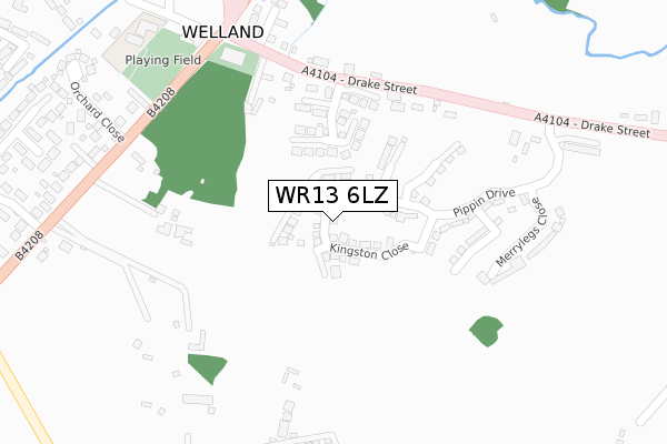
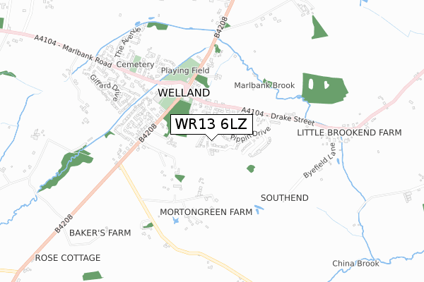
WR13 6LZ is located in the Castlemorton, Welland & Wells electoral ward, within the local authority district of Malvern Hills and the English Parliamentary constituency of West Worcestershire. The Sub Integrated Care Board (ICB) Location is NHS Herefordshire and Worcestershire ICB - 18C and the police force is West Mercia. This postcode has been in use since September 2018.


GetTheData
Source: OS Open Zoomstack (Ordnance Survey)
Licence: Open Government Licence (requires attribution)
Attribution: Contains OS data © Crown copyright and database right 2024
Source: Open Postcode Geo
Licence: Open Government Licence (requires attribution)
Attribution: Contains OS data © Crown copyright and database right 2024; Contains Royal Mail data © Royal Mail copyright and database right 2024; Source: Office for National Statistics licensed under the Open Government Licence v.3.0
| Easting | 379851 |
| Northing | 239724 |
| Latitude | 52.055539 |
| Longitude | -2.295264 |
GetTheData
Source: Open Postcode Geo
Licence: Open Government Licence
| Country | England |
| Postcode District | WR13 |
| ➜ WR13 open data dashboard ➜ See where WR13 is on a map ➜ Where is Welland? | |
GetTheData
Source: Land Registry Price Paid Data
Licence: Open Government Licence
| Ward | Castlemorton, Welland & Wells |
| Constituency | West Worcestershire |
GetTheData
Source: ONS Postcode Database
Licence: Open Government Licence
2022 29 JUN £750,000 |
2022 28 JUN £740,000 |
35, KINGSTON CLOSE, WELLAND, MALVERN, WR13 6LZ 2020 20 MAR £525,000 |
13, KINGSTON CLOSE, WELLAND, MALVERN, WR13 6LZ 2020 24 FEB £525,000 |
37, KINGSTON CLOSE, WELLAND, MALVERN, WR13 6LZ 2019 18 DEC £550,000 |
2019 15 NOV £515,000 |
2019 8 NOV £550,000 |
29, KINGSTON CLOSE, WELLAND, MALVERN, WR13 6LZ 2019 31 MAY £391,995 |
23, KINGSTON CLOSE, WELLAND, MALVERN, WR13 6LZ 2018 20 DEC £315,000 |
21, KINGSTON CLOSE, WELLAND, MALVERN, WR13 6LZ 2018 14 DEC £315,000 |
GetTheData
Source: HM Land Registry Price Paid Data
Licence: Contains HM Land Registry data © Crown copyright and database right 2024. This data is licensed under the Open Government Licence v3.0.
| June 2022 | Violence and sexual offences | On or near Sports/Recreation Area | 372m |
| June 2022 | Violence and sexual offences | On or near Sports/Recreation Area | 372m |
| June 2022 | Public order | On or near Sports/Recreation Area | 376m |
| ➜ Get more crime data in our Crime section | |||
GetTheData
Source: data.police.uk
Licence: Open Government Licence
| The Pheasant (Drake Street) | Welland | 272m |
| The Pheasant (Drake Street) | Welland | 280m |
| Post Office (Castlemorton Road) | Welland | 311m |
| Post Office (Castlemorton Road) | Welland | 327m |
| Hanley Road Shelter (Hanley Road) | Welland | 362m |
| Colwall Station | 5km |
GetTheData
Source: NaPTAN
Licence: Open Government Licence
| Percentage of properties with Next Generation Access | 100.0% |
| Percentage of properties with Superfast Broadband | 100.0% |
| Percentage of properties with Ultrafast Broadband | 100.0% |
| Percentage of properties with Full Fibre Broadband | 100.0% |
Superfast Broadband is between 30Mbps and 300Mbps
Ultrafast Broadband is > 300Mbps
| Percentage of properties unable to receive 2Mbps | 0.0% |
| Percentage of properties unable to receive 5Mbps | 0.0% |
| Percentage of properties unable to receive 10Mbps | 0.0% |
| Percentage of properties unable to receive 30Mbps | 0.0% |
GetTheData
Source: Ofcom
Licence: Ofcom Terms of Use (requires attribution)
GetTheData
Source: ONS Postcode Database
Licence: Open Government Licence
➜ Get more ratings from the Food Standards Agency
GetTheData
Source: Food Standards Agency
Licence: FSA terms & conditions
| Last Collection | |||
|---|---|---|---|
| Location | Mon-Fri | Sat | Distance |
| Welland P.o. | 17:00 | 10:45 | 321m |
| Welland (Old Po) | 17:00 | 09:30 | 450m |
| Marlbank Road | 17:00 | 09:30 | 947m |
GetTheData
Source: Dracos
Licence: Creative Commons Attribution-ShareAlike
| Facility | Distance |
|---|---|
| Spitalfield Recreation Ground Marlbank Road, Welland, Malvern Grass Pitches | 393m |
| Castlemorton C Of E Primary School Church Road, Castlemorton, Malvern Grass Pitches | 2.6km |
| Hanley Swan Playing Fields Welland Road, Hanley Swan Grass Pitches | 3km |
GetTheData
Source: Active Places
Licence: Open Government Licence
| School | Phase of Education | Distance |
|---|---|---|
| Welland Primary School Marlbank Road, Welland, Malvern, WR13 6NE | Primary | 407m |
| Castlemorton Church of England Primary School Church Road, Castlemorton, Malvern, WR13 6BG | Primary | 2.6km |
| Bridge School Malvern Unit 2, Hanley Workshops, Hanley Road, Hanley Swan, WR8 0DX | Not applicable | 2.8km |
GetTheData
Source: Edubase
Licence: Open Government Licence
The below table lists the International Territorial Level (ITL) codes (formerly Nomenclature of Territorial Units for Statistics (NUTS) codes) and Local Administrative Units (LAU) codes for WR13 6LZ:
| ITL 1 Code | Name |
|---|---|
| TLG | West Midlands (England) |
| ITL 2 Code | Name |
| TLG1 | Herefordshire, Worcestershire and Warwickshire |
| ITL 3 Code | Name |
| TLG12 | Worcestershire CC |
| LAU 1 Code | Name |
| E07000235 | Malvern Hills |
GetTheData
Source: ONS Postcode Directory
Licence: Open Government Licence
The below table lists the Census Output Area (OA), Lower Layer Super Output Area (LSOA), and Middle Layer Super Output Area (MSOA) for WR13 6LZ:
| Code | Name | |
|---|---|---|
| OA | E00164250 | |
| LSOA | E01032200 | Malvern Hills 011B |
| MSOA | E02006720 | Malvern Hills 011 |
GetTheData
Source: ONS Postcode Directory
Licence: Open Government Licence
| WR13 6LP | Drake Street | 226m |
| WR13 6LA | Gloucester Road | 378m |
| WR13 6LR | Morton Green | 423m |
| WR13 6AJ | Orchard Close | 467m |
| WR13 6LL | Merryfields | 468m |
| WR13 6LB | Welland Gardens | 499m |
| WR13 6LD | Gloucester Road | 518m |
| WR13 6SH | Gainsborough Close | 549m |
| WR13 6NE | Marlbank Road | 569m |
| WR13 6LY | Lime Grove | 575m |
GetTheData
Source: Open Postcode Geo; Land Registry Price Paid Data
Licence: Open Government Licence