WR11 2SJ maps, stats, and open data
WR11 2SJ is located in the Hampton electoral ward, within the local authority district of Wychavon and the English Parliamentary constituency of Mid Worcestershire. The Sub Integrated Care Board (ICB) Location is NHS Herefordshire and Worcestershire ICB - 18C and the police force is West Mercia. This postcode has been in use since September 2017.
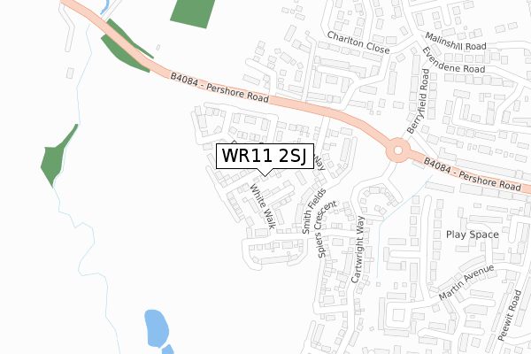
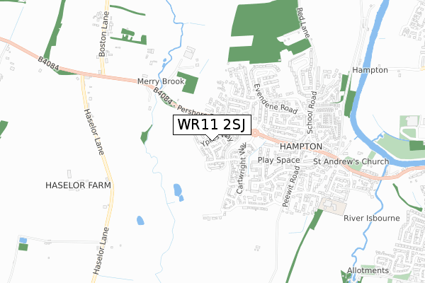
WR11 2SJ maps


Licence: Open Government Licence (requires attribution)
Attribution: Contains OS data © Crown copyright and database right 2025
Source: Open Postcode Geo
Licence: Open Government Licence (requires attribution)
Attribution: Contains OS data © Crown copyright and database right 2025; Contains Royal Mail data © Royal Mail copyright and database right 2025; Source: Office for National Statistics licensed under the Open Government Licence v.3.0
WR11 2SJ geodata
| Easting | 402052 |
| Northing | 243230 |
| Latitude | 52.087428 |
| Longitude | -1.971457 |
Where is WR11 2SJ?
| Country | England |
| Postcode District | WR11 |
Politics
| Ward | Hampton |
|---|---|
| Constituency | Mid Worcestershire |
House Prices
Sales of detached houses in WR11 2SJ
43, YPRES WAY, EVESHAM, WR11 2SJ 2023 28 JUN £370,000 |
2022 14 JAN £380,000 |
43, YPRES WAY, EVESHAM, WR11 2SJ 2021 30 JUN £340,000 |
2020 17 JUL £260,000 |
2020 5 FEB £331,000 |
8, YPRES WAY, EVESHAM, WR11 2SJ 2020 9 JAN £375,000 |
43, YPRES WAY, EVESHAM, WR11 2SJ 2018 21 DEC £333,000 |
41, YPRES WAY, EVESHAM, WR11 2SJ 2018 20 DEC £335,000 |
45, YPRES WAY, EVESHAM, WR11 2SJ 2018 17 DEC £260,000 |
39, YPRES WAY, EVESHAM, WR11 2SJ 2018 14 DEC £352,000 |
Licence: Contains HM Land Registry data © Crown copyright and database right 2025. This data is licensed under the Open Government Licence v3.0.
Transport
Nearest bus stops to WR11 2SJ
| Berryfield Road (Pershore Road) | Hampton | 221m |
| Berryfield Road (Pershore Road) | Hampton | 228m |
| Berryfield Road | Hampton | 295m |
| Charlton Close (Evendene Road) | Hampton | 380m |
| Charlton Close (Evendene Road) | Hampton | 400m |
Nearest railway stations to WR11 2SJ
| Evesham Station | 2.1km |
Broadband
Broadband access in WR11 2SJ (2020 data)
| Percentage of properties with Next Generation Access | 100.0% |
| Percentage of properties with Superfast Broadband | 100.0% |
| Percentage of properties with Ultrafast Broadband | 100.0% |
| Percentage of properties with Full Fibre Broadband | 96.9% |
Superfast Broadband is between 30Mbps and 300Mbps
Ultrafast Broadband is > 300Mbps
Broadband speed in WR11 2SJ (2019 data)
Download
| Median download speed | 100.0Mbps |
| Average download speed | 114.8Mbps |
| Maximum download speed | 350.00Mbps |
Upload
Ofcom does not currently provide upload speed data for WR11 2SJ. This is because there are less than four broadband connections in this postcode.
Broadband limitations in WR11 2SJ (2020 data)
| Percentage of properties unable to receive 2Mbps | 0.0% |
| Percentage of properties unable to receive 5Mbps | 0.0% |
| Percentage of properties unable to receive 10Mbps | 0.0% |
| Percentage of properties unable to receive 30Mbps | 0.0% |
Deprivation
47.7% of English postcodes are less deprived than WR11 2SJ:Food Standards Agency
Three nearest food hygiene ratings to WR11 2SJ (metres)


➜ Get more ratings from the Food Standards Agency
Nearest post box to WR11 2SJ
| Last Collection | |||
|---|---|---|---|
| Location | Mon-Fri | Sat | Distance |
| Martin Avenue | 17:15 | 11:00 | 399m |
| Hampton P.o. | 17:30 | 11:00 | 508m |
| Evendene Road | 17:30 | 11:00 | 519m |
WR11 2SJ ITL and WR11 2SJ LAU
The below table lists the International Territorial Level (ITL) codes (formerly Nomenclature of Territorial Units for Statistics (NUTS) codes) and Local Administrative Units (LAU) codes for WR11 2SJ:
| ITL 1 Code | Name |
|---|---|
| TLG | West Midlands (England) |
| ITL 2 Code | Name |
| TLG1 | Herefordshire, Worcestershire and Warwickshire |
| ITL 3 Code | Name |
| TLG12 | Worcestershire CC |
| LAU 1 Code | Name |
| E07000238 | Wychavon |
WR11 2SJ census areas
The below table lists the Census Output Area (OA), Lower Layer Super Output Area (LSOA), and Middle Layer Super Output Area (MSOA) for WR11 2SJ:
| Code | Name | |
|---|---|---|
| OA | E00165174 | |
| LSOA | E01032385 | Wychavon 015C |
| MSOA | E02006762 | Wychavon 015 |
Nearest postcodes to WR11 2SJ
| WR11 2AA | Stewart Close | 200m |
| WR11 2PB | Hillside Close | 239m |
| WR11 2AT | Merry Brook Heights | 258m |
| WR11 2NR | St Andrew Road | 309m |
| WR11 2QE | Charlton Close | 315m |
| WR11 2QD | Berryfield Road | 325m |
| WR11 2NP | Martin Avenue | 337m |
| WR11 2QF | Merrybrook | 395m |
| WR11 2NB | Pershore Road | 414m |
| WR11 2PJ | Pershore Road | 414m |