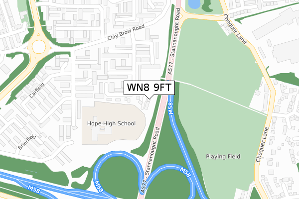
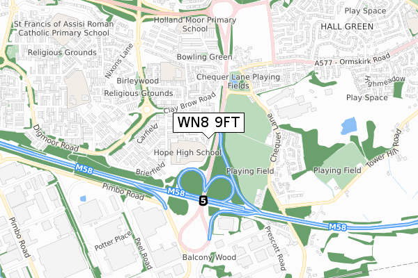
WN8 9FT is located in the Skelmersdale South electoral ward, within the local authority district of West Lancashire and the English Parliamentary constituency of West Lancashire. The Sub Integrated Care Board (ICB) Location is NHS Lancashire and South Cumbria ICB - 02G and the police force is Lancashire. This postcode has been in use since April 2020.


GetTheData
Source: OS Open Zoomstack (Ordnance Survey)
Licence: Open Government Licence (requires attribution)
Attribution: Contains OS data © Crown copyright and database right 2024
Source: Open Postcode Geo
Licence: Open Government Licence (requires attribution)
Attribution: Contains OS data © Crown copyright and database right 2024; Contains Royal Mail data © Royal Mail copyright and database right 2024; Source: Office for National Statistics licensed under the Open Government Licence v.3.0
| Easting | 350472 |
| Northing | 404670 |
| Latitude | 53.536348 |
| Longitude | -2.748756 |
GetTheData
Source: Open Postcode Geo
Licence: Open Government Licence
| Country | England |
| Postcode District | WN8 |
| ➜ WN8 open data dashboard ➜ See where WN8 is on a map ➜ Where is Skelmersdale? | |
GetTheData
Source: Land Registry Price Paid Data
Licence: Open Government Licence
| Ward | Skelmersdale South |
| Constituency | West Lancashire |
GetTheData
Source: ONS Postcode Database
Licence: Open Government Licence
| January 2024 | Anti-social behaviour | On or near Back Lane | 357m |
| January 2024 | Anti-social behaviour | On or near Back Lane | 357m |
| December 2023 | Anti-social behaviour | On or near Petrol Station | 423m |
| ➜ Get more crime data in our Crime section | |||
GetTheData
Source: data.police.uk
Licence: Open Government Licence
| Cherrycroft (Clay Brow Road) | Clay Brow | 236m |
| Cherrycroft (Clay Brow Road) | Clay Brow | 252m |
| Hare And Hounds (Ormskirk Road) | Clay Brow | 437m |
| Hare And Hounds (Ormskirk Road) | Clay Brow | 450m |
| Birkrig (Digmoor Road) | Digmoor | 501m |
| Upholland Station | 1km |
| Orrell Station | 2.7km |
| Rainford Station | 3.4km |
GetTheData
Source: NaPTAN
Licence: Open Government Licence
GetTheData
Source: ONS Postcode Database
Licence: Open Government Licence


➜ Get more ratings from the Food Standards Agency
GetTheData
Source: Food Standards Agency
Licence: FSA terms & conditions
| Last Collection | |||
|---|---|---|---|
| Location | Mon-Fri | Sat | Distance |
| Martins Lane | 17:30 | 11:00 | 1,167m |
| 83 Banksbarn | 17:35 | 11:00 | 1,175m |
| Upholland P O | 18:30 | 11:30 | 1,526m |
GetTheData
Source: Dracos
Licence: Creative Commons Attribution-ShareAlike
| Facility | Distance |
|---|---|
| Hope High School Carfield, Skelmersdale Grass Pitches, Sports Hall | 209m |
| Chequer Lane Playing Field Chequer Lane, Up Holland Grass Pitches | 224m |
| Moorside Academy Back Lane, Holland Moor, Skelmersdale Grass Pitches | 428m |
GetTheData
Source: Active Places
Licence: Open Government Licence
| School | Phase of Education | Distance |
|---|---|---|
| Hope High School Carfield, Clay Brow, Skelmersdale, WN8 9DP | Not applicable | 288m |
| Moorside Community Primary Academy School Back Lane, Holland Moor, Skelmersdale, WN8 9EA | Primary | 425m |
| Holland Moor Primary School Cornbrook, Skelmersdale, WN8 9AG | Primary | 689m |
GetTheData
Source: Edubase
Licence: Open Government Licence
The below table lists the International Territorial Level (ITL) codes (formerly Nomenclature of Territorial Units for Statistics (NUTS) codes) and Local Administrative Units (LAU) codes for WN8 9FT:
| ITL 1 Code | Name |
|---|---|
| TLD | North West (England) |
| ITL 2 Code | Name |
| TLD4 | Lancashire |
| ITL 3 Code | Name |
| TLD47 | Chorley and West Lancashire |
| LAU 1 Code | Name |
| E07000127 | West Lancashire |
GetTheData
Source: ONS Postcode Directory
Licence: Open Government Licence
The below table lists the Census Output Area (OA), Lower Layer Super Output Area (LSOA), and Middle Layer Super Output Area (MSOA) for WN8 9FT:
| Code | Name | |
|---|---|---|
| OA | E00129427 | |
| LSOA | E01025503 | West Lancashire 014C |
| MSOA | E02005317 | West Lancashire 014 |
GetTheData
Source: ONS Postcode Directory
Licence: Open Government Licence
| WN8 9DU | Castlehey | 105m |
| WN8 9DT | Castlehey | 127m |
| WN8 9DS | Castlehey | 158m |
| WN8 9DX | Castlehey | 199m |
| WN8 9DR | Carfield | 224m |
| WN8 9DZ | Charnock | 287m |
| WN8 9DP | Carfield | 293m |
| WN8 9DY | Cherrycroft | 295m |
| WN8 9DJ | Cherrycroft | 332m |
| WN8 9DW | Carfield | 334m |
GetTheData
Source: Open Postcode Geo; Land Registry Price Paid Data
Licence: Open Government Licence