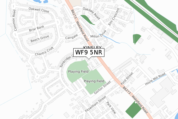
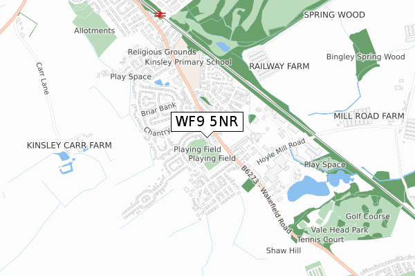
WF9 5NR is located in the Hemsworth electoral ward, within the metropolitan district of Wakefield and the English Parliamentary constituency of Hemsworth. The Sub Integrated Care Board (ICB) Location is NHS West Yorkshire ICB - 03R and the police force is West Yorkshire. This postcode has been in use since June 2019.


GetTheData
Source: OS Open Zoomstack (Ordnance Survey)
Licence: Open Government Licence (requires attribution)
Attribution: Contains OS data © Crown copyright and database right 2024
Source: Open Postcode Geo
Licence: Open Government Licence (requires attribution)
Attribution: Contains OS data © Crown copyright and database right 2024; Contains Royal Mail data © Royal Mail copyright and database right 2024; Source: Office for National Statistics licensed under the Open Government Licence v.3.0
| Easting | 441747 |
| Northing | 414549 |
| Latitude | 53.625835 |
| Longitude | -1.370261 |
GetTheData
Source: Open Postcode Geo
Licence: Open Government Licence
| Country | England |
| Postcode District | WF9 |
| ➜ WF9 open data dashboard ➜ See where WF9 is on a map ➜ Where is Kinsley? | |
GetTheData
Source: Land Registry Price Paid Data
Licence: Open Government Licence
| Ward | Hemsworth |
| Constituency | Hemsworth |
GetTheData
Source: ONS Postcode Database
Licence: Open Government Licence
| May 2023 | Other theft | On or near Briar Bank | 343m |
| June 2022 | Violence and sexual offences | On or near Sports/Recreation Area | 92m |
| June 2022 | Violence and sexual offences | On or near Carrgate | 157m |
| ➜ Get more crime data in our Crime section | |||
GetTheData
Source: data.police.uk
Licence: Open Government Licence
| Wakefield Rd Morris Close (Wakefield Road) | Kinsley | 86m |
| Wakefield Road Stadium (Wakefield Road) | Kinsley | 134m |
| Wakefield Rd Morris Close (Wakefield Road) | Kinsley | 218m |
| Kinsley Hotel Ford Street (Wakefield Road) | Kinsley | 248m |
| Wakefield Rd Farmfield Drive (Wakefield Road) | Kinsley | 456m |
| Fitzwilliam Station | 0.8km |
| Moorthorpe Station | 5.5km |
GetTheData
Source: NaPTAN
Licence: Open Government Licence
| Percentage of properties with Next Generation Access | 100.0% |
| Percentage of properties with Superfast Broadband | 100.0% |
| Percentage of properties with Ultrafast Broadband | 0.0% |
| Percentage of properties with Full Fibre Broadband | 0.0% |
Superfast Broadband is between 30Mbps and 300Mbps
Ultrafast Broadband is > 300Mbps
| Percentage of properties unable to receive 2Mbps | 0.0% |
| Percentage of properties unable to receive 5Mbps | 0.0% |
| Percentage of properties unable to receive 10Mbps | 0.0% |
| Percentage of properties unable to receive 30Mbps | 0.0% |
GetTheData
Source: Ofcom
Licence: Ofcom Terms of Use (requires attribution)
GetTheData
Source: ONS Postcode Database
Licence: Open Government Licence


➜ Get more ratings from the Food Standards Agency
GetTheData
Source: Food Standards Agency
Licence: FSA terms & conditions
| Last Collection | |||
|---|---|---|---|
| Location | Mon-Fri | Sat | Distance |
| 33 Tonbridge Cres | 17:15 | 11:45 | 191m |
| Kinsley P.o. | 17:30 | 11:30 | 240m |
| Briar Bank / West Moor Road | 17:15 | 11:45 | 344m |
GetTheData
Source: Dracos
Licence: Creative Commons Attribution-ShareAlike
| Facility | Distance |
|---|---|
| Kinsley Playing Fields Tombridge Crescent, Kinsley, Pontefract Grass Pitches | 58m |
| Gorton Road (Closed) Gorton Street, Kinsley, Pontefract Grass Pitches | 118m |
| Gorton Street Playing Field Gorton Street, Kinsley, Pontefract Grass Pitches | 148m |
GetTheData
Source: Active Places
Licence: Open Government Licence
| School | Phase of Education | Distance |
|---|---|---|
| King's Meadow Academy Wakefield Road, Fitzwilliam, Pontefract, WF9 5BP | Primary | 522m |
| West End Academy Regent Street, Hemsworth, Pontefract, WF9 4QJ | Primary | 1.4km |
| Fitzwilliam Primary School Second Avenue, Pontefract, WF9 5BA | Primary | 1.4km |
GetTheData
Source: Edubase
Licence: Open Government Licence
The below table lists the International Territorial Level (ITL) codes (formerly Nomenclature of Territorial Units for Statistics (NUTS) codes) and Local Administrative Units (LAU) codes for WF9 5NR:
| ITL 1 Code | Name |
|---|---|
| TLE | Yorkshire and The Humber |
| ITL 2 Code | Name |
| TLE4 | West Yorkshire |
| ITL 3 Code | Name |
| TLE45 | Wakefield |
| LAU 1 Code | Name |
| E08000036 | Wakefield |
GetTheData
Source: ONS Postcode Directory
Licence: Open Government Licence
The below table lists the Census Output Area (OA), Lower Layer Super Output Area (LSOA), and Middle Layer Super Output Area (MSOA) for WF9 5NR:
| Code | Name | |
|---|---|---|
| OA | E00059435 | |
| LSOA | E01011792 | Wakefield 039D |
| MSOA | E02002476 | Wakefield 039 |
GetTheData
Source: ONS Postcode Directory
Licence: Open Government Licence
| WF9 5EY | Wakefield Road | 38m |
| WF9 5HA | Tombridge Crescent | 104m |
| WF9 5LQ | Redland Crescent | 107m |
| WF9 5HH | Kinsley Street | 155m |
| WF9 5JQ | Carrgate | 170m |
| WF9 5LF | Milton Drive | 175m |
| WF9 5HQ | Longsight Terrace | 179m |
| WF9 5HB | Tombridge Crescent | 183m |
| WF9 5EH | Wakefield Road | 183m |
| WF9 5ES | Gorton Street | 187m |
GetTheData
Source: Open Postcode Geo; Land Registry Price Paid Data
Licence: Open Government Licence