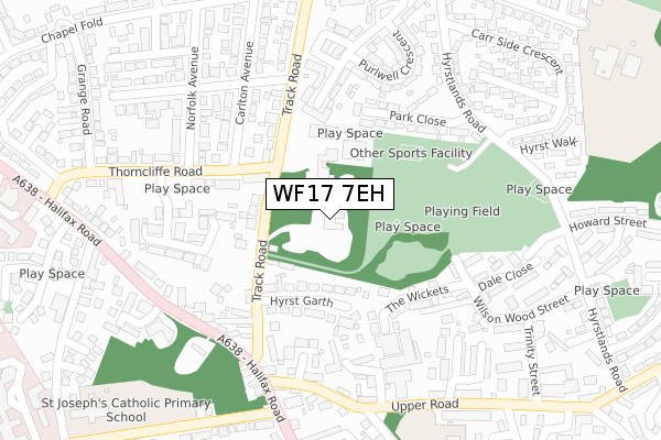
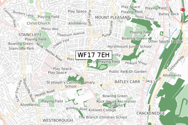
WF17 7EH is located in the Batley East electoral ward, within the metropolitan district of Kirklees and the English Parliamentary constituency of Batley and Spen. The Sub Integrated Care Board (ICB) Location is NHS West Yorkshire ICB - X2C4Y and the police force is West Yorkshire. This postcode has been in use since April 2020.


GetTheData
Source: OS Open Zoomstack (Ordnance Survey)
Licence: Open Government Licence (requires attribution)
Attribution: Contains OS data © Crown copyright and database right 2024
Source: Open Postcode Geo
Licence: Open Government Licence (requires attribution)
Attribution: Contains OS data © Crown copyright and database right 2024; Contains Royal Mail data © Royal Mail copyright and database right 2024; Source: Office for National Statistics licensed under the Open Government Licence v.3.0
| Easting | 423776 |
| Northing | 423054 |
| Latitude | 53.703396 |
| Longitude | -1.641328 |
GetTheData
Source: Open Postcode Geo
Licence: Open Government Licence
| Country | England |
| Postcode District | WF17 |
| ➜ WF17 open data dashboard ➜ See where WF17 is on a map ➜ Where is Batley? | |
GetTheData
Source: Land Registry Price Paid Data
Licence: Open Government Licence
| Ward | Batley East |
| Constituency | Batley And Spen |
GetTheData
Source: ONS Postcode Database
Licence: Open Government Licence
| January 2024 | Violence and sexual offences | On or near Beckett Road | 422m |
| December 2023 | Public order | On or near Purlwell Avenue | 312m |
| December 2023 | Violence and sexual offences | On or near Purlwell Avenue | 312m |
| ➜ Get more crime data in our Crime section | |||
GetTheData
Source: data.police.uk
Licence: Open Government Licence
| Thorncliffe Rd Norfolk Avenue (Thorncliffe Road) | Staincliffe | 204m |
| Thorncliffe Road Ashcroft Close (Thorncliffe Road) | Staincliffe | 228m |
| Halifax Rd Upper Road (Halifax Road) | Dewsbury | 244m |
| Halifax Rd Healds Road (Halifax Road) | Dewsbury | 285m |
| Hyrstlands Road Carr Side Cres (Hyrstlands Road) | Batley Carr | 314m |
| Dewsbury Station | 1.4km |
| Batley Station | 1.4km |
| Ravensthorpe Station | 3.2km |
GetTheData
Source: NaPTAN
Licence: Open Government Licence
GetTheData
Source: ONS Postcode Database
Licence: Open Government Licence


➜ Get more ratings from the Food Standards Agency
GetTheData
Source: Food Standards Agency
Licence: FSA terms & conditions
| Last Collection | |||
|---|---|---|---|
| Location | Mon-Fri | Sat | Distance |
| Longlands | 17:45 | 11:30 | 217m |
| Carlton Grange | 17:30 | 11:30 | 244m |
| Naylor St | 17:30 | 11:00 | 280m |
GetTheData
Source: Dracos
Licence: Creative Commons Attribution-ShareAlike
| Facility | Distance |
|---|---|
| Al-hikmah Sports Hall Track Road, Track Road, Batley Artificial Grass Pitch | 151m |
| Hyrstlands Park Park Close, Batley Grass Pitches | 178m |
| St Josephs Catholic Primary School Healds Road, Dewsbury Grass Pitches | 423m |
GetTheData
Source: Active Places
Licence: Open Government Licence
| School | Phase of Education | Distance |
|---|---|---|
| Carlton Junior and Infant School Upper Road, Batley Carr, Dewsbury, WF13 2DQ | Primary | 370m |
| St Joseph's Catholic Primary Academy Healds Road, Dewsbury, WF13 4HY | Primary | 423m |
| Purlwell Infant and Nursery School Purlwell Lane, Batley, WF17 7PE | Primary | 441m |
GetTheData
Source: Edubase
Licence: Open Government Licence
The below table lists the International Territorial Level (ITL) codes (formerly Nomenclature of Territorial Units for Statistics (NUTS) codes) and Local Administrative Units (LAU) codes for WF17 7EH:
| ITL 1 Code | Name |
|---|---|
| TLE | Yorkshire and The Humber |
| ITL 2 Code | Name |
| TLE4 | West Yorkshire |
| ITL 3 Code | Name |
| TLE44 | Calderdale and Kirklees |
| LAU 1 Code | Name |
| E08000034 | Kirklees |
GetTheData
Source: ONS Postcode Directory
Licence: Open Government Licence
The below table lists the Census Output Area (OA), Lower Layer Super Output Area (LSOA), and Middle Layer Super Output Area (MSOA) for WF17 7EH:
| Code | Name | |
|---|---|---|
| OA | E00055562 | |
| LSOA | E01011018 | Kirklees 013C |
| MSOA | E02002283 | Kirklees 013 |
GetTheData
Source: ONS Postcode Directory
Licence: Open Government Licence
| WF17 7AA | Track Road | 72m |
| WF17 7AE | Track Road | 111m |
| WF17 7AD | Hyrst Garth | 111m |
| WF17 7BL | Swiss Walk | 150m |
| WF17 7BN | Carr Top Close | 152m |
| WF17 7AF | Track Mount | 153m |
| WF17 7LP | Pickles Field | 191m |
| WF17 7DP | Ashcroft Close | 205m |
| WF17 7BJ | Upper Road | 209m |
| WF17 7AQ | Carlton Avenue | 226m |
GetTheData
Source: Open Postcode Geo; Land Registry Price Paid Data
Licence: Open Government Licence