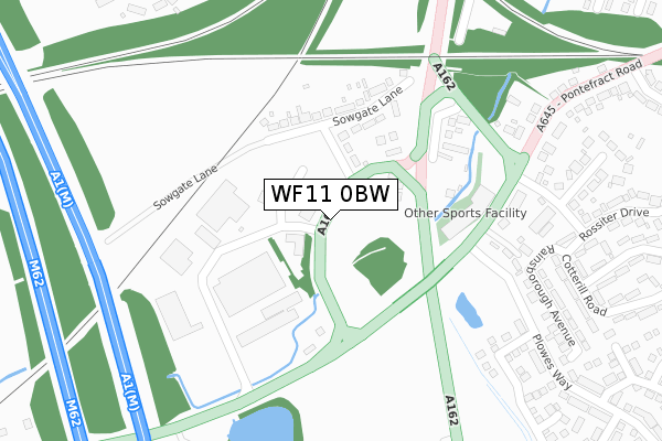
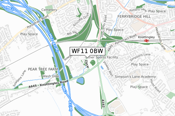
WF11 0BW is located in the Knottingley electoral ward, within the metropolitan district of Wakefield and the English Parliamentary constituency of Normanton, Pontefract and Castleford. The Sub Integrated Care Board (ICB) Location is NHS West Yorkshire ICB - 03R and the police force is West Yorkshire. This postcode has been in use since November 2019.


GetTheData
Source: OS Open Zoomstack (Ordnance Survey)
Licence: Open Government Licence (requires attribution)
Attribution: Contains OS data © Crown copyright and database right 2024
Source: Open Postcode Geo
Licence: Open Government Licence (requires attribution)
Attribution: Contains OS data © Crown copyright and database right 2024; Contains Royal Mail data © Royal Mail copyright and database right 2024; Source: Office for National Statistics licensed under the Open Government Licence v.3.0
| Easting | 449102 |
| Northing | 423412 |
| Latitude | 53.704855 |
| Longitude | -1.257666 |
GetTheData
Source: Open Postcode Geo
Licence: Open Government Licence
| Country | England |
| Postcode District | WF11 |
| ➜ WF11 open data dashboard ➜ See where WF11 is on a map ➜ Where is Knottingley? | |
GetTheData
Source: Land Registry Price Paid Data
Licence: Open Government Licence
| Ward | Knottingley |
| Constituency | Normanton, Pontefract And Castleford |
GetTheData
Source: ONS Postcode Database
Licence: Open Government Licence
| October 2023 | Violence and sexual offences | On or near Elm Place | 338m |
| October 2023 | Violence and sexual offences | On or near Elm Place | 338m |
| August 2023 | Public order | On or near Elm Place | 338m |
| ➜ Get more crime data in our Crime section | |||
GetTheData
Source: data.police.uk
Licence: Open Government Licence
| Spawd Bone Lane Hazel Rd (Spawd Bone Lane) | Knottingley | 115m |
| Hazel Rd Spawd Bone Lane (Spawd Bone Lane) | Knottingley | 137m |
| Hazel Rd Kershaw Lane (Hazel Road) | Knottingley | 188m |
| Hazel Road Pinewood Place (Hazel Road) | Knottingley | 233m |
| Headlands Lane Cotswold Dr (Headlands Lane) | Knottingley | 281m |
| Knottingley Station | 0.2km |
| Pontefract Monkhill Station | 3.1km |
| Pontefract Baghill Station | 3.3km |
GetTheData
Source: NaPTAN
Licence: Open Government Licence
| Percentage of properties with Next Generation Access | 0.0% |
| Percentage of properties with Superfast Broadband | 0.0% |
| Percentage of properties with Ultrafast Broadband | 0.0% |
| Percentage of properties with Full Fibre Broadband | 0.0% |
Superfast Broadband is between 30Mbps and 300Mbps
Ultrafast Broadband is > 300Mbps
| Percentage of properties unable to receive 2Mbps | 0.0% |
| Percentage of properties unable to receive 5Mbps | 0.0% |
| Percentage of properties unable to receive 10Mbps | 0.0% |
| Percentage of properties unable to receive 30Mbps | 0.0% |
GetTheData
Source: Ofcom
Licence: Ofcom Terms of Use (requires attribution)
GetTheData
Source: ONS Postcode Database
Licence: Open Government Licence


➜ Get more ratings from the Food Standards Agency
GetTheData
Source: Food Standards Agency
Licence: FSA terms & conditions
| Last Collection | |||
|---|---|---|---|
| Location | Mon-Fri | Sat | Distance |
| Simpsons Lane/Fairfax Avenue | 18:00 | 10:30 | 276m |
| Pinewood Place P.o. | 18:00 | 12:00 | 293m |
| Knottingley P.o. | 17:45 | 12:00 | 381m |
GetTheData
Source: Dracos
Licence: Creative Commons Attribution-ShareAlike
| Facility | Distance |
|---|---|
| The Vale Primary Academy Ferrybridge Road, Knottingley Grass Pitches | 505m |
| Kellingley Welfare Social Club Marine Villa Road, Knottingley Grass Pitches | 635m |
| Knottingley Sports Centre (Closed) Hill Top, Knottingley Sports Hall, Swimming Pool, Health and Fitness Gym, Squash Courts | 732m |
GetTheData
Source: Active Places
Licence: Open Government Licence
| School | Phase of Education | Distance |
|---|---|---|
| Simpson's Lane Academy Sycamore Avenue, Knottingley, WF11 0PL | Primary | 389m |
| The Vale Primary Academy Ferrybridge Road, Knottingley, WF11 8JF | Primary | 561m |
| England Lane Academy England Lane, Knottingley, WF11 0JA | Primary | 884m |
GetTheData
Source: Edubase
Licence: Open Government Licence
The below table lists the International Territorial Level (ITL) codes (formerly Nomenclature of Territorial Units for Statistics (NUTS) codes) and Local Administrative Units (LAU) codes for WF11 0BW:
| ITL 1 Code | Name |
|---|---|
| TLE | Yorkshire and The Humber |
| ITL 2 Code | Name |
| TLE4 | West Yorkshire |
| ITL 3 Code | Name |
| TLE45 | Wakefield |
| LAU 1 Code | Name |
| E08000036 | Wakefield |
GetTheData
Source: ONS Postcode Directory
Licence: Open Government Licence
The below table lists the Census Output Area (OA), Lower Layer Super Output Area (LSOA), and Middle Layer Super Output Area (MSOA) for WF11 0BW:
| Code | Name | |
|---|---|---|
| OA | E00059560 | |
| LSOA | E01011809 | Wakefield 011D |
| MSOA | E02002448 | Wakefield 011 |
GetTheData
Source: ONS Postcode Directory
Licence: Open Government Licence
| WF11 0HR | Spawd Bone Lane | 38m |
| WF11 0PG | Kershaw Lane | 103m |
| WF11 0PF | Hazel Road | 110m |
| WF11 0PQ | Birch Tree Walk | 165m |
| WF11 0LE | Cherry Tree Walk | 188m |
| WF11 0HG | Simpsons Lane | 195m |
| WF11 0PU | Maple Walk | 200m |
| WF11 0HS | Eddystone Rise | 214m |
| WF11 0HE | Simpsons Lane | 235m |
| WF11 0PS | Acacia Walk | 249m |
GetTheData
Source: Open Postcode Geo; Land Registry Price Paid Data
Licence: Open Government Licence