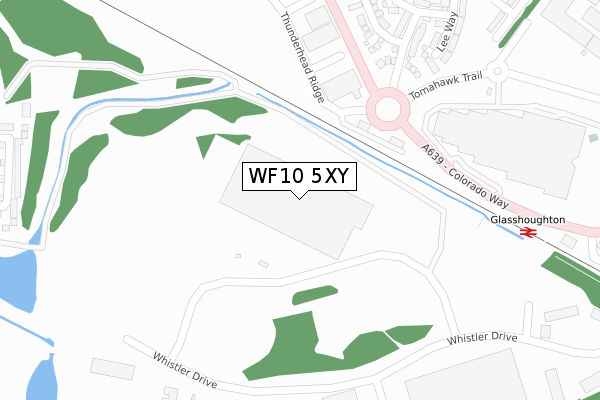
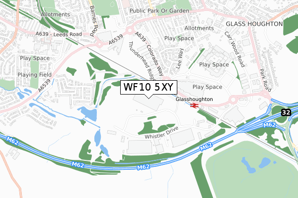
WF10 5XY is located in the Castleford Central and Glasshoughton electoral ward, within the metropolitan district of Wakefield and the English Parliamentary constituency of Normanton, Pontefract and Castleford. The Sub Integrated Care Board (ICB) Location is NHS West Yorkshire ICB - 03R and the police force is West Yorkshire. This postcode has been in use since September 2019.


GetTheData
Source: OS Open Zoomstack (Ordnance Survey)
Licence: Open Government Licence (requires attribution)
Attribution: Contains OS data © Crown copyright and database right 2024
Source: Open Postcode Geo
Licence: Open Government Licence (requires attribution)
Attribution: Contains OS data © Crown copyright and database right 2024; Contains Royal Mail data © Royal Mail copyright and database right 2024; Source: Office for National Statistics licensed under the Open Government Licence v.3.0
| Easting | 443166 |
| Northing | 423869 |
| Latitude | 53.709485 |
| Longitude | -1.347516 |
GetTheData
Source: Open Postcode Geo
Licence: Open Government Licence
| Country | England |
| Postcode District | WF10 |
| ➜ WF10 open data dashboard ➜ See where WF10 is on a map | |
GetTheData
Source: Land Registry Price Paid Data
Licence: Open Government Licence
| Ward | Castleford Central And Glasshoughton |
| Constituency | Normanton, Pontefract And Castleford |
GetTheData
Source: ONS Postcode Database
Licence: Open Government Licence
| June 2022 | Vehicle crime | On or near Thunderhead Ridge | 336m |
| June 2022 | Anti-social behaviour | On or near Parking Area | 371m |
| June 2022 | Anti-social behaviour | On or near Parking Area | 371m |
| ➜ Get more crime data in our Crime section | |||
GetTheData
Source: data.police.uk
Licence: Open Government Licence
| Colorado Way Carr Ln (Colorado Way) | Glasshoughton | 286m |
| Colorado Way Carr Ln (Colorado Way) | Glasshoughton | 293m |
| Tomahawk Trail Keystone Avenue (Tomahawks Trail) | Glasshoughton | 319m |
| Glasshoughton Rail Station (Colorado Way) | Glasshoughton | 374m |
| Asda Leeds Road (Leeds Road) | Glasshoughton | 567m |
| Glasshoughton Station | 0.4km |
| Castleford Station | 1.7km |
| Pontefract Tanshelf Station | 2.5km |
GetTheData
Source: NaPTAN
Licence: Open Government Licence
GetTheData
Source: ONS Postcode Database
Licence: Open Government Licence


➜ Get more ratings from the Food Standards Agency
GetTheData
Source: Food Standards Agency
Licence: FSA terms & conditions
| Last Collection | |||
|---|---|---|---|
| Location | Mon-Fri | Sat | Distance |
| Cannon Street / Leeds Road | 17:30 | 11:30 | 677m |
| Freeport | 18:30 | 929m | |
| Colorado Way Off Carwood Road | 18:30 | 12:45 | 932m |
GetTheData
Source: Dracos
Licence: Creative Commons Attribution-ShareAlike
| Facility | Distance |
|---|---|
| Jd Gyms (Castleford) Colorado Way, Castleford Health and Fitness Gym, Studio | 359m |
| Snozone Castleford Colorado Way, Castleford Ski Slopes | 435m |
| Glasshoughton Centre Leeds Road, Glasshoughton, Castleford Grass Pitches, Artificial Grass Pitch | 804m |
GetTheData
Source: Active Places
Licence: Open Government Licence
| School | Phase of Education | Distance |
|---|---|---|
| Smawthorne Henry Moore Primary School, Castleford Ashton Road, Castleford, WF10 5AX | Primary | 904m |
| Half Acres Primary Academy Temple Street, Castleford, WF10 5RE | Primary | 1.5km |
| Glasshoughton Infant Academy Newfield Avenue, Castleford, WF10 4BH | Primary | 1.5km |
GetTheData
Source: Edubase
Licence: Open Government Licence
The below table lists the International Territorial Level (ITL) codes (formerly Nomenclature of Territorial Units for Statistics (NUTS) codes) and Local Administrative Units (LAU) codes for WF10 5XY:
| ITL 1 Code | Name |
|---|---|
| TLE | Yorkshire and The Humber |
| ITL 2 Code | Name |
| TLE4 | West Yorkshire |
| ITL 3 Code | Name |
| TLE45 | Wakefield |
| LAU 1 Code | Name |
| E08000036 | Wakefield |
GetTheData
Source: ONS Postcode Directory
Licence: Open Government Licence
The below table lists the Census Output Area (OA), Lower Layer Super Output Area (LSOA), and Middle Layer Super Output Area (MSOA) for WF10 5XY:
| Code | Name | |
|---|---|---|
| OA | E00168731 | |
| LSOA | E01011749 | Wakefield 005B |
| MSOA | E02002442 | Wakefield 005 |
GetTheData
Source: ONS Postcode Directory
Licence: Open Government Licence
| WF10 4TH | Keystone Avenue | 349m |
| WF10 5HX | Whistler Drive | 362m |
| WF10 4TD | Merefield Way | 365m |
| WF10 4TA | Colorado Way | 379m |
| WF10 4TQ | Lee Way | 414m |
| WF10 4TG | Parison Court | 421m |
| WF10 4TE | Champion Avenue | 442m |
| WF10 4PW | Carr Lane Avenue | 479m |
| WF10 4PN | Carr Lane | 494m |
| WF10 5HW | Flemming Court | 496m |
GetTheData
Source: Open Postcode Geo; Land Registry Price Paid Data
Licence: Open Government Licence