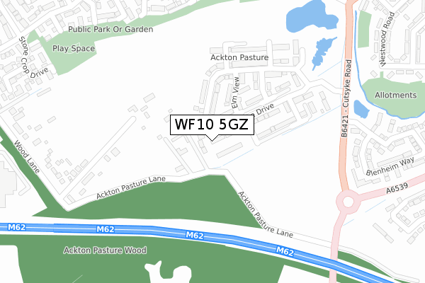
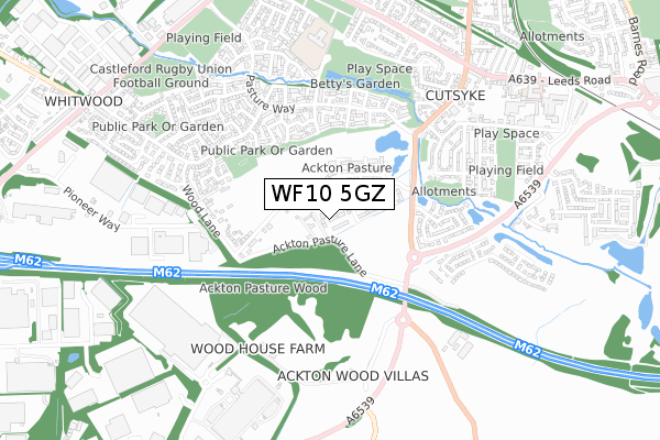
WF10 5GZ is located in the Altofts and Whitwood electoral ward, within the metropolitan district of Wakefield and the English Parliamentary constituency of Normanton, Pontefract and Castleford. The Sub Integrated Care Board (ICB) Location is NHS West Yorkshire ICB - 03R and the police force is West Yorkshire. This postcode has been in use since November 2019.


GetTheData
Source: OS Open Zoomstack (Ordnance Survey)
Licence: Open Government Licence (requires attribution)
Attribution: Contains OS data © Crown copyright and database right 2024
Source: Open Postcode Geo
Licence: Open Government Licence (requires attribution)
Attribution: Contains OS data © Crown copyright and database right 2024; Contains Royal Mail data © Royal Mail copyright and database right 2024; Source: Office for National Statistics licensed under the Open Government Licence v.3.0
| Easting | 441538 |
| Northing | 423845 |
| Latitude | 53.709401 |
| Longitude | -1.372182 |
GetTheData
Source: Open Postcode Geo
Licence: Open Government Licence
| Country | England |
| Postcode District | WF10 |
| ➜ WF10 open data dashboard ➜ See where WF10 is on a map ➜ Where is Castleford? | |
GetTheData
Source: Land Registry Price Paid Data
Licence: Open Government Licence
| Ward | Altofts And Whitwood |
| Constituency | Normanton, Pontefract And Castleford |
GetTheData
Source: ONS Postcode Database
Licence: Open Government Licence
11, PEAR TREE WAY, CASTLEFORD, WF10 5GZ 2020 30 JUN £184,950 |
7, PEAR TREE WAY, CASTLEFORD, WF10 5GZ 2020 26 JUN £199,950 |
9, PEAR TREE WAY, CASTLEFORD, WF10 5GZ 2020 30 APR £239,950 |
1, PEAR TREE WAY, CASTLEFORD, WF10 5GZ 2020 10 JAN £214,950 |
GetTheData
Source: HM Land Registry Price Paid Data
Licence: Contains HM Land Registry data © Crown copyright and database right 2024. This data is licensed under the Open Government Licence v3.0.
| November 2023 | Anti-social behaviour | On or near Checkstone Avenue | 494m |
| October 2023 | Violence and sexual offences | On or near Elderberry View | 400m |
| October 2023 | Criminal damage and arson | On or near Jasmine Gardens | 448m |
| ➜ Get more crime data in our Crime section | |||
GetTheData
Source: data.police.uk
Licence: Open Government Licence
| Cutsyke Rd Premier Way (Cutsyke Road) | Cutsyke | 311m |
| Cutsyke Rd Blenheim Way (Cutsyke Road) | Cutsyke | 335m |
| Cutsyke Road Castleford Ln (Cutsyke Road) | Cutsyke | 386m |
| Cutsyke Road Castleford Ln (Cutsyke Road) | Cutsyke | 395m |
| Pasture Wy Cowslip Lane (Pasture Way) | Whitwood | 484m |
| Glasshoughton Station | 2km |
| Castleford Station | 2km |
| Featherstone Station | 3.5km |
GetTheData
Source: NaPTAN
Licence: Open Government Licence
GetTheData
Source: ONS Postcode Database
Licence: Open Government Licence


➜ Get more ratings from the Food Standards Agency
GetTheData
Source: Food Standards Agency
Licence: FSA terms & conditions
| Last Collection | |||
|---|---|---|---|
| Location | Mon-Fri | Sat | Distance |
| 38 Westwood Road Cutsyke | 17:30 | 11:15 | 525m |
| Pasture Way, Whitwood | 17:00 | 11:00 | 789m |
| Cutsyke P.o. | 17:00 | 11:15 | 847m |
GetTheData
Source: Dracos
Licence: Creative Commons Attribution-ShareAlike
| Facility | Distance |
|---|---|
| Cutsyke Recreation Ground (Green Lane) Green Lane, Castleford Grass Pitches | 730m |
| Castleford Rufc (Willowbridge Lane) Willowbridge Lane , Whitwood , Castleford Grass Pitches | 855m |
| Whitwood Recreation Ground Willowbridge Lane, Castleford Grass Pitches | 919m |
GetTheData
Source: Active Places
Licence: Open Government Licence
| School | Phase of Education | Distance |
|---|---|---|
| Ackton Pastures Primary Academy College Grove, Whitwood, Castleford, WF10 5NS | Primary | 732m |
| Half Acres Primary Academy Temple Street, Castleford, WF10 5RE | Primary | 1.5km |
| St Wilfrid's Catholic High School & Sixth Form College: A Voluntary Academy Cutsyke Road, Featherstone, Pontefract, WF7 6BD | Secondary | 1.6km |
GetTheData
Source: Edubase
Licence: Open Government Licence
The below table lists the International Territorial Level (ITL) codes (formerly Nomenclature of Territorial Units for Statistics (NUTS) codes) and Local Administrative Units (LAU) codes for WF10 5GZ:
| ITL 1 Code | Name |
|---|---|
| TLE | Yorkshire and The Humber |
| ITL 2 Code | Name |
| TLE4 | West Yorkshire |
| ITL 3 Code | Name |
| TLE45 | Wakefield |
| LAU 1 Code | Name |
| E08000036 | Wakefield |
GetTheData
Source: ONS Postcode Directory
Licence: Open Government Licence
The below table lists the Census Output Area (OA), Lower Layer Super Output Area (LSOA), and Middle Layer Super Output Area (MSOA) for WF10 5GZ:
| Code | Name | |
|---|---|---|
| OA | E00168738 | |
| LSOA | E01011775 | Wakefield 024A |
| MSOA | E02002461 | Wakefield 024 |
GetTheData
Source: ONS Postcode Directory
Licence: Open Government Licence
| WF10 5PN | Wood Lane | 133m |
| WF10 5PL | Wood Lane | 249m |
| WF10 5UH | Elderberry View | 385m |
| WF10 5QZ | Blenheim Way | 401m |
| WF10 5UJ | Foxglove Fold | 412m |
| WF10 5PJ | Wood Lane | 414m |
| WF10 5FQ | Honeysuckle Way | 430m |
| WF10 5FP | Dandelion Close | 431m |
| WF10 5GG | Blenheim Way | 435m |
| WF10 5UG | Cowslip Lane | 439m |
GetTheData
Source: Open Postcode Geo; Land Registry Price Paid Data
Licence: Open Government Licence