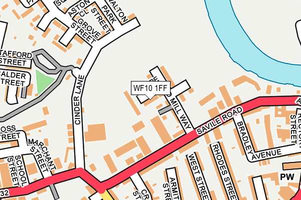
WF10 1FF is located in the Castleford Central and Glasshoughton electoral ward, within the metropolitan district of Wakefield and the English Parliamentary constituency of Normanton, Pontefract and Castleford. The Sub Integrated Care Board (ICB) Location is NHS West Yorkshire ICB - 03R and the police force is West Yorkshire. This postcode has been in use since May 2017.


GetTheData
Source: OS OpenMap – Local (Ordnance Survey)
Source: OS VectorMap District (Ordnance Survey)
Licence: Open Government Licence (requires attribution)
| Easting | 442278 |
| Northing | 425886 |
| Latitude | 53.727685 |
| Longitude | -1.360694 |
GetTheData
Source: Open Postcode Geo
Licence: Open Government Licence
| Country | England |
| Postcode District | WF10 |
➜ See where WF10 is on a map ➜ Where is Castleford? | |
GetTheData
Source: Land Registry Price Paid Data
Licence: Open Government Licence
| Ward | Castleford Central And Glasshoughton |
| Constituency | Normanton, Pontefract And Castleford |
GetTheData
Source: ONS Postcode Database
Licence: Open Government Licence
2021 30 JUL £283,000 |
2, MOORE WAY, CASTLEFORD, WF10 1FF 2017 21 DEC £225,950 |
4, MOORE WAY, CASTLEFORD, WF10 1FF 2017 15 SEP £180,000 |
2017 28 JUL £227,500 |
21, MOORE WAY, CASTLEFORD, WF10 1FF 2017 26 JUL £225,000 |
14, MOORE WAY, CASTLEFORD, WF10 1FF 2017 21 JUL £195,000 |
19, MOORE WAY, CASTLEFORD, WF10 1FF 2017 7 JUL £215,000 |
GetTheData
Source: HM Land Registry Price Paid Data
Licence: Contains HM Land Registry data © Crown copyright and database right 2025. This data is licensed under the Open Government Licence v3.0.
| Wood Street Factories (Wood Street) | Castleford | 215m |
| Wood Street Factories (Wood Street) | Castleford | 272m |
| Methley Rd School Street (Methley Road) | Castleford | 283m |
| Methley Rd Wellington Street (Methley Road) | Castleford | 347m |
| Bank Street | Castleford | 448m |
| Castleford Station | 0.6km |
| Glasshoughton Station | 2.4km |
| Pontefract Tanshelf Station | 4.6km |
GetTheData
Source: NaPTAN
Licence: Open Government Licence
| Percentage of properties with Next Generation Access | 100.0% |
| Percentage of properties with Superfast Broadband | 100.0% |
| Percentage of properties with Ultrafast Broadband | 100.0% |
| Percentage of properties with Full Fibre Broadband | 0.0% |
Superfast Broadband is between 30Mbps and 300Mbps
Ultrafast Broadband is > 300Mbps
| Median download speed | 100.0Mbps |
| Average download speed | 107.6Mbps |
| Maximum download speed | 350.00Mbps |
| Median upload speed | 19.5Mbps |
| Average upload speed | 14.0Mbps |
| Maximum upload speed | 20.00Mbps |
| Percentage of properties unable to receive 2Mbps | 0.0% |
| Percentage of properties unable to receive 5Mbps | 0.0% |
| Percentage of properties unable to receive 10Mbps | 0.0% |
| Percentage of properties unable to receive 30Mbps | 0.0% |
GetTheData
Source: Ofcom
Licence: Ofcom Terms of Use (requires attribution)
GetTheData
Source: ONS Postcode Database
Licence: Open Government Licence


➜ Get more ratings from the Food Standards Agency
GetTheData
Source: Food Standards Agency
Licence: FSA terms & conditions
| Last Collection | |||
|---|---|---|---|
| Location | Mon-Fri | Sat | Distance |
| By Bus Station Albion Street | 18:30 | 12:30 | 370m |
| Whitwood Mere | 18:30 | 11:00 | 405m |
| Pioneer | 18:30 | 12:30 | 474m |
GetTheData
Source: Dracos
Licence: Creative Commons Attribution-ShareAlike
| Risk of WF10 1FF flooding from rivers and sea | Medium |
| ➜ WF10 1FF flood map | |
GetTheData
Source: Open Flood Risk by Postcode
Licence: Open Government Licence
The below table lists the International Territorial Level (ITL) codes (formerly Nomenclature of Territorial Units for Statistics (NUTS) codes) and Local Administrative Units (LAU) codes for WF10 1FF:
| ITL 1 Code | Name |
|---|---|
| TLE | Yorkshire and The Humber |
| ITL 2 Code | Name |
| TLE4 | West Yorkshire |
| ITL 3 Code | Name |
| TLE45 | Wakefield |
| LAU 1 Code | Name |
| E08000036 | Wakefield |
GetTheData
Source: ONS Postcode Directory
Licence: Open Government Licence
The below table lists the Census Output Area (OA), Lower Layer Super Output Area (LSOA), and Middle Layer Super Output Area (MSOA) for WF10 1FF:
| Code | Name | |
|---|---|---|
| OA | E00059288 | |
| LSOA | E01011760 | Wakefield 002D |
| MSOA | E02002439 | Wakefield 002 |
GetTheData
Source: ONS Postcode Directory
Licence: Open Government Licence
| WF10 1PE | Savile Road | 142m |
| WF10 1LF | West Street | 165m |
| WF10 1LP | Wood Street | 171m |
| WF10 1LU | Cinder Lane | 172m |
| WF10 1BT | Cinder Lane | 172m |
| WF10 1PD | Savile Road | 174m |
| WF10 1LH | Armitage Street | 184m |
| WF10 1PF | Cross Street | 192m |
| WF10 1LE | Rhodes Street | 205m |
| WF10 1BL | Blakestone Mews | 209m |
GetTheData
Source: Open Postcode Geo; Land Registry Price Paid Data
Licence: Open Government Licence