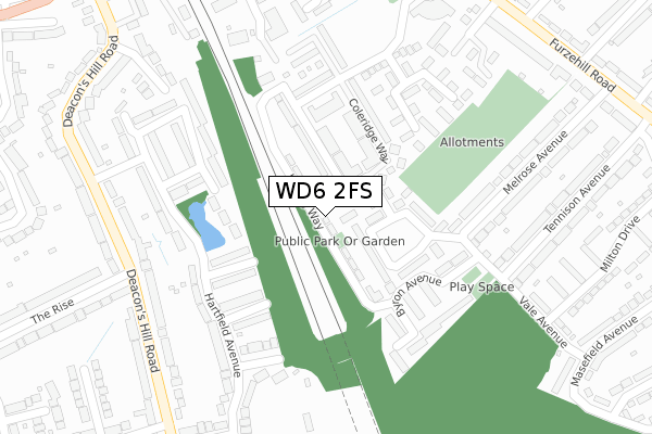
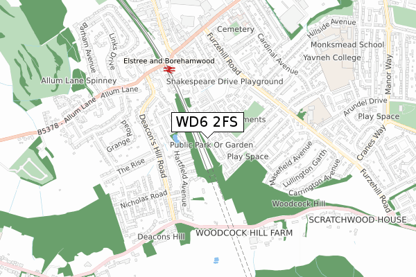
WD6 2FS is located in the Borehamwood Hillside electoral ward, within the local authority district of Hertsmere and the English Parliamentary constituency of Hertsmere. The Sub Integrated Care Board (ICB) Location is NHS Hertfordshire and West Essex ICB - 06N and the police force is Hertfordshire. This postcode has been in use since December 2019.


GetTheData
Source: OS Open Zoomstack (Ordnance Survey)
Licence: Open Government Licence (requires attribution)
Attribution: Contains OS data © Crown copyright and database right 2024
Source: Open Postcode Geo
Licence: Open Government Licence (requires attribution)
Attribution: Contains OS data © Crown copyright and database right 2024; Contains Royal Mail data © Royal Mail copyright and database right 2024; Source: Office for National Statistics licensed under the Open Government Licence v.3.0
| Easting | 519321 |
| Northing | 195899 |
| Latitude | 51.649237 |
| Longitude | -0.276719 |
GetTheData
Source: Open Postcode Geo
Licence: Open Government Licence
| Country | England |
| Postcode District | WD6 |
| ➜ WD6 open data dashboard ➜ See where WD6 is on a map ➜ Where is Borehamwood? | |
GetTheData
Source: Land Registry Price Paid Data
Licence: Open Government Licence
| Ward | Borehamwood Hillside |
| Constituency | Hertsmere |
GetTheData
Source: ONS Postcode Database
Licence: Open Government Licence
18, KIPLING WAY, BOREHAMWOOD, WD6 2FS 2020 3 APR £639,000 |
GetTheData
Source: HM Land Registry Price Paid Data
Licence: Contains HM Land Registry data © Crown copyright and database right 2024. This data is licensed under the Open Government Licence v3.0.
| January 2024 | Other crime | On or near Hartfield Avenue | 216m |
| June 2022 | Public order | On or near Coleridge Way | 121m |
| June 2022 | Violence and sexual offences | On or near Coleridge Way | 121m |
| ➜ Get more crime data in our Crime section | |||
GetTheData
Source: data.police.uk
Licence: Open Government Licence
| Wordsworth Gardens (Melrose Avenue) | Borehamwood | 245m |
| Vale Avenue (Tennison Avenue) | Borehamwood | 315m |
| Melrose Avenue | Borehamwood | 422m |
| Oakwood Avenue (Furzehill Road) | Borehamwood | 444m |
| Oakwood Avenue (Furzehill Road) | Borehamwood | 446m |
| Elstree & Borehamwood Station | 0.5km |
| Mill Hill Broadway Station | 4.4km |
| Radlett Station | 4.9km |
GetTheData
Source: NaPTAN
Licence: Open Government Licence
GetTheData
Source: ONS Postcode Database
Licence: Open Government Licence


➜ Get more ratings from the Food Standards Agency
GetTheData
Source: Food Standards Agency
Licence: FSA terms & conditions
| Last Collection | |||
|---|---|---|---|
| Location | Mon-Fri | Sat | Distance |
| Deaconshill Road | 17:30 | 11:30 | 499m |
| Borehamwood Station | 17:30 | 11:30 | 503m |
| Barham Avenue | 17:30 | 11:30 | 619m |
GetTheData
Source: Dracos
Licence: Creative Commons Attribution-ShareAlike
| Facility | Distance |
|---|---|
| Furzehill Middle (Closed) Furzehill Road, Borehamwood Grass Pitches | 375m |
| Puregym (Borehamwood) Shenley Road, Borehamwood Swimming Pool, Health and Fitness Gym, Studio | 672m |
| Yavneh College Sports Centre Hillside Avenue, Borehamwood Sports Hall, Grass Pitches, Studio | 924m |
GetTheData
Source: Active Places
Licence: Open Government Licence
| School | Phase of Education | Distance |
|---|---|---|
| Summerswood Primary School Furzehill Road, Borehamwood, WD6 2DW | Primary | 633m |
| Yavneh College Hillside Avenue, Borehamwood, WD6 1HL | Secondary | 810m |
| Yavneh Primary School Hillside Avenue, Borehamwood, WD6 1HL | Primary | 924m |
GetTheData
Source: Edubase
Licence: Open Government Licence
The below table lists the International Territorial Level (ITL) codes (formerly Nomenclature of Territorial Units for Statistics (NUTS) codes) and Local Administrative Units (LAU) codes for WD6 2FS:
| ITL 1 Code | Name |
|---|---|
| TLH | East |
| ITL 2 Code | Name |
| TLH2 | Bedfordshire and Hertfordshire |
| ITL 3 Code | Name |
| TLH23 | Hertfordshire CC |
| LAU 1 Code | Name |
| E07000098 | Hertsmere |
GetTheData
Source: ONS Postcode Directory
Licence: Open Government Licence
The below table lists the Census Output Area (OA), Lower Layer Super Output Area (LSOA), and Middle Layer Super Output Area (MSOA) for WD6 2FS:
| Code | Name | |
|---|---|---|
| OA | E00169764 | |
| LSOA | E01023539 | Hertsmere 011A |
| MSOA | E02004906 | Hertsmere 011 |
GetTheData
Source: ONS Postcode Directory
Licence: Open Government Licence
| WD6 2AB | Wordsworth Gardens | 94m |
| WD6 2AR | Coleridge Way | 97m |
| WD6 2AL | Auden Drive | 105m |
| WD6 2AE | Coleridge Way | 129m |
| WD6 2AT | Coleridge Way | 133m |
| WD6 2AH | Wordsworth Gardens | 146m |
| WD6 3LD | Lakeside Court | 159m |
| WD6 3JN | Berkeley Close | 162m |
| WD6 2AF | Coleridge Way | 166m |
| WD6 2AS | Coleridge Way | 167m |
GetTheData
Source: Open Postcode Geo; Land Registry Price Paid Data
Licence: Open Government Licence