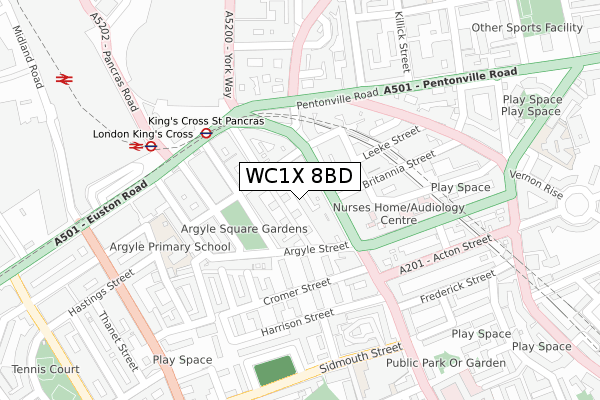
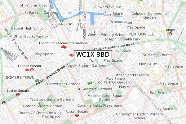
WC1X 8BD is located in the King's Cross electoral ward, within the London borough of Camden and the English Parliamentary constituency of Holborn and St Pancras. The Sub Integrated Care Board (ICB) Location is NHS North Central London ICB - 93C and the police force is Metropolitan Police. This postcode has been in use since September 2017.


GetTheData
Source: OS Open Zoomstack (Ordnance Survey)
Licence: Open Government Licence (requires attribution)
Attribution: Contains OS data © Crown copyright and database right 2024
Source: Open Postcode Geo
Licence: Open Government Licence (requires attribution)
Attribution: Contains OS data © Crown copyright and database right 2024; Contains Royal Mail data © Royal Mail copyright and database right 2024; Source: Office for National Statistics licensed under the Open Government Licence v.3.0
| Easting | 530443 |
| Northing | 182839 |
| Latitude | 51.529404 |
| Longitude | -0.120899 |
GetTheData
Source: Open Postcode Geo
Licence: Open Government Licence
| Country | England |
| Postcode District | WC1X |
| ➜ WC1X open data dashboard ➜ See where WC1X is on a map ➜ Where is London? | |
GetTheData
Source: Land Registry Price Paid Data
Licence: Open Government Licence
| Ward | King's Cross |
| Constituency | Holborn And St Pancras |
GetTheData
Source: ONS Postcode Database
Licence: Open Government Licence
| January 2024 | Anti-social behaviour | On or near St Chad'S Street | 72m |
| January 2024 | Anti-social behaviour | On or near St Chad'S Street | 72m |
| January 2024 | Anti-social behaviour | On or near St Chad'S Street | 72m |
| ➜ Get more crime data in our Crime section | |||
GetTheData
Source: data.police.uk
Licence: Open Government Licence
| Swinton Street | Pentonville | 58m |
| King's Cross St. Pancras | King's Cross | 130m |
| Kings Cross Caledonian Road (Pentonville Road) | Pentonville | 163m |
| Swinton Street | Pentonville | 172m |
| King's Cross St. Pancras (Euston Road) | King's Cross | 186m |
| King's Cross St. Pancras Underground Station | King's Cross | 211m |
| Russell Square Underground Station | Russell Square | 742m |
| Euston Underground Station | Euston | 906m |
| Angel Underground Station | Angel | 1,102m |
| Euston Square Underground Station | Euston Square | 1,117m |
| London Kings Cross Station | 0.2km |
| London St Pancras International LL Station | 0.5km |
| London St Pancras International Station | 0.5km |
GetTheData
Source: NaPTAN
Licence: Open Government Licence
➜ Broadband speed and availability dashboard for WC1X 8BD
| Percentage of properties with Next Generation Access | 100.0% |
| Percentage of properties with Superfast Broadband | 100.0% |
| Percentage of properties with Ultrafast Broadband | 0.0% |
| Percentage of properties with Full Fibre Broadband | 0.0% |
Superfast Broadband is between 30Mbps and 300Mbps
Ultrafast Broadband is > 300Mbps
| Median download speed | 18.7Mbps |
| Average download speed | 23.6Mbps |
| Maximum download speed | 79.98Mbps |
| Median upload speed | 1.2Mbps |
| Average upload speed | 3.2Mbps |
| Maximum upload speed | 20.00Mbps |
| Percentage of properties unable to receive 2Mbps | 0.0% |
| Percentage of properties unable to receive 5Mbps | 0.0% |
| Percentage of properties unable to receive 10Mbps | 0.0% |
| Percentage of properties unable to receive 30Mbps | 0.0% |
➜ Broadband speed and availability dashboard for WC1X 8BD
GetTheData
Source: Ofcom
Licence: Ofcom Terms of Use (requires attribution)
GetTheData
Source: ONS Postcode Database
Licence: Open Government Licence


➜ Get more ratings from the Food Standards Agency
GetTheData
Source: Food Standards Agency
Licence: FSA terms & conditions
| Last Collection | |||
|---|---|---|---|
| Location | Mon-Fri | Sat | Distance |
| Grays Inn Road (Swinton St) | 18:30 | 12:00 | 90m |
| Kings Cross Road (Britannia St) | 18:30 | 12:00 | 290m |
| 192 Pentonville Road | 18:30 | 12:00 | 308m |
GetTheData
Source: Dracos
Licence: Creative Commons Attribution-ShareAlike
| Facility | Distance |
|---|---|
| Urban Kings Gym (Closed) Bravingtons Walk, London Health and Fitness Gym, Studio | 228m |
| Anytime Fitness (London Kings Cross) Pentonville Road, London Health and Fitness Gym | 311m |
| St. Pancras Renaissance London Hotel Euston Road, London Health and Fitness Gym, Swimming Pool | 317m |
GetTheData
Source: Active Places
Licence: Open Government Licence
| School | Phase of Education | Distance |
|---|---|---|
| Argyle Primary School Tonbridge Street, London, WC1H 9EG | Primary | 219m |
| Capital City College Group 211 Gray's Inn Road, London, WC1X 8RA | 16 plus | 315m |
| Winton Primary School Killick Street, Pentonville Road, London, N1 9AZ | Primary | 384m |
GetTheData
Source: Edubase
Licence: Open Government Licence
The below table lists the International Territorial Level (ITL) codes (formerly Nomenclature of Territorial Units for Statistics (NUTS) codes) and Local Administrative Units (LAU) codes for WC1X 8BD:
| ITL 1 Code | Name |
|---|---|
| TLI | London |
| ITL 2 Code | Name |
| TLI3 | Inner London - West |
| ITL 3 Code | Name |
| TLI31 | Camden and City of London |
| LAU 1 Code | Name |
| E09000007 | Camden |
GetTheData
Source: ONS Postcode Directory
Licence: Open Government Licence
The below table lists the Census Output Area (OA), Lower Layer Super Output Area (LSOA), and Middle Layer Super Output Area (MSOA) for WC1X 8BD:
| Code | Name | |
|---|---|---|
| OA | E00004658 | |
| LSOA | E01000939 | Camden 024C |
| MSOA | E02000189 | Camden 024 |
GetTheData
Source: ONS Postcode Directory
Licence: Open Government Licence
| WC1X 8QF | Grays Inn Road | 33m |
| WC1H 8BL | Birkenhead Street | 34m |
| WC1H 8BJ | Birkenhead Street | 35m |
| WC1X 8QJ | Grays Inn Road | 36m |
| WC1X 8QP | Grays Inn Road | 52m |
| WC1H 8BP | Birkenhead Street | 56m |
| WC1H 8BH | Birkenhead Street | 60m |
| WC1H 8AS | Argyle Square | 65m |
| WC1H 8EF | Argyle Street | 74m |
| WC1H 8BD | St Chad's Street | 80m |
GetTheData
Source: Open Postcode Geo; Land Registry Price Paid Data
Licence: Open Government Licence