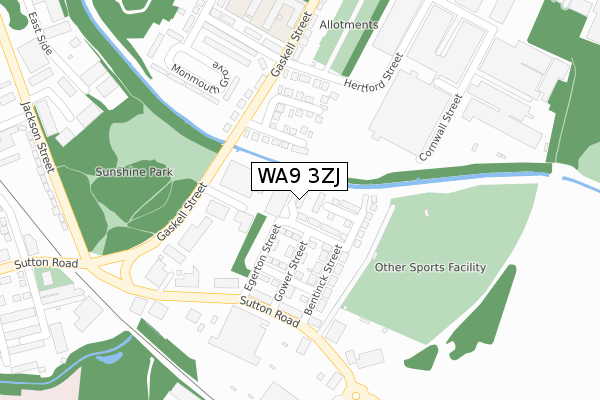
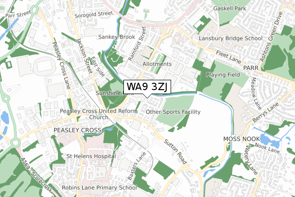
WA9 3ZJ is located in the Peasley Cross & Fingerpost electoral ward, within the metropolitan district of St. Helens and the English Parliamentary constituency of St Helens South and Whiston. The Sub Integrated Care Board (ICB) Location is NHS Cheshire and Merseyside ICB - 01X and the police force is Merseyside. This postcode has been in use since April 2019.


GetTheData
Source: OS Open Zoomstack (Ordnance Survey)
Licence: Open Government Licence (requires attribution)
Attribution: Contains OS data © Crown copyright and database right 2024
Source: Open Postcode Geo
Licence: Open Government Licence (requires attribution)
Attribution: Contains OS data © Crown copyright and database right 2024; Contains Royal Mail data © Royal Mail copyright and database right 2024; Source: Office for National Statistics licensed under the Open Government Licence v.3.0
| Easting | 352745 |
| Northing | 394496 |
| Latitude | 53.445117 |
| Longitude | -2.712927 |
GetTheData
Source: Open Postcode Geo
Licence: Open Government Licence
| Country | England |
| Postcode District | WA9 |
| ➜ WA9 open data dashboard ➜ See where WA9 is on a map ➜ Where is St Helens? | |
GetTheData
Source: Land Registry Price Paid Data
Licence: Open Government Licence
| Ward | Peasley Cross & Fingerpost |
| Constituency | St Helens South And Whiston |
GetTheData
Source: ONS Postcode Database
Licence: Open Government Licence
| December 2023 | Violence and sexual offences | On or near Smithfield Street | 422m |
| December 2023 | Violence and sexual offences | On or near Smithfield Street | 422m |
| November 2023 | Violence and sexual offences | On or near Saffron Gardens | 118m |
| ➜ Get more crime data in our Crime section | |||
GetTheData
Source: data.police.uk
Licence: Open Government Licence
| Gower Street (Sutton Road) | Sutton | 187m |
| Gower Street (Sutton Road) | Sutton | 197m |
| Hammond Street (Gaskell Street) | Parr Stocks | 220m |
| Hertford Street (Gaskell Street) | Parr Stocks | 254m |
| Baxters Lane (Sutton Road) | Sutton | 273m |
| St Helens Central Station | 1.5km |
| St Helens Junction Station | 1.5km |
| Lea Green Station | 2.2km |
GetTheData
Source: NaPTAN
Licence: Open Government Licence
| Percentage of properties with Next Generation Access | 100.0% |
| Percentage of properties with Superfast Broadband | 100.0% |
| Percentage of properties with Ultrafast Broadband | 100.0% |
| Percentage of properties with Full Fibre Broadband | 100.0% |
Superfast Broadband is between 30Mbps and 300Mbps
Ultrafast Broadband is > 300Mbps
| Percentage of properties unable to receive 2Mbps | 0.0% |
| Percentage of properties unable to receive 5Mbps | 0.0% |
| Percentage of properties unable to receive 10Mbps | 0.0% |
| Percentage of properties unable to receive 30Mbps | 0.0% |
GetTheData
Source: Ofcom
Licence: Ofcom Terms of Use (requires attribution)
GetTheData
Source: ONS Postcode Database
Licence: Open Government Licence


➜ Get more ratings from the Food Standards Agency
GetTheData
Source: Food Standards Agency
Licence: FSA terms & conditions
| Last Collection | |||
|---|---|---|---|
| Location | Mon-Fri | Sat | Distance |
| Peasley Cross Post Office | 17:00 | 11:00 | 647m |
| Sorogold Street | 17:00 | 11:00 | 773m |
| Marshalls Cross | 17:30 | 11:00 | 815m |
GetTheData
Source: Dracos
Licence: Creative Commons Attribution-ShareAlike
| Facility | Distance |
|---|---|
| Beeches Playing Fields Sutton Road, St. Helens Grass Pitches | 210m |
| Joey's Gym, St Helens Fitness Centre (Closed) Sutton Road, St. Helens Health and Fitness Gym, Studio | 306m |
| Allanson Street Primary School Gaskell Street, St. Helens Sports Hall, Grass Pitches | 330m |
GetTheData
Source: Active Places
Licence: Open Government Licence
| School | Phase of Education | Distance |
|---|---|---|
| Allanson Street Primary School Gaskell Street, Parr, St Helens, Merseyside, WA9 1PL | Primary | 348m |
| St Cuthbert's Catholic High School Berrys Lane, Sutton, St Helens, WA9 3HE | Secondary | 827m |
| Robins Lane Community Primary School Kinmel Street, St Helens, WA9 3NF | Primary | 831m |
GetTheData
Source: Edubase
Licence: Open Government Licence
The below table lists the International Territorial Level (ITL) codes (formerly Nomenclature of Territorial Units for Statistics (NUTS) codes) and Local Administrative Units (LAU) codes for WA9 3ZJ:
| ITL 1 Code | Name |
|---|---|
| TLD | North West (England) |
| ITL 2 Code | Name |
| TLD7 | Merseyside |
| ITL 3 Code | Name |
| TLD71 | East Merseyside |
| LAU 1 Code | Name |
| E08000013 | St. Helens |
GetTheData
Source: ONS Postcode Directory
Licence: Open Government Licence
The below table lists the Census Output Area (OA), Lower Layer Super Output Area (LSOA), and Middle Layer Super Output Area (MSOA) for WA9 3ZJ:
| Code | Name | |
|---|---|---|
| OA | E00034698 | |
| LSOA | E01006845 | St. Helens 014A |
| MSOA | E02001419 | St. Helens 014 |
GetTheData
Source: ONS Postcode Directory
Licence: Open Government Licence
| WA9 1RH | Saffron Gardens | 95m |
| WA9 1PX | Gaskell Street | 125m |
| WA9 1RJ | Roysten Gardens | 143m |
| WA9 3DQ | Bentinck Street | 144m |
| WA9 3DP | Gower Street | 146m |
| WA9 3DU | Sutton Road | 179m |
| WA9 1RL | Hertford Street | 192m |
| WA9 1PY | Gaskell Street | 197m |
| WA9 1QB | Monmouth Grove | 251m |
| WA9 1QA | Monmouth Grove | 277m |
GetTheData
Source: Open Postcode Geo; Land Registry Price Paid Data
Licence: Open Government Licence