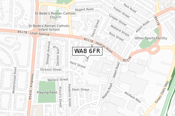
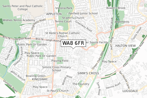
WA8 6FR is located in the Appleton electoral ward, within the unitary authority of Halton and the English Parliamentary constituency of Halton. The Sub Integrated Care Board (ICB) Location is NHS Cheshire and Merseyside ICB - 01F and the police force is Cheshire. This postcode has been in use since September 2017.


GetTheData
Source: OS Open Zoomstack (Ordnance Survey)
Licence: Open Government Licence (requires attribution)
Attribution: Contains OS data © Crown copyright and database right 2024
Source: Open Postcode Geo
Licence: Open Government Licence (requires attribution)
Attribution: Contains OS data © Crown copyright and database right 2024; Contains Royal Mail data © Royal Mail copyright and database right 2024; Source: Office for National Statistics licensed under the Open Government Licence v.3.0
| Easting | 351642 |
| Northing | 386046 |
| Latitude | 53.369069 |
| Longitude | -2.728235 |
GetTheData
Source: Open Postcode Geo
Licence: Open Government Licence
| Country | England |
| Postcode District | WA8 |
| ➜ WA8 open data dashboard ➜ See where WA8 is on a map | |
GetTheData
Source: Land Registry Price Paid Data
Licence: Open Government Licence
| Ward | Appleton |
| Constituency | Halton |
GetTheData
Source: ONS Postcode Database
Licence: Open Government Licence
| January 2024 | Criminal damage and arson | On or near Parking Area | 121m |
| January 2024 | Possession of weapons | On or near Parking Area | 121m |
| January 2024 | Shoplifting | On or near Parking Area | 121m |
| ➜ Get more crime data in our Crime section | |||
GetTheData
Source: data.police.uk
Licence: Open Government Licence
| Dickson Street (South Street) | Widnes | 146m |
| Leigh Avenue | Appleton | 185m |
| The Bradley (Deacon Road) | Widnes | 193m |
| Leigh Avenue | Widnes | 193m |
| Harris Shop (Albert Road) | Appleton | 212m |
| Widnes Station | 1.1km |
| Hough Green Station | 3.1km |
| Runcorn Station | 3.5km |
GetTheData
Source: NaPTAN
Licence: Open Government Licence
GetTheData
Source: ONS Postcode Database
Licence: Open Government Licence


➜ Get more ratings from the Food Standards Agency
GetTheData
Source: Food Standards Agency
Licence: FSA terms & conditions
| Last Collection | |||
|---|---|---|---|
| Location | Mon-Fri | Sat | Distance |
| Elliott Street | 17:30 | 11:00 | 253m |
| Appleton Village | 17:30 | 11:00 | 435m |
| Greenway Road | 17:30 | 11:00 | 515m |
GetTheData
Source: Dracos
Licence: Creative Commons Attribution-ShareAlike
| Facility | Distance |
|---|---|
| Stones Gym Gladstone Street, Widnes Health and Fitness Gym | 216m |
| Jd Gyms (Widnes) Widnes Shopping Park, Widnes Health and Fitness Gym | 355m |
| Dw Fitness First (Widnes) (Closed) Cross Street, Widnes Swimming Pool, Health and Fitness Gym, Studio | 363m |
GetTheData
Source: Active Places
Licence: Open Government Licence
| School | Phase of Education | Distance |
|---|---|---|
| St Bede's Catholic Infant School Leigh Avenue, Widnes, WA8 6EL | Primary | 281m |
| St Bede's Catholic Junior School Appleton Village, St Bede's Junior School, WIDNES, WA8 6EL | Primary | 326m |
| Kingsway Primary Academy School Kingsway, Widnes, WA8 7QS | Primary | 447m |
GetTheData
Source: Edubase
Licence: Open Government Licence
The below table lists the International Territorial Level (ITL) codes (formerly Nomenclature of Territorial Units for Statistics (NUTS) codes) and Local Administrative Units (LAU) codes for WA8 6FR:
| ITL 1 Code | Name |
|---|---|
| TLD | North West (England) |
| ITL 2 Code | Name |
| TLD7 | Merseyside |
| ITL 3 Code | Name |
| TLD71 | East Merseyside |
| LAU 1 Code | Name |
| E06000006 | Halton |
GetTheData
Source: ONS Postcode Directory
Licence: Open Government Licence
The below table lists the Census Output Area (OA), Lower Layer Super Output Area (LSOA), and Middle Layer Super Output Area (MSOA) for WA8 6FR:
| Code | Name | |
|---|---|---|
| OA | E00062401 | |
| LSOA | E01012367 | Halton 007A |
| MSOA | E02002580 | Halton 007 |
GetTheData
Source: ONS Postcode Directory
Licence: Open Government Licence
| WA8 6PE | Frederick Street | 74m |
| WA8 6EF | Deacon Road | 94m |
| WA8 6EA | Deacon Road | 105m |
| WA8 6NF | Dickson Close | 116m |
| WA8 6JW | Albert Square | 119m |
| WA8 6EG | Deacon Road | 130m |
| WA8 6ED | Deacon Road | 140m |
| WA8 6PS | Dean Street | 159m |
| WA8 6PA | Deirdre Avenue | 182m |
| WA8 6EE | Sayce Street | 185m |
GetTheData
Source: Open Postcode Geo; Land Registry Price Paid Data
Licence: Open Government Licence