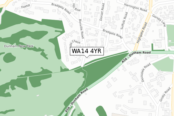
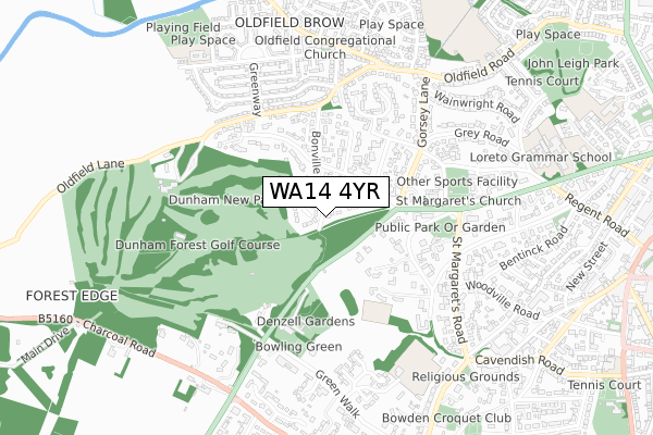
WA14 4YR is located in the Bowdon electoral ward, within the metropolitan district of Trafford and the English Parliamentary constituency of Altrincham and Sale West. The Sub Integrated Care Board (ICB) Location is NHS Greater Manchester ICB - 02A and the police force is Greater Manchester. This postcode has been in use since January 2018.


GetTheData
Source: OS Open Zoomstack (Ordnance Survey)
Licence: Open Government Licence (requires attribution)
Attribution: Contains OS data © Crown copyright and database right 2024
Source: Open Postcode Geo
Licence: Open Government Licence (requires attribution)
Attribution: Contains OS data © Crown copyright and database right 2024; Contains Royal Mail data © Royal Mail copyright and database right 2024; Source: Office for National Statistics licensed under the Open Government Licence v.3.0
| Easting | 375525 |
| Northing | 387804 |
| Latitude | 53.386522 |
| Longitude | -2.369445 |
GetTheData
Source: Open Postcode Geo
Licence: Open Government Licence
| Country | England |
| Postcode District | WA14 |
| ➜ WA14 open data dashboard ➜ See where WA14 is on a map ➜ Where is Altrincham? | |
GetTheData
Source: Land Registry Price Paid Data
Licence: Open Government Licence
| Ward | Bowdon |
| Constituency | Altrincham And Sale West |
GetTheData
Source: ONS Postcode Database
Licence: Open Government Licence
2018 15 MAR £1,035,000 |
2007 31 JUL £1,130,000 |
GetTheData
Source: HM Land Registry Price Paid Data
Licence: Contains HM Land Registry data © Crown copyright and database right 2024. This data is licensed under the Open Government Licence v3.0.
| Oldfield Road/Bonville Road (Oldfield Road) | Oldfield Brow | 412m |
| Turning Circle (Dunham Road) | Oldfield Brow | 479m |
| Greenway/Oldfield Road (Greenway) | Oldfield Brow | 493m |
| St Margarets Rd/War Memorial (Sbnd) (St Margarets Rd) | Oldfield Brow | 497m |
| Walton Road/Taylor Road (Walton Road) | Oldfield Brow | 604m |
| Altrincham (Manchester Metrolink) (Stamford New Road) | Altrincham | 1,505m |
| Altrincham Station | 1.5km |
| Hale Station | 1.7km |
| Navigation Road Station | 2km |
GetTheData
Source: NaPTAN
Licence: Open Government Licence
| Percentage of properties with Next Generation Access | 100.0% |
| Percentage of properties with Superfast Broadband | 100.0% |
| Percentage of properties with Ultrafast Broadband | 0.0% |
| Percentage of properties with Full Fibre Broadband | 0.0% |
Superfast Broadband is between 30Mbps and 300Mbps
Ultrafast Broadband is > 300Mbps
| Percentage of properties unable to receive 2Mbps | 0.0% |
| Percentage of properties unable to receive 5Mbps | 0.0% |
| Percentage of properties unable to receive 10Mbps | 0.0% |
| Percentage of properties unable to receive 30Mbps | 0.0% |
GetTheData
Source: Ofcom
Licence: Ofcom Terms of Use (requires attribution)
GetTheData
Source: ONS Postcode Database
Licence: Open Government Licence


➜ Get more ratings from the Food Standards Agency
GetTheData
Source: Food Standards Agency
Licence: FSA terms & conditions
| Last Collection | |||
|---|---|---|---|
| Location | Mon-Fri | Sat | Distance |
| St. Margarets Road | 17:30 | 11:00 | 488m |
| Walton Road | 16:00 | 11:00 | 519m |
| Oldfield Road | 17:30 | 11:00 | 751m |
GetTheData
Source: Dracos
Licence: Creative Commons Attribution-ShareAlike
| Facility | Distance |
|---|---|
| Dunham Forest Golf And Country Club Oldfield Lane, Dunham Massey, Altrincham Golf | 635m |
| Altrincham Grammar School For Girls (Sixth Form Centre) Green Courts, Bowdon Artificial Grass Pitch, Grass Pitches, Sports Hall | 660m |
| Oldfield Brow Primary School Taylor Road, Altrincham Grass Pitches, Sports Hall, Artificial Grass Pitch | 773m |
GetTheData
Source: Active Places
Licence: Open Government Licence
| School | Phase of Education | Distance |
|---|---|---|
| Oldfield Brow Primary School Taylor Road, Altrincham, WA14 4LE | Primary | 781m |
| Loreto Grammar School Dunham Road, Altrincham, WA14 4AH | Secondary | 834m |
| Altrincham Grammar School for Girls Cavendish Road, Bowdon, Altrincham, WA14 2NL | Secondary | 839m |
GetTheData
Source: Edubase
Licence: Open Government Licence
The below table lists the International Territorial Level (ITL) codes (formerly Nomenclature of Territorial Units for Statistics (NUTS) codes) and Local Administrative Units (LAU) codes for WA14 4YR:
| ITL 1 Code | Name |
|---|---|
| TLD | North West (England) |
| ITL 2 Code | Name |
| TLD3 | Greater Manchester |
| ITL 3 Code | Name |
| TLD34 | Greater Manchester South West |
| LAU 1 Code | Name |
| E08000009 | Trafford |
GetTheData
Source: ONS Postcode Directory
Licence: Open Government Licence
The below table lists the Census Output Area (OA), Lower Layer Super Output Area (LSOA), and Middle Layer Super Output Area (MSOA) for WA14 4YR:
| Code | Name | |
|---|---|---|
| OA | E00030783 | |
| LSOA | E01006076 | Trafford 025C |
| MSOA | E02001283 | Trafford 025 |
GetTheData
Source: ONS Postcode Directory
Licence: Open Government Licence
| WA14 4QP | Normanby Chase | 76m |
| WA14 4RA | Longcroft Drive | 94m |
| WA14 4PQ | Allandale | 128m |
| WA14 4QA | Bonville Chase | 141m |
| WA14 4QJ | Bradgate Road | 178m |
| WA14 4QG | Dunham Road | 199m |
| WA14 4QN | Dorset Road | 271m |
| WA14 4QX | Suffolk Road | 274m |
| WA14 4QR | Bonville Road | 281m |
| WA14 2YB | Parklands | 295m |
GetTheData
Source: Open Postcode Geo; Land Registry Price Paid Data
Licence: Open Government Licence