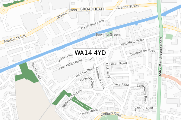
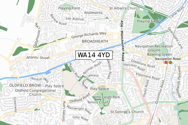
WA14 4YD is located in the Altrincham electoral ward, within the metropolitan district of Trafford and the English Parliamentary constituency of Altrincham and Sale West. The Sub Integrated Care Board (ICB) Location is NHS Greater Manchester ICB - 02A and the police force is Greater Manchester. This postcode has been in use since October 2019.


GetTheData
Source: OS Open Zoomstack (Ordnance Survey)
Licence: Open Government Licence (requires attribution)
Attribution: Contains OS data © Crown copyright and database right 2024
Source: Open Postcode Geo
Licence: Open Government Licence (requires attribution)
Attribution: Contains OS data © Crown copyright and database right 2024; Contains Royal Mail data © Royal Mail copyright and database right 2024; Source: Office for National Statistics licensed under the Open Government Licence v.3.0
| Easting | 376295 |
| Northing | 388849 |
| Latitude | 53.395950 |
| Longitude | -2.357948 |
GetTheData
Source: Open Postcode Geo
Licence: Open Government Licence
| Country | England |
| Postcode District | WA14 |
| ➜ WA14 open data dashboard ➜ See where WA14 is on a map ➜ Where is Altrincham? | |
GetTheData
Source: Land Registry Price Paid Data
Licence: Open Government Licence
| Ward | Altrincham |
| Constituency | Altrincham And Sale West |
GetTheData
Source: ONS Postcode Database
Licence: Open Government Licence
| Atlantic Street/Davenport Lane (Atlantic Street) | Broadheath | 296m |
| Oldfield Road/John Leigh Park (Oldfield Road) | Oldfield Brow | 325m |
| Atlantic Street/Asda (Atlantic Street) | Broadheath | 350m |
| Oldfield Road/John Leigh Park (Oldfield Road) | Oldfield Brow | 358m |
| Manchester Road/Harcourt Road (Manchester Road) | Broadheath | 389m |
| Navigation Road (Manchester Metrolink) (Navigation Road) | Navigation Road | 974m |
| Altrincham (Manchester Metrolink) (Stamford New Road) | Altrincham | 1,148m |
| Timperley (Manchester Metrolink) (Park Road) | Timperley | 1,562m |
| Navigation Road Station | 1km |
| Altrincham Station | 1.2km |
| Hale Station | 2km |
GetTheData
Source: NaPTAN
Licence: Open Government Licence
GetTheData
Source: ONS Postcode Database
Licence: Open Government Licence


➜ Get more ratings from the Food Standards Agency
GetTheData
Source: Food Standards Agency
Licence: FSA terms & conditions
| Last Collection | |||
|---|---|---|---|
| Location | Mon-Fri | Sat | Distance |
| Bemrose Avenue | 16:00 | 11:00 | 212m |
| Atlantic St Business Box | 18:30 | 323m | |
| Navigation Road | 17:30 | 11:00 | 431m |
GetTheData
Source: Dracos
Licence: Creative Commons Attribution-ShareAlike
| Facility | Distance |
|---|---|
| Jag Fitness Base One Gym (Closed) Woodfield Road, Broadheath, Altrincham Health and Fitness Gym | 170m |
| The Gym Group (Altrincham) Atlantic Street, Broadheath, Altrincham Health and Fitness Gym | 225m |
| North Cestrian Grammar School Playing Fields Dunham Road, Altrincham Grass Pitches | 429m |
GetTheData
Source: Active Places
Licence: Open Government Licence
| School | Phase of Education | Distance |
|---|---|---|
| Navigation Primary School Hawarden Road, Altrincham, WA14 1NG | Primary | 651m |
| Altrincham CofE (Aided) Primary School Townfield Road, Altrincham, WA14 4DS | Primary | 701m |
| Loreto Grammar School Dunham Road, Altrincham, WA14 4AH | Secondary | 855m |
GetTheData
Source: Edubase
Licence: Open Government Licence
The below table lists the International Territorial Level (ITL) codes (formerly Nomenclature of Territorial Units for Statistics (NUTS) codes) and Local Administrative Units (LAU) codes for WA14 4YD:
| ITL 1 Code | Name |
|---|---|
| TLD | North West (England) |
| ITL 2 Code | Name |
| TLD3 | Greater Manchester |
| ITL 3 Code | Name |
| TLD34 | Greater Manchester South West |
| LAU 1 Code | Name |
| E08000009 | Trafford |
GetTheData
Source: ONS Postcode Directory
Licence: Open Government Licence
The below table lists the Census Output Area (OA), Lower Layer Super Output Area (LSOA), and Middle Layer Super Output Area (MSOA) for WA14 4YD:
| Code | Name | |
|---|---|---|
| OA | E00168585 | |
| LSOA | E01006079 | Trafford 025D |
| MSOA | E02001283 | Trafford 025 |
GetTheData
Source: ONS Postcode Directory
Licence: Open Government Licence
| WA14 4EB | Norman Road | 45m |
| WA14 4FD | Minerva Close | 74m |
| WA14 4HD | Lock Road | 109m |
| WA14 4HB | Lock Road | 109m |
| WA14 4UQ | Waveney Drive | 110m |
| WA14 4FB | Jubilee Way | 114m |
| WA14 4HA | Pollen Road | 139m |
| WA14 4FG | Maximus Drive | 148m |
| WA14 4HQ | Lock Road | 167m |
| WA14 4HP | Weldon Road | 174m |
GetTheData
Source: Open Postcode Geo; Land Registry Price Paid Data
Licence: Open Government Licence