WA13 9DD maps, stats, and open data
WA13 9DD is located in the Lymm North and Thelwall electoral ward, within the unitary authority of Warrington and the English Parliamentary constituency of Warrington South. The Sub Integrated Care Board (ICB) Location is NHS Cheshire and Merseyside ICB - 02E and the police force is Cheshire. This postcode has been in use since July 2018.
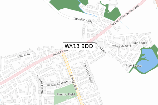
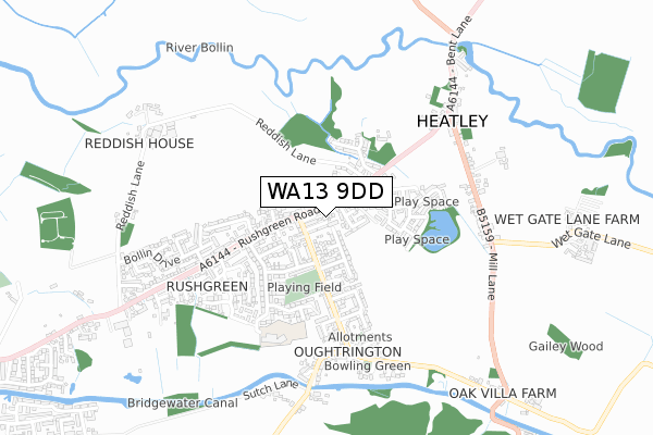
WA13 9DD maps


Licence: Open Government Licence (requires attribution)
Attribution: Contains OS data © Crown copyright and database right 2025
Source: Open Postcode Geo
Licence: Open Government Licence (requires attribution)
Attribution: Contains OS data © Crown copyright and database right 2025; Contains Royal Mail data © Royal Mail copyright and database right 2025; Source: Office for National Statistics licensed under the Open Government Licence v.3.0
WA13 9DD geodata
| Easting | 369755 |
| Northing | 388090 |
| Latitude | 53.388793 |
| Longitude | -2.456223 |
Where is WA13 9DD?
| Country | England |
| Postcode District | WA13 |
Politics
| Ward | Lymm North And Thelwall |
|---|---|
| Constituency | Warrington South |
House Prices
Sales of detached houses in WA13 9DD
2023 20 MAR £627,500 |
6, ELDERFIELD GARDENS, LYMM, WA13 9DD 2019 31 MAY £542,000 |
9, ELDERFIELD GARDENS, LYMM, WA13 9DD 2019 9 MAY £497,500 |
5, ELDERFIELD GARDENS, LYMM, WA13 9DD 2018 14 DEC £542,500 |
1, ELDERFIELD GARDENS, LYMM, WA13 9DD 2018 26 SEP £509,995 |
10, ELDERFIELD GARDENS, LYMM, WA13 9DD 2018 24 SEP £494,453 |
3, ELDERFIELD GARDENS, LYMM, WA13 9DD 2018 23 AUG £554,950 |
2018 21 AUG £545,000 |
2, ELDERFIELD GARDENS, LYMM, WA13 9DD 2018 13 JUL £514,950 |
Licence: Contains HM Land Registry data © Crown copyright and database right 2025. This data is licensed under the Open Government Licence v3.0.
Transport
Nearest bus stops to WA13 9DD
| Sandy Lane | Oughtrington | 128m |
| Sandy Lane (Rushgreen Road) | Rushgreen | 153m |
| Sandy Lane (Rushgreen Road) | Rushgreen | 192m |
| Rushes Meadow (Birch Brook Road) | Heatley | 339m |
| Sandy Lane Post Office (Sandy Lane) | Oughtrington | 356m |
Nearest railway stations to WA13 9DD
| Glazebrook Station | 4.4km |
| Birchwood Station | 5.3km |
Broadband
Broadband access in WA13 9DD (2020 data)
| Percentage of properties with Next Generation Access | 100.0% |
| Percentage of properties with Superfast Broadband | 100.0% |
| Percentage of properties with Ultrafast Broadband | 0.0% |
| Percentage of properties with Full Fibre Broadband | 0.0% |
Superfast Broadband is between 30Mbps and 300Mbps
Ultrafast Broadband is > 300Mbps
Broadband speed in WA13 9DD (2019 data)
Download
| Median download speed | 40.0Mbps |
| Average download speed | 54.7Mbps |
| Maximum download speed | 80.00Mbps |
Upload
| Median upload speed | 10.0Mbps |
| Average upload speed | 14.1Mbps |
| Maximum upload speed | 20.00Mbps |
Broadband limitations in WA13 9DD (2020 data)
| Percentage of properties unable to receive 2Mbps | 0.0% |
| Percentage of properties unable to receive 5Mbps | 0.0% |
| Percentage of properties unable to receive 10Mbps | 0.0% |
| Percentage of properties unable to receive 30Mbps | 0.0% |
Deprivation
5.3% of English postcodes are less deprived than WA13 9DD:Food Standards Agency
Three nearest food hygiene ratings to WA13 9DD (metres)


➜ Get more ratings from the Food Standards Agency
Nearest post box to WA13 9DD
| Last Collection | |||
|---|---|---|---|
| Location | Mon-Fri | Sat | Distance |
| Adey Road | 17:30 | 11:00 | 299m |
| Oughtrington Lane | 16:00 | 12:00 | 388m |
| Birch Brook Road | 17:30 | 11:00 | 631m |
WA13 9DD ITL and WA13 9DD LAU
The below table lists the International Territorial Level (ITL) codes (formerly Nomenclature of Territorial Units for Statistics (NUTS) codes) and Local Administrative Units (LAU) codes for WA13 9DD:
| ITL 1 Code | Name |
|---|---|
| TLD | North West (England) |
| ITL 2 Code | Name |
| TLD6 | Cheshire |
| ITL 3 Code | Name |
| TLD61 | Warrington |
| LAU 1 Code | Name |
| E06000007 | Warrington |
WA13 9DD census areas
The below table lists the Census Output Area (OA), Lower Layer Super Output Area (LSOA), and Middle Layer Super Output Area (MSOA) for WA13 9DD:
| Code | Name | |
|---|---|---|
| OA | E00063143 | |
| LSOA | E01012517 | Warrington 021E |
| MSOA | E02002610 | Warrington 021 |
Nearest postcodes to WA13 9DD
| WA13 9HH | Orchard Road | 61m |
| WA13 9GR | Springbank Gardens | 97m |
| WA13 9HW | Ashfield Close | 99m |
| WA13 9RE | Rushgreen Road | 104m |
| WA13 9HJ | Sandy Lane | 126m |
| WA13 9HQ | Sandy Lane | 127m |
| WA13 9RT | Moore Grove | 130m |
| WA13 9QY | Rushgreen Road | 142m |
| WA13 9RR | Birchbrook Road | 151m |
| WA13 9HN | Cedarfield Road | 152m |