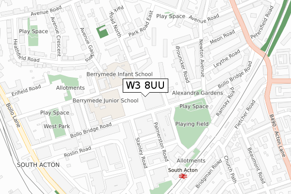
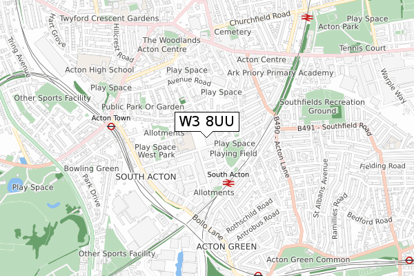
W3 8UU is located in the South Acton electoral ward, within the London borough of Ealing and the English Parliamentary constituency of Ealing Central and Acton. The Sub Integrated Care Board (ICB) Location is NHS North West London ICB - W2U3Z and the police force is Metropolitan Police. This postcode has been in use since January 2018.


GetTheData
Source: OS Open Zoomstack (Ordnance Survey)
Licence: Open Government Licence (requires attribution)
Attribution: Contains OS data © Crown copyright and database right 2024
Source: Open Postcode Geo
Licence: Open Government Licence (requires attribution)
Attribution: Contains OS data © Crown copyright and database right 2024; Contains Royal Mail data © Royal Mail copyright and database right 2024; Source: Office for National Statistics licensed under the Open Government Licence v.3.0
| Easting | 520046 |
| Northing | 179546 |
| Latitude | 51.502111 |
| Longitude | -0.271830 |
GetTheData
Source: Open Postcode Geo
Licence: Open Government Licence
| Country | England |
| Postcode District | W3 |
| ➜ W3 open data dashboard ➜ See where W3 is on a map ➜ Where is Acton? | |
GetTheData
Source: Land Registry Price Paid Data
Licence: Open Government Licence
| Ward | South Acton |
| Constituency | Ealing Central And Acton |
GetTheData
Source: ONS Postcode Database
Licence: Open Government Licence
| January 2024 | Vehicle crime | On or near Beaulieu Place | 495m |
| November 2023 | Anti-social behaviour | On or near Clandon Close | 399m |
| November 2023 | Burglary | On or near Beaulieu Place | 495m |
| ➜ Get more crime data in our Crime section | |||
GetTheData
Source: data.police.uk
Licence: Open Government Licence
| All Saints Road | South Acton | 128m |
| Palmerston Road Stanley Road | South Acton | 128m |
| Palmerston Road Stanley Road | South Acton | 129m |
| Newton Avenue (Bollo Bridge Road) | South Acton | 187m |
| Hanbury Road (Bollo Bridge Road) | South Acton | 277m |
| Acton Town Underground Station | Acton Town | 607m |
| Chiswick Park Underground Station | Chiswick Park | 875m |
| Gunnersbury Underground Station | Gunnersbury | 1,171m |
| Turnham Green Underground Station | Turnham Green | 1,429m |
| Ealing Common Underground Station | Ealing Common | 1,448m |
| South Acton Station | 0.3km |
| Acton Central Station | 1km |
| Gunnersbury Station | 1.2km |
GetTheData
Source: NaPTAN
Licence: Open Government Licence
➜ Broadband speed and availability dashboard for W3 8UU
| Percentage of properties with Next Generation Access | 100.0% |
| Percentage of properties with Superfast Broadband | 100.0% |
| Percentage of properties with Ultrafast Broadband | 100.0% |
| Percentage of properties with Full Fibre Broadband | 100.0% |
Superfast Broadband is between 30Mbps and 300Mbps
Ultrafast Broadband is > 300Mbps
Ofcom does not currently provide download speed data for W3 8UU. This is because there are less than four broadband connections in this postcode.
Ofcom does not currently provide upload speed data for W3 8UU. This is because there are less than four broadband connections in this postcode.
| Percentage of properties unable to receive 2Mbps | 0.0% |
| Percentage of properties unable to receive 5Mbps | 0.0% |
| Percentage of properties unable to receive 10Mbps | 0.0% |
| Percentage of properties unable to receive 30Mbps | 0.0% |
➜ Broadband speed and availability dashboard for W3 8UU
GetTheData
Source: Ofcom
Licence: Ofcom Terms of Use (requires attribution)
GetTheData
Source: ONS Postcode Database
Licence: Open Government Licence


➜ Get more ratings from the Food Standards Agency
GetTheData
Source: Food Standards Agency
Licence: FSA terms & conditions
| Last Collection | |||
|---|---|---|---|
| Location | Mon-Fri | Sat | Distance |
| Bollo Bridge Road | 17:30 | 12:00 | 50m |
| Park Road East | 17:30 | 12:00 | 215m |
| Hanbury Road | 17:30 | 12:00 | 300m |
GetTheData
Source: Dracos
Licence: Creative Commons Attribution-ShareAlike
| Facility | Distance |
|---|---|
| The Wellbeing Centre (Closed) Bollo Bridge Road, London Health and Fitness Gym, Sports Hall | 34m |
| Energie Fitness (Acton) Bollo Bridge Road, London Health and Fitness Gym | 47m |
| Acton Centre High Street, Acton Health and Fitness Gym, Swimming Pool, Studio | 550m |
GetTheData
Source: Active Places
Licence: Open Government Licence
| School | Phase of Education | Distance |
|---|---|---|
| Acton Gardens Primary School Osborne Road, Acton, London, W3 8SJ | Primary | 141m |
| South Acton Childrens Centre Castle Close, Acton, London, W3 8RX | Nursery | 221m |
| Ark Priory Primary Academy Acton Lane, London, W3 8NR | Primary | 484m |
GetTheData
Source: Edubase
Licence: Open Government Licence
The below table lists the International Territorial Level (ITL) codes (formerly Nomenclature of Territorial Units for Statistics (NUTS) codes) and Local Administrative Units (LAU) codes for W3 8UU:
| ITL 1 Code | Name |
|---|---|
| TLI | London |
| ITL 2 Code | Name |
| TLI7 | Outer London - West and North West |
| ITL 3 Code | Name |
| TLI73 | Ealing |
| LAU 1 Code | Name |
| E09000009 | Ealing |
GetTheData
Source: ONS Postcode Directory
Licence: Open Government Licence
The below table lists the Census Output Area (OA), Lower Layer Super Output Area (LSOA), and Middle Layer Super Output Area (MSOA) for W3 8UU:
| Code | Name | |
|---|---|---|
| OA | E00006729 | |
| LSOA | E01001357 | Ealing 033D |
| MSOA | E02000270 | Ealing 033 |
GetTheData
Source: ONS Postcode Directory
Licence: Open Government Licence
| W3 8FL | Bollo Bridge Road | 89m |
| W3 8FT | Stanley Road | 93m |
| W3 8FU | Palmerston Road | 100m |
| W3 8BB | Sunninghill Court | 108m |
| W3 8FB | Packington Road | 130m |
| W3 8FS | All Saints Road | 134m |
| W3 8AF | Brouncker Road | 147m |
| W3 8FR | All Saints Road | 157m |
| W3 8FP | Palmerston Road | 164m |
| W3 8AD | Castle Close | 171m |
GetTheData
Source: Open Postcode Geo; Land Registry Price Paid Data
Licence: Open Government Licence