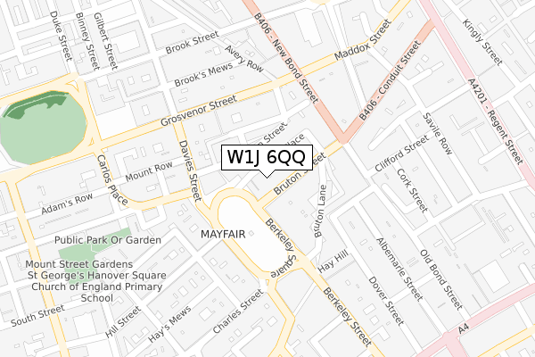
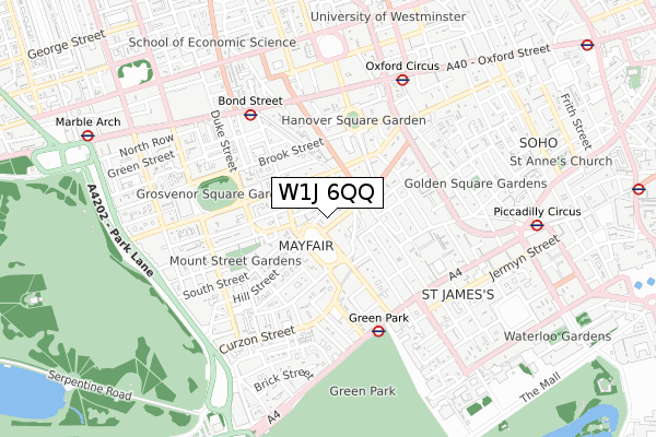
W1J 6QQ is located in the West End electoral ward, within the London borough of Westminster and the English Parliamentary constituency of Cities of London and Westminster. The Sub Integrated Care Board (ICB) Location is NHS North West London ICB - W2U3Z and the police force is Metropolitan Police. This postcode has been in use since February 2018.


GetTheData
Source: OS Open Zoomstack (Ordnance Survey)
Licence: Open Government Licence (requires attribution)
Attribution: Contains OS data © Crown copyright and database right 2024
Source: Open Postcode Geo
Licence: Open Government Licence (requires attribution)
Attribution: Contains OS data © Crown copyright and database right 2024; Contains Royal Mail data © Royal Mail copyright and database right 2024; Source: Office for National Statistics licensed under the Open Government Licence v.3.0
| Easting | 528800 |
| Northing | 180700 |
| Latitude | 51.510558 |
| Longitude | -0.145353 |
GetTheData
Source: Open Postcode Geo
Licence: Open Government Licence
| Country | England |
| Postcode District | W1J |
| ➜ W1J open data dashboard ➜ See where W1J is on a map ➜ Where is City of Westminster? | |
GetTheData
Source: Land Registry Price Paid Data
Licence: Open Government Licence
| Ward | West End |
| Constituency | Cities Of London And Westminster |
GetTheData
Source: ONS Postcode Database
Licence: Open Government Licence
| January 2024 | Other theft | On or near Dering Street | 407m |
| January 2024 | Other theft | On or near Dering Street | 407m |
| January 2024 | Other theft | On or near Dering Street | 407m |
| ➜ Get more crime data in our Crime section | |||
GetTheData
Source: data.police.uk
Licence: Open Government Licence
| Berkeley Square (Bruton Street) | Mayfair | 53m |
| New Bond Street | Mayfair | 123m |
| Berkeley Square | Mayfair | 148m |
| Conduit Street New Bond Street | Mayfair | 228m |
| Conduit Street Saville Row | Oxford Circus | 293m |
| Green Park Underground Station | Green Park | 440m |
| Bond Street Underground Station | Bond Street | 514m |
| Oxford Circus Underground Station | Oxford Circus | 572m |
| Piccadilly Circus Underground Station | Piccadilly Circus | 806m |
| Hyde Park Corner Underground Station | Hyde Park Corner | 970m |
| London Charing Cross Station | 1.5km |
| London Victoria Station | 1.7km |
| London Marylebone Station | 1.8km |
GetTheData
Source: NaPTAN
Licence: Open Government Licence
GetTheData
Source: ONS Postcode Database
Licence: Open Government Licence


➜ Get more ratings from the Food Standards Agency
GetTheData
Source: Food Standards Agency
Licence: FSA terms & conditions
| Last Collection | |||
|---|---|---|---|
| Location | Mon-Fri | Sat | Distance |
| Bruton Street | 18:30 | 12:00 | 66m |
| Hill Street | 18:30 | 12:00 | 135m |
| Berkeley Square | 18:30 | 12:00 | 152m |
GetTheData
Source: Dracos
Licence: Creative Commons Attribution-ShareAlike
| Facility | Distance |
|---|---|
| Fitness First (Berkeley Square) Berkeley Square, London Health and Fitness Gym | 93m |
| Bath & Racquets Club Brook's Mews, London Health and Fitness Gym, Squash Courts | 238m |
| Lansdowne Club Fitzmaurice Place, London Health and Fitness Gym, Swimming Pool, Studio, Squash Courts | 253m |
GetTheData
Source: Active Places
Licence: Open Government Licence
| School | Phase of Education | Distance |
|---|---|---|
| St George's Hanover Square CofE Primary School South Street, London, W1K 2XH | Primary | 381m |
| Eaton Square Senior School 106 Piccadilly, London, W1J 7NL | Not applicable | 599m |
| University of Westminster 309 Regent Street, London, W1B 2UW | Not applicable | 708m |
GetTheData
Source: Edubase
Licence: Open Government Licence
The below table lists the International Territorial Level (ITL) codes (formerly Nomenclature of Territorial Units for Statistics (NUTS) codes) and Local Administrative Units (LAU) codes for W1J 6QQ:
| ITL 1 Code | Name |
|---|---|
| TLI | London |
| ITL 2 Code | Name |
| TLI3 | Inner London - West |
| ITL 3 Code | Name |
| TLI32 | Westminster |
| LAU 1 Code | Name |
| E09000033 | Westminster |
GetTheData
Source: ONS Postcode Directory
Licence: Open Government Licence
The below table lists the Census Output Area (OA), Lower Layer Super Output Area (LSOA), and Middle Layer Super Output Area (MSOA) for W1J 6QQ:
| Code | Name | |
|---|---|---|
| OA | E00175196 | |
| LSOA | E01033595 | Westminster 013E |
| MSOA | E02000972 | Westminster 013 |
GetTheData
Source: ONS Postcode Directory
Licence: Open Government Licence
| W1J 6NU | Bruton Place | 12m |
| W1J 6QG | Bruton Street | 16m |
| W1J 6QF | Bruton Street | 19m |
| W1J 6QE | Bruton Street | 24m |
| W1J 6NZ | Bruton Place | 39m |
| W1J 6NF | Bruton Place | 43m |
| W1J 6NX | Bruton Place | 44m |
| W1K 3PF | Bourdon Street | 45m |
| W1K 3PG | Bourdon Street | 47m |
| W1J 6NT | Bruton Place | 48m |
GetTheData
Source: Open Postcode Geo; Land Registry Price Paid Data
Licence: Open Government Licence