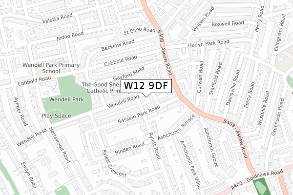
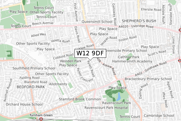
W12 9DF is located in the Wendell Park electoral ward, within the London borough of Hammersmith and Fulham and the English Parliamentary constituency of Hammersmith. The Sub Integrated Care Board (ICB) Location is NHS North West London ICB - W2U3Z and the police force is Metropolitan Police. This postcode has been in use since April 2019.


GetTheData
Source: OS Open Zoomstack (Ordnance Survey)
Licence: Open Government Licence (requires attribution)
Attribution: Contains OS data © Crown copyright and database right 2025
Source: Open Postcode Geo
Licence: Open Government Licence (requires attribution)
Attribution: Contains OS data © Crown copyright and database right 2025; Contains Royal Mail data © Royal Mail copyright and database right 2025; Source: Office for National Statistics licensed under the Open Government Licence v.3.0
| Easting | 521616 |
| Northing | 179397 |
| Latitude | 51.500437 |
| Longitude | -0.249272 |
GetTheData
Source: Open Postcode Geo
Licence: Open Government Licence
| Country | England |
| Postcode District | W12 |
➜ See where W12 is on a map ➜ Where is London? | |
GetTheData
Source: Land Registry Price Paid Data
Licence: Open Government Licence
| Ward | Wendell Park |
| Constituency | Hammersmith |
GetTheData
Source: ONS Postcode Database
Licence: Open Government Licence
9, AUBURY PLACE, LONDON, W12 9DF 2020 27 AUG £4,200,000 |
8, AUBURY PLACE, LONDON, W12 9DF 2020 27 MAR £3,750,000 |
5, AUBURY PLACE, LONDON, W12 9DF 2019 20 DEC £4,150,000 |
GetTheData
Source: HM Land Registry Price Paid Data
Licence: Contains HM Land Registry data © Crown copyright and database right 2025. This data is licensed under the Open Government Licence v3.0.
| Larden Road Factory Quarter | Bedford Park | 324m |
| Larden Road Factory Quarter | Bedford Park | 332m |
| Abinger Road (Bath Road) | Stamford Brook | 386m |
| Flanchford Road (Stamford Brook Road) | Stamford Brook | 392m |
| Abinger Road (Bath Road) | Stamford Brook | 409m |
| Stamford Brook Underground Station | Stamford Brook | 663m |
| Turnham Green Underground Station | Turnham Green | 693m |
| Ravenscourt Park Underground Station | Ravenscourt Park | 1,167m |
| Chiswick Park Underground Station | Chiswick Park | 1,449m |
| Acton Central Station | 1.3km |
| South Acton Station | 1.5km |
| Gunnersbury Station | 2.1km |
GetTheData
Source: NaPTAN
Licence: Open Government Licence
| Percentage of properties with Next Generation Access | 100.0% |
| Percentage of properties with Superfast Broadband | 100.0% |
| Percentage of properties with Ultrafast Broadband | 0.0% |
| Percentage of properties with Full Fibre Broadband | 0.0% |
Superfast Broadband is between 30Mbps and 300Mbps
Ultrafast Broadband is > 300Mbps
| Percentage of properties unable to receive 2Mbps | 0.0% |
| Percentage of properties unable to receive 5Mbps | 0.0% |
| Percentage of properties unable to receive 10Mbps | 0.0% |
| Percentage of properties unable to receive 30Mbps | 0.0% |
GetTheData
Source: Ofcom
Licence: Ofcom Terms of Use (requires attribution)
GetTheData
Source: ONS Postcode Database
Licence: Open Government Licence


➜ Get more ratings from the Food Standards Agency
GetTheData
Source: Food Standards Agency
Licence: FSA terms & conditions
| Last Collection | |||
|---|---|---|---|
| Location | Mon-Fri | Sat | Distance |
| Harswood Road | 17:30 | 12:00 | 114m |
| Woodstock Road | 17:30 | 12:00 | 307m |
| Stamford Brook Road | 17:30 | 12:00 | 326m |
GetTheData
Source: Dracos
Licence: Creative Commons Attribution-ShareAlike
| Risk of W12 9DF flooding from rivers and sea | Very Low |
| ➜ W12 9DF flood map | |
GetTheData
Source: Open Flood Risk by Postcode
Licence: Open Government Licence
The below table lists the International Territorial Level (ITL) codes (formerly Nomenclature of Territorial Units for Statistics (NUTS) codes) and Local Administrative Units (LAU) codes for W12 9DF:
| ITL 1 Code | Name |
|---|---|
| TLI | London |
| ITL 2 Code | Name |
| TLI3 | Inner London - West |
| ITL 3 Code | Name |
| TLI33 | Kensington & Chelsea and Hammersmith & Fulham |
| LAU 1 Code | Name |
| E09000013 | Hammersmith and Fulham |
GetTheData
Source: ONS Postcode Directory
Licence: Open Government Licence
The below table lists the Census Output Area (OA), Lower Layer Super Output Area (LSOA), and Middle Layer Super Output Area (MSOA) for W12 9DF:
| Code | Name | |
|---|---|---|
| OA | E00009677 | |
| LSOA | E01001927 | Hammersmith and Fulham 008C |
| MSOA | E02000379 | Hammersmith and Fulham 008 |
GetTheData
Source: ONS Postcode Directory
Licence: Open Government Licence
| W12 9NE | Hartswood Road | 61m |
| W12 9SD | Wendell Road | 88m |
| W12 9NR | Hartswood Gardens | 92m |
| W12 9NF | Hartswood Road | 93m |
| W12 9TG | Emlyn Road | 109m |
| W12 9TD | Emlyn Road | 125m |
| W12 9SF | Cosmur Close | 140m |
| W12 9SG | Balmoral Mews | 141m |
| W12 9SB | Wendell Road | 151m |
| W12 9TA | Emlyn Road | 169m |
GetTheData
Source: Open Postcode Geo; Land Registry Price Paid Data
Licence: Open Government Licence