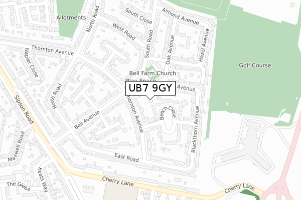
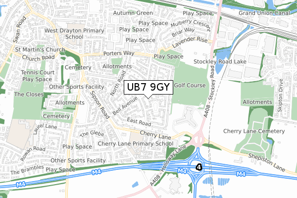
UB7 9GY is located in the West Drayton electoral ward, within the London borough of Hillingdon and the English Parliamentary constituency of Hayes and Harlington. The Sub Integrated Care Board (ICB) Location is NHS North West London ICB - W2U3Z and the police force is Metropolitan Police. This postcode has been in use since January 2019.


GetTheData
Source: OS Open Zoomstack (Ordnance Survey)
Licence: Open Government Licence (requires attribution)
Attribution: Contains OS data © Crown copyright and database right 2024
Source: Open Postcode Geo
Licence: Open Government Licence (requires attribution)
Attribution: Contains OS data © Crown copyright and database right 2024; Contains Royal Mail data © Royal Mail copyright and database right 2024; Source: Office for National Statistics licensed under the Open Government Licence v.3.0
| Easting | 507063 |
| Northing | 179123 |
| Latitude | 51.500916 |
| Longitude | -0.458933 |
GetTheData
Source: Open Postcode Geo
Licence: Open Government Licence
| Country | England |
| Postcode District | UB7 |
| ➜ UB7 open data dashboard ➜ See where UB7 is on a map ➜ Where is West Drayton? | |
GetTheData
Source: Land Registry Price Paid Data
Licence: Open Government Licence
| Ward | West Drayton |
| Constituency | Hayes And Harlington |
GetTheData
Source: ONS Postcode Database
Licence: Open Government Licence
| January 2024 | Violence and sexual offences | On or near North Road | 289m |
| January 2024 | Criminal damage and arson | On or near North Road | 289m |
| January 2024 | Anti-social behaviour | On or near North Road | 289m |
| ➜ Get more crime data in our Crime section | |||
GetTheData
Source: data.police.uk
Licence: Open Government Licence
| Cherry Lane Schools | Sipson | 286m |
| Cherry Lane Schools | Sipson | 292m |
| Crowne Plaza Heathrow | Sipson | 373m |
| Maxwell Road | West Drayton | 375m |
| North Road (Ub7) (Porters Way) | West Drayton | 400m |
| West Drayton Station | 1.4km |
| Hayes & Harlington Station | 2.7km |
| Heathrow Terminals 1-3 Station | 3.3km |
GetTheData
Source: NaPTAN
Licence: Open Government Licence
| Percentage of properties with Next Generation Access | 0.0% |
| Percentage of properties with Superfast Broadband | 0.0% |
| Percentage of properties with Ultrafast Broadband | 0.0% |
| Percentage of properties with Full Fibre Broadband | 0.0% |
Superfast Broadband is between 30Mbps and 300Mbps
Ultrafast Broadband is > 300Mbps
| Percentage of properties unable to receive 2Mbps | 0.0% |
| Percentage of properties unable to receive 5Mbps | 0.0% |
| Percentage of properties unable to receive 10Mbps | 0.0% |
| Percentage of properties unable to receive 30Mbps | 100.0% |
GetTheData
Source: Ofcom
Licence: Ofcom Terms of Use (requires attribution)
GetTheData
Source: ONS Postcode Database
Licence: Open Government Licence


➜ Get more ratings from the Food Standards Agency
GetTheData
Source: Food Standards Agency
Licence: FSA terms & conditions
| Last Collection | |||
|---|---|---|---|
| Location | Mon-Fri | Sat | Distance |
| Mulberry Parade Post Office | 17:15 | 12:00 | 897m |
| West Drayton Post Office | 17:10 | 12:00 | 1,255m |
| Bourne Avenue | 16:45 | 13:00 | 1,259m |
GetTheData
Source: Dracos
Licence: Creative Commons Attribution-ShareAlike
| Facility | Distance |
|---|---|
| Heathpark Golf Club (Closed) Stockley Road, West Drayton Golf | 352m |
| West Drayton Youth Football Club (Cherry Lane) Cherry Lane, West Drayton Grass Pitches, Sports Hall | 362m |
| Spirit Health Club (Heathrow) Stockley Road, West Drayton Swimming Pool, Health and Fitness Gym | 362m |
GetTheData
Source: Active Places
Licence: Open Government Licence
| School | Phase of Education | Distance |
|---|---|---|
| Cherry Lane Primary School Sipson Road, West Drayton, UB7 9DL | Primary | 437m |
| West Drayton Academy Kingston Lane, West Drayton, UB7 9EA | Primary | 711m |
| Laurel Lane Primary School Laurel Lane, West Drayton, UB7 7TX | Primary | 1km |
GetTheData
Source: Edubase
Licence: Open Government Licence
The below table lists the International Territorial Level (ITL) codes (formerly Nomenclature of Territorial Units for Statistics (NUTS) codes) and Local Administrative Units (LAU) codes for UB7 9GY:
| ITL 1 Code | Name |
|---|---|
| TLI | London |
| ITL 2 Code | Name |
| TLI7 | Outer London - West and North West |
| ITL 3 Code | Name |
| TLI74 | Harrow and Hillingdon |
| LAU 1 Code | Name |
| E09000017 | Hillingdon |
GetTheData
Source: ONS Postcode Directory
Licence: Open Government Licence
The below table lists the Census Output Area (OA), Lower Layer Super Output Area (LSOA), and Middle Layer Super Output Area (MSOA) for UB7 9GY:
| Code | Name | |
|---|---|---|
| OA | E00012573 | |
| LSOA | E01002528 | Hillingdon 028D |
| MSOA | E02000521 | Hillingdon 028 |
GetTheData
Source: ONS Postcode Directory
Licence: Open Government Licence
| UB7 9ES | Fir Tree Avenue | 39m |
| UB7 9JY | Thornton Avenue | 79m |
| UB7 9LW | South Road | 112m |
| UB7 9ER | Oak Avenue | 115m |
| UB7 9ET | Fir Tree Avenue | 123m |
| UB7 9LJ | Bell Avenue | 124m |
| UB7 9JZ | Thornton Avenue | 131m |
| UB7 9LQ | Beech Close | 132m |
| UB7 9EW | Walnut Avenue | 145m |
| UB7 9LL | Myrtle Close | 169m |
GetTheData
Source: Open Postcode Geo; Land Registry Price Paid Data
Licence: Open Government Licence