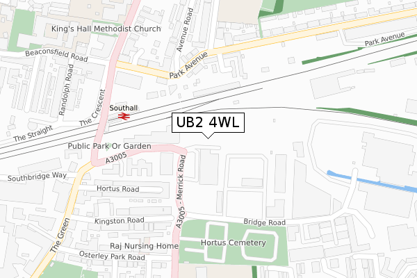
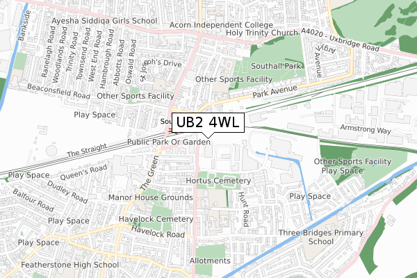
UB2 4WL is located in the Norwood Green electoral ward, within the London borough of Ealing and the English Parliamentary constituency of Ealing, Southall. The Sub Integrated Care Board (ICB) Location is NHS North West London ICB - W2U3Z and the police force is Metropolitan Police. This postcode has been in use since July 2019.


GetTheData
Source: OS Open Zoomstack (Ordnance Survey)
Licence: Open Government Licence (requires attribution)
Attribution: Contains OS data © Crown copyright and database right 2024
Source: Open Postcode Geo
Licence: Open Government Licence (requires attribution)
Attribution: Contains OS data © Crown copyright and database right 2024; Contains Royal Mail data © Royal Mail copyright and database right 2024; Source: Office for National Statistics licensed under the Open Government Licence v.3.0
| Easting | 512842 |
| Northing | 179771 |
| Latitude | 51.505616 |
| Longitude | -0.375503 |
GetTheData
Source: Open Postcode Geo
Licence: Open Government Licence
| Country | England |
| Postcode District | UB2 |
| ➜ UB2 open data dashboard ➜ See where UB2 is on a map ➜ Where is Southall? | |
GetTheData
Source: Land Registry Price Paid Data
Licence: Open Government Licence
| Ward | Norwood Green |
| Constituency | Ealing, Southall |
GetTheData
Source: ONS Postcode Database
Licence: Open Government Licence
| January 2024 | Anti-social behaviour | On or near Avenue Road | 375m |
| January 2024 | Vehicle crime | On or near Hanson Gardens | 414m |
| January 2024 | Violence and sexual offences | On or near Hanson Gardens | 414m |
| ➜ Get more crime data in our Crime section | |||
GetTheData
Source: data.police.uk
Licence: Open Government Licence
| Bridge Road (Ub2) | Southall | 83m |
| The Green (Ub2) (Merrick Road) | Southall | 123m |
| Southall Station | Southall | 233m |
| Southall Station (The Green) | Southall | 236m |
| Park Avenue (Ub1) | Southall | 292m |
| Southall Station | 0.2km |
| Hanwell Station | 2.7km |
| Hayes & Harlington Station | 3.1km |
GetTheData
Source: NaPTAN
Licence: Open Government Licence
| Percentage of properties with Next Generation Access | 100.0% |
| Percentage of properties with Superfast Broadband | 100.0% |
| Percentage of properties with Ultrafast Broadband | 100.0% |
| Percentage of properties with Full Fibre Broadband | 100.0% |
Superfast Broadband is between 30Mbps and 300Mbps
Ultrafast Broadband is > 300Mbps
| Percentage of properties unable to receive 2Mbps | 0.0% |
| Percentage of properties unable to receive 5Mbps | 0.0% |
| Percentage of properties unable to receive 10Mbps | 0.0% |
| Percentage of properties unable to receive 30Mbps | 0.0% |
GetTheData
Source: Ofcom
Licence: Ofcom Terms of Use (requires attribution)
GetTheData
Source: ONS Postcode Database
Licence: Open Government Licence


➜ Get more ratings from the Food Standards Agency
GetTheData
Source: Food Standards Agency
Licence: FSA terms & conditions
| Last Collection | |||
|---|---|---|---|
| Location | Mon-Fri | Sat | Distance |
| Southall Delivery Office | 19:00 | 12:45 | 292m |
| The Green | 17:15 | 11:45 | 394m |
| Hunt Road Post Office | 19:00 | 12:30 | 474m |
GetTheData
Source: Dracos
Licence: Creative Commons Attribution-ShareAlike
| Facility | Distance |
|---|---|
| Southall Community Centre (Closed) Merrick Road, Southall Sports Hall | 70m |
| The Gym Group (London Southall) The Green, Southall Health and Fitness Gym | 345m |
| Swift Road Outdoor Sports Centre Swift Road, Southall Artificial Grass Pitch | 401m |
GetTheData
Source: Active Places
Licence: Open Government Licence
| School | Phase of Education | Distance |
|---|---|---|
| Ayesha Siddiqa Girls School 165-169 The Broadway, Southall, UB1 1LS | Not applicable | 293m |
| Hambrough Primary School South Road, Southall, Middlesex, UB1 1SF | Primary | 357m |
| Villiers High School Boyd Avenue, Southall, UB1 3BT | Secondary | 369m |
GetTheData
Source: Edubase
Licence: Open Government Licence
The below table lists the International Territorial Level (ITL) codes (formerly Nomenclature of Territorial Units for Statistics (NUTS) codes) and Local Administrative Units (LAU) codes for UB2 4WL:
| ITL 1 Code | Name |
|---|---|
| TLI | London |
| ITL 2 Code | Name |
| TLI7 | Outer London - West and North West |
| ITL 3 Code | Name |
| TLI73 | Ealing |
| LAU 1 Code | Name |
| E09000009 | Ealing |
GetTheData
Source: ONS Postcode Directory
Licence: Open Government Licence
The below table lists the Census Output Area (OA), Lower Layer Super Output Area (LSOA), and Middle Layer Super Output Area (MSOA) for UB2 4WL:
| Code | Name | |
|---|---|---|
| OA | E00006647 | |
| LSOA | E01001338 | Ealing 029E |
| MSOA | E02000266 | Ealing 029 |
GetTheData
Source: ONS Postcode Directory
Licence: Open Government Licence
| UB2 4AU | Merrick Road | 150m |
| UB1 3AH | Park Avenue | 194m |
| UB1 3AQ | Park Avenue | 195m |
| UB2 4AJ | Hortus Road | 197m |
| UB1 3BW | Avenue Road | 208m |
| UB2 4AL | Hortus Road | 221m |
| UB2 4AW | Kingston Road | 238m |
| UB1 1BE | The Crescent | 269m |
| UB2 4AP | Kingston Road | 271m |
| UB1 3BS | Villiers Road | 286m |
GetTheData
Source: Open Postcode Geo; Land Registry Price Paid Data
Licence: Open Government Licence