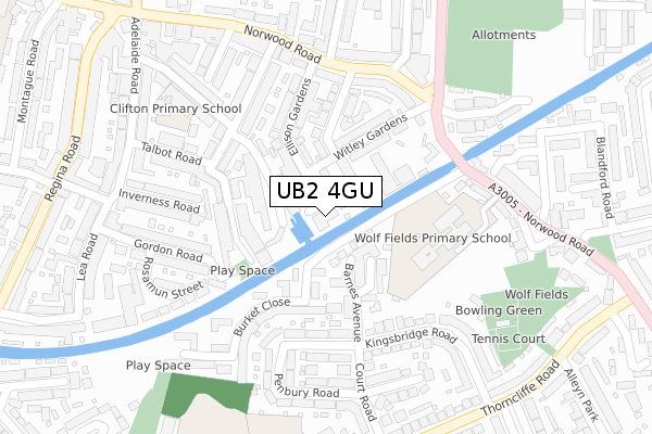
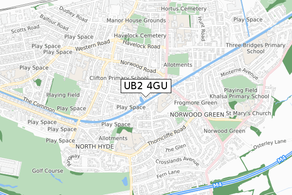
UB2 4GU is located in the Norwood Green electoral ward, within the London borough of Ealing and the English Parliamentary constituency of Ealing, Southall. The Sub Integrated Care Board (ICB) Location is NHS North West London ICB - W2U3Z and the police force is Metropolitan Police. This postcode has been in use since December 2018.


GetTheData
Source: OS Open Zoomstack (Ordnance Survey)
Licence: Open Government Licence (requires attribution)
Attribution: Contains OS data © Crown copyright and database right 2024
Source: Open Postcode Geo
Licence: Open Government Licence (requires attribution)
Attribution: Contains OS data © Crown copyright and database right 2024; Contains Royal Mail data © Royal Mail copyright and database right 2024; Source: Office for National Statistics licensed under the Open Government Licence v.3.0
| Easting | 512608 |
| Northing | 178755 |
| Latitude | 51.496531 |
| Longitude | -0.379197 |
GetTheData
Source: Open Postcode Geo
Licence: Open Government Licence
| Country | England |
| Postcode District | UB2 |
| ➜ UB2 open data dashboard ➜ See where UB2 is on a map ➜ Where is Southall? | |
GetTheData
Source: Land Registry Price Paid Data
Licence: Open Government Licence
| Ward | Norwood Green |
| Constituency | Ealing, Southall |
GetTheData
Source: ONS Postcode Database
Licence: Open Government Licence
| January 2024 | Vehicle crime | On or near Parking Area | 381m |
| January 2024 | Other theft | On or near Parking Area | 435m |
| December 2023 | Burglary | On or near Court Road | 291m |
| ➜ Get more crime data in our Crime section | |||
GetTheData
Source: data.police.uk
Licence: Open Government Licence
| Norwood Gardens | Norwood Green | 229m |
| Norwood Gardens (Norwood Road) | Norwood Green | 239m |
| Harewood Terrace | Norwood Green | 276m |
| Norwood Road (Ub2) | Norwood Green | 321m |
| Harewood Terrace | Norwood Green | 324m |
| Southall Station | 1km |
| Hayes & Harlington Station | 3km |
| Hanwell Station | 3.3km |
GetTheData
Source: NaPTAN
Licence: Open Government Licence
| Percentage of properties with Next Generation Access | 100.0% |
| Percentage of properties with Superfast Broadband | 100.0% |
| Percentage of properties with Ultrafast Broadband | 100.0% |
| Percentage of properties with Full Fibre Broadband | 100.0% |
Superfast Broadband is between 30Mbps and 300Mbps
Ultrafast Broadband is > 300Mbps
| Percentage of properties unable to receive 2Mbps | 0.0% |
| Percentage of properties unable to receive 5Mbps | 0.0% |
| Percentage of properties unable to receive 10Mbps | 0.0% |
| Percentage of properties unable to receive 30Mbps | 0.0% |
GetTheData
Source: Ofcom
Licence: Ofcom Terms of Use (requires attribution)
GetTheData
Source: ONS Postcode Database
Licence: Open Government Licence


➜ Get more ratings from the Food Standards Agency
GetTheData
Source: Food Standards Agency
Licence: FSA terms & conditions
| Last Collection | |||
|---|---|---|---|
| Location | Mon-Fri | Sat | Distance |
| Rectory Road | 17:45 | 12:15 | 246m |
| George Street | 17:45 | 12:00 | 337m |
| Norwood Green Post Office | 17:00 | 12:15 | 343m |
GetTheData
Source: Dracos
Licence: Creative Commons Attribution-ShareAlike
| Facility | Distance |
|---|---|
| Clifton Primary School Clifton Road, Southall Sports Hall | 284m |
| Wolf Fields Norwood Road, Southall Outdoor Tennis Courts | 322m |
| Bixley Field Willowbrook Road, Southall Grass Pitches | 417m |
GetTheData
Source: Active Places
Licence: Open Government Licence
| School | Phase of Education | Distance |
|---|---|---|
| Clifton Primary School Clifton Road, Southall, UB2 5QP | Primary | 286m |
| Wolf Fields Primary School Norwood Road, Norwood Green, Southall, UB2 4JS | Primary | 305m |
| Norwood Green Junior School Thorncliffe Road, Southall, UB2 5RN | Primary | 414m |
GetTheData
Source: Edubase
Licence: Open Government Licence
The below table lists the International Territorial Level (ITL) codes (formerly Nomenclature of Territorial Units for Statistics (NUTS) codes) and Local Administrative Units (LAU) codes for UB2 4GU:
| ITL 1 Code | Name |
|---|---|
| TLI | London |
| ITL 2 Code | Name |
| TLI7 | Outer London - West and North West |
| ITL 3 Code | Name |
| TLI73 | Ealing |
| LAU 1 Code | Name |
| E09000009 | Ealing |
GetTheData
Source: ONS Postcode Directory
Licence: Open Government Licence
The below table lists the Census Output Area (OA), Lower Layer Super Output Area (LSOA), and Middle Layer Super Output Area (MSOA) for UB2 4GU:
| Code | Name | |
|---|---|---|
| OA | E00006798 | |
| LSOA | E01001372 | Ealing 037F |
| MSOA | E02000274 | Ealing 037 |
GetTheData
Source: ONS Postcode Directory
Licence: Open Government Licence
| UB2 5SB | Barnes Avenue | 64m |
| UB2 4EZ | Witley Industrial Estate | 66m |
| UB2 5UX | Jessop Avenue | 100m |
| UB2 5TB | Barnes Avenue | 101m |
| UB2 5TD | Barnes Avenue | 102m |
| UB2 5QR | Endsleigh Industrial Estate | 110m |
| UB2 5QF | Salisbury Road | 123m |
| UB2 5QJ | Salisbury Road | 123m |
| UB2 5NU | Burket Close | 127m |
| UB2 4ES | Witley Gardens | 129m |
GetTheData
Source: Open Postcode Geo; Land Registry Price Paid Data
Licence: Open Government Licence