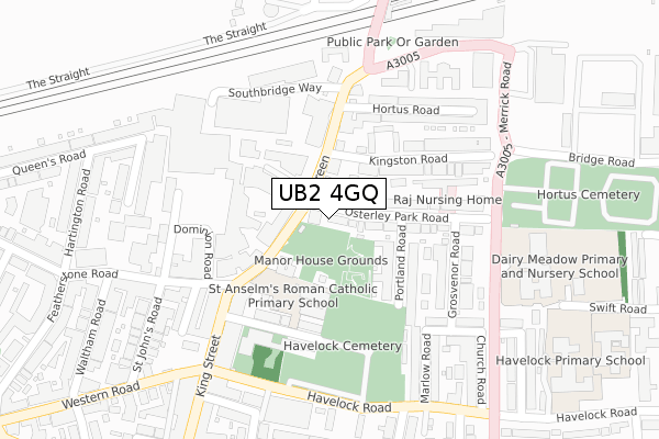
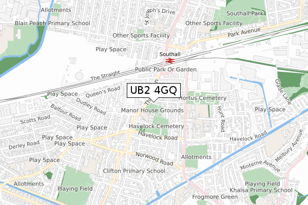
UB2 4GQ is located in the Southall Green electoral ward, within the London borough of Ealing and the English Parliamentary constituency of Ealing, Southall. The Sub Integrated Care Board (ICB) Location is NHS North West London ICB - W2U3Z and the police force is Metropolitan Police. This postcode has been in use since January 2019.


GetTheData
Source: OS Open Zoomstack (Ordnance Survey)
Licence: Open Government Licence (requires attribution)
Attribution: Contains OS data © Crown copyright and database right 2024
Source: Open Postcode Geo
Licence: Open Government Licence (requires attribution)
Attribution: Contains OS data © Crown copyright and database right 2024; Contains Royal Mail data © Royal Mail copyright and database right 2024; Source: Office for National Statistics licensed under the Open Government Licence v.3.0
| Easting | 512538 |
| Northing | 179478 |
| Latitude | 51.503043 |
| Longitude | -0.379975 |
GetTheData
Source: Open Postcode Geo
Licence: Open Government Licence
| Country | England |
| Postcode District | UB2 |
| ➜ UB2 open data dashboard ➜ See where UB2 is on a map ➜ Where is Southall? | |
GetTheData
Source: Land Registry Price Paid Data
Licence: Open Government Licence
| Ward | Southall Green |
| Constituency | Ealing, Southall |
GetTheData
Source: ONS Postcode Database
Licence: Open Government Licence
| January 2024 | Violence and sexual offences | On or near Parking Area | 199m |
| January 2024 | Other theft | On or near Parking Area | 415m |
| January 2024 | Vehicle crime | On or near Parking Area | 421m |
| ➜ Get more crime data in our Crime section | |||
GetTheData
Source: data.police.uk
Licence: Open Government Licence
| The Green | Southall | 72m |
| The Green | Southall | 117m |
| King Street (Ub2) (King Street) | Southall | 237m |
| Southall Station (The Green) | Southall | 265m |
| Havelock Rd Norwood Green (Havelock Road) | Norwood Green | 273m |
| Southall Station | 0.3km |
| Hayes & Harlington Station | 2.8km |
| Hanwell Station | 3km |
GetTheData
Source: NaPTAN
Licence: Open Government Licence
➜ Broadband speed and availability dashboard for UB2 4GQ
| Percentage of properties with Next Generation Access | 100.0% |
| Percentage of properties with Superfast Broadband | 100.0% |
| Percentage of properties with Ultrafast Broadband | 0.0% |
| Percentage of properties with Full Fibre Broadband | 0.0% |
Superfast Broadband is between 30Mbps and 300Mbps
Ultrafast Broadband is > 300Mbps
| Median download speed | 39.9Mbps |
| Average download speed | 46.3Mbps |
| Maximum download speed | 80.00Mbps |
| Median upload speed | 10.0Mbps |
| Average upload speed | 10.9Mbps |
| Maximum upload speed | 20.00Mbps |
| Percentage of properties unable to receive 2Mbps | 0.0% |
| Percentage of properties unable to receive 5Mbps | 0.0% |
| Percentage of properties unable to receive 10Mbps | 0.0% |
| Percentage of properties unable to receive 30Mbps | 0.0% |
➜ Broadband speed and availability dashboard for UB2 4GQ
GetTheData
Source: Ofcom
Licence: Ofcom Terms of Use (requires attribution)
GetTheData
Source: ONS Postcode Database
Licence: Open Government Licence


➜ Get more ratings from the Food Standards Agency
GetTheData
Source: Food Standards Agency
Licence: FSA terms & conditions
| Last Collection | |||
|---|---|---|---|
| Location | Mon-Fri | Sat | Distance |
| The Green | 17:15 | 11:45 | 57m |
| King Street Post Office | 19:00 | 12:30 | 222m |
| Windsor Road | 17:00 | 12:30 | 259m |
GetTheData
Source: Dracos
Licence: Creative Commons Attribution-ShareAlike
| Facility | Distance |
|---|---|
| The Gym Group (London Southall) The Green, Southall Health and Fitness Gym | 158m |
| Southall Community Centre (Closed) Merrick Road, Southall Sports Hall | 372m |
| Swift Road Outdoor Sports Centre Swift Road, Southall Artificial Grass Pitch | 391m |
GetTheData
Source: Active Places
Licence: Open Government Licence
| School | Phase of Education | Distance |
|---|---|---|
| St Anselm's Catholic Primary School Church Avenue, Southall, UB2 4DH | Primary | 119m |
| Havelock Primary School, Nursery & Arp Havelock Road, Southall, UB2 4PA | Primary | 426m |
| The Sybil Elgar School The National Autistic Society, Havelock Road, Southall, UB2 4NY | Not applicable | 476m |
GetTheData
Source: Edubase
Licence: Open Government Licence
The below table lists the International Territorial Level (ITL) codes (formerly Nomenclature of Territorial Units for Statistics (NUTS) codes) and Local Administrative Units (LAU) codes for UB2 4GQ:
| ITL 1 Code | Name |
|---|---|
| TLI | London |
| ITL 2 Code | Name |
| TLI7 | Outer London - West and North West |
| ITL 3 Code | Name |
| TLI73 | Ealing |
| LAU 1 Code | Name |
| E09000009 | Ealing |
GetTheData
Source: ONS Postcode Directory
Licence: Open Government Licence
The below table lists the Census Output Area (OA), Lower Layer Super Output Area (LSOA), and Middle Layer Super Output Area (MSOA) for UB2 4GQ:
| Code | Name | |
|---|---|---|
| OA | E00006649 | |
| LSOA | E01001333 | Ealing 038A |
| MSOA | E02000275 | Ealing 038 |
GetTheData
Source: ONS Postcode Directory
Licence: Open Government Licence
| UB2 4AR | The Green | 48m |
| UB2 5AF | Drayside Mews | 66m |
| UB2 4BL | Osterley Park Road | 90m |
| UB2 4BG | The Green | 107m |
| UB2 4AN | The Green | 127m |
| UB2 4BQ | The Green | 141m |
| UB2 4BX | Portland Road | 149m |
| UB2 4BN | Osterley Park Road | 158m |
| UB2 4AP | Kingston Road | 160m |
| UB2 4DH | Church Avenue | 168m |
GetTheData
Source: Open Postcode Geo; Land Registry Price Paid Data
Licence: Open Government Licence