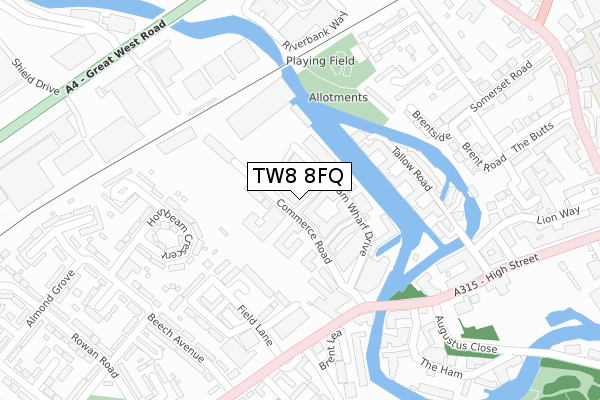
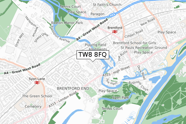
TW8 8FQ is located in the Syon & Brentford Lock electoral ward, within the London borough of Hounslow and the English Parliamentary constituency of Brentford and Isleworth. The Sub Integrated Care Board (ICB) Location is NHS North West London ICB - W2U3Z and the police force is Metropolitan Police. This postcode has been in use since September 2018.


GetTheData
Source: OS Open Zoomstack (Ordnance Survey)
Licence: Open Government Licence (requires attribution)
Attribution: Contains OS data © Crown copyright and database right 2024
Source: Open Postcode Geo
Licence: Open Government Licence (requires attribution)
Attribution: Contains OS data © Crown copyright and database right 2024; Contains Royal Mail data © Royal Mail copyright and database right 2024; Source: Office for National Statistics licensed under the Open Government Licence v.3.0
| Easting | 517162 |
| Northing | 177466 |
| Latitude | 51.484021 |
| Longitude | -0.314051 |
GetTheData
Source: Open Postcode Geo
Licence: Open Government Licence
| Country | England |
| Postcode District | TW8 |
| ➜ TW8 open data dashboard ➜ See where TW8 is on a map ➜ Where is London? | |
GetTheData
Source: Land Registry Price Paid Data
Licence: Open Government Licence
| Ward | Syon & Brentford Lock |
| Constituency | Brentford And Isleworth |
GetTheData
Source: ONS Postcode Database
Licence: Open Government Licence
| December 2023 | Burglary | On or near Church Walk | 374m |
| December 2023 | Vehicle crime | On or near Church Walk | 374m |
| October 2023 | Other theft | On or near Church Walk | 374m |
| ➜ Get more crime data in our Crime section | |||
GetTheData
Source: data.police.uk
Licence: Open Government Licence
| Brentford Bus Depot (Commerce Road) | Brentford End | 99m |
| Commerce Road Brentford Lock (Commerce Road) | Brentford End | 131m |
| Commerce Road Brentford Lock (Commerce Road) | Brentford End | 148m |
| Brent Lea (London Road) | Brentford End | 199m |
| Brent Lea (London Road) | Brentford End | 259m |
| Boston Manor Underground Station | Boston Manor | 1,496m |
| Brentford Station | 0.5km |
| Syon Lane Station | 0.8km |
| Isleworth Station | 1.9km |
GetTheData
Source: NaPTAN
Licence: Open Government Licence
| Percentage of properties with Next Generation Access | 100.0% |
| Percentage of properties with Superfast Broadband | 100.0% |
| Percentage of properties with Ultrafast Broadband | 100.0% |
| Percentage of properties with Full Fibre Broadband | 100.0% |
Superfast Broadband is between 30Mbps and 300Mbps
Ultrafast Broadband is > 300Mbps
| Percentage of properties unable to receive 2Mbps | 0.0% |
| Percentage of properties unable to receive 5Mbps | 0.0% |
| Percentage of properties unable to receive 10Mbps | 0.0% |
| Percentage of properties unable to receive 30Mbps | 0.0% |
GetTheData
Source: Ofcom
Licence: Ofcom Terms of Use (requires attribution)
GetTheData
Source: ONS Postcode Database
Licence: Open Government Licence


➜ Get more ratings from the Food Standards Agency
GetTheData
Source: Food Standards Agency
Licence: FSA terms & conditions
| Last Collection | |||
|---|---|---|---|
| Location | Mon-Fri | Sat | Distance |
| Brentford Bridge And | 18:30 | 11:15 | 143m |
| 50 London Road | 18:30 | 11:15 | 298m |
| Somerset Road | 17:00 | 11:30 | 356m |
GetTheData
Source: Dracos
Licence: Creative Commons Attribution-ShareAlike
| Facility | Distance |
|---|---|
| Kallima Spa (London Syon Park) London Road, Brentford Health and Fitness Gym, Swimming Pool | 461m |
| Brentford School For Girls Boston Manor Road, Brentford Sports Hall | 531m |
| Topnotch Health Club (Brentford) (Closed) Windsor Close, Brentford Health and Fitness Gym, Studio, Squash Courts | 586m |
GetTheData
Source: Active Places
Licence: Open Government Licence
| School | Phase of Education | Distance |
|---|---|---|
| Brentford School for Girls 5 Boston Manor Road, Brentford, TW8 0PG | Secondary | 554m |
| St Paul's CofE Primary School St Paul's Road, Brentford, TW8 0PN | Primary | 640m |
| Our Lady and St John's Catholic Primary School Boston Park Road, Brentford, TW8 9JF | Primary | 729m |
GetTheData
Source: Edubase
Licence: Open Government Licence
The below table lists the International Territorial Level (ITL) codes (formerly Nomenclature of Territorial Units for Statistics (NUTS) codes) and Local Administrative Units (LAU) codes for TW8 8FQ:
| ITL 1 Code | Name |
|---|---|
| TLI | London |
| ITL 2 Code | Name |
| TLI7 | Outer London - West and North West |
| ITL 3 Code | Name |
| TLI75 | Hounslow and Richmond upon Thames |
| LAU 1 Code | Name |
| E09000018 | Hounslow |
GetTheData
Source: ONS Postcode Directory
Licence: Open Government Licence
The below table lists the Census Output Area (OA), Lower Layer Super Output Area (LSOA), and Middle Layer Super Output Area (MSOA) for TW8 8FQ:
| Code | Name | |
|---|---|---|
| OA | E00168195 | |
| LSOA | E01002684 | Hounslow 006D |
| MSOA | E02000531 | Hounslow 006 |
GetTheData
Source: ONS Postcode Directory
Licence: Open Government Licence
| TW8 8FH | Durham Wharf Drive | 56m |
| TW8 8LG | Brentford Business Centre | 65m |
| TW8 8FD | Narrowboat Avenue | 91m |
| TW8 8FB | Durham Wharf Drive | 92m |
| TW8 8NA | Field Lane | 141m |
| TW8 8HR | Durham Wharf Drive | 143m |
| TW8 8ET | Tallow Road | 144m |
| TW8 8HP | Durham Wharf Drive | 153m |
| TW8 8ER | Tallow Road | 161m |
| TW8 8JN | Brickfield Close | 189m |
GetTheData
Source: Open Postcode Geo; Land Registry Price Paid Data
Licence: Open Government Licence