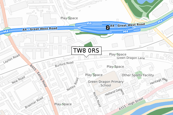
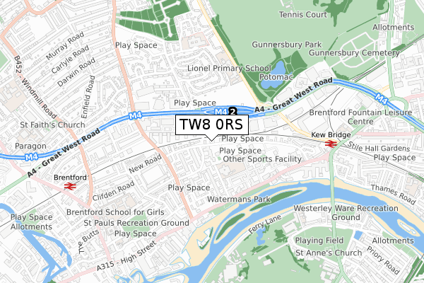
TW8 0RS is located in the Brentford East electoral ward, within the London borough of Hounslow and the English Parliamentary constituency of Brentford and Isleworth. The Sub Integrated Care Board (ICB) Location is NHS North West London ICB - W2U3Z and the police force is Metropolitan Police. This postcode has been in use since October 2017.


GetTheData
Source: OS Open Zoomstack (Ordnance Survey)
Licence: Open Government Licence (requires attribution)
Attribution: Contains OS data © Crown copyright and database right 2024
Source: Open Postcode Geo
Licence: Open Government Licence (requires attribution)
Attribution: Contains OS data © Crown copyright and database right 2024; Contains Royal Mail data © Royal Mail copyright and database right 2024; Source: Office for National Statistics licensed under the Open Government Licence v.3.0
| Easting | 518292 |
| Northing | 178139 |
| Latitude | 51.489835 |
| Longitude | -0.297560 |
GetTheData
Source: Open Postcode Geo
Licence: Open Government Licence
| Country | England |
| Postcode District | TW8 |
| ➜ TW8 open data dashboard ➜ See where TW8 is on a map ➜ Where is Brentford? | |
GetTheData
Source: Land Registry Price Paid Data
Licence: Open Government Licence
| Ward | Brentford East |
| Constituency | Brentford And Isleworth |
GetTheData
Source: ONS Postcode Database
Licence: Open Government Licence
| January 2024 | Vehicle crime | On or near Crowther Avenue | 383m |
| January 2024 | Vehicle crime | On or near Crowther Avenue | 383m |
| January 2024 | Violence and sexual offences | On or near Crowther Avenue | 383m |
| ➜ Get more crime data in our Crime section | |||
GetTheData
Source: data.police.uk
Licence: Open Government Licence
| Clayponds Avenue (Great West Road) | Brentford | 233m |
| Great West Quarter | Brentford | 261m |
| Clayponds Avenue | Brentford | 263m |
| New Road (Tw8) | Brentford | 284m |
| New Road (Tw8) | Brentford | 291m |
| South Ealing Underground Station | South Ealing | 1,418m |
| Northfields Underground Station | Northfields | 1,590m |
| Kew Gardens Underground Station | Kew Gardens | 1,660m |
| Acton Town Underground Station | Acton Town | 1,891m |
| Kew Bridge Station | 0.7km |
| Brentford Station | 0.9km |
| Gunnersbury Station | 1.6km |
GetTheData
Source: NaPTAN
Licence: Open Government Licence
GetTheData
Source: ONS Postcode Database
Licence: Open Government Licence


➜ Get more ratings from the Food Standards Agency
GetTheData
Source: Food Standards Agency
Licence: FSA terms & conditions
| Last Collection | |||
|---|---|---|---|
| Location | Mon-Fri | Sat | Distance |
| Netley Road | 17:15 | 11:45 | 285m |
| Ealing Road | 17:45 | 12:15 | 303m |
| Claypond Avenue | 17:00 | 11:15 | 394m |
GetTheData
Source: Dracos
Licence: Creative Commons Attribution-ShareAlike
| Facility | Distance |
|---|---|
| Cruyff Court Brentford Towers Pump House Crescent, Pump House Crescent, Brentford Artificial Grass Pitch | 317m |
| Carville Hall Park North Carville Crescent, Brentford Grass Pitches | 324m |
| Brentford Fc (Griffin Park) (Closed) Braemar Road, Brentford Grass Pitches | 417m |
GetTheData
Source: Active Places
Licence: Open Government Licence
| School | Phase of Education | Distance |
|---|---|---|
| Green Dragon Primary School North Road, Green Dragon Primary School, Brentford, TW8 0BJ | Primary | 237m |
| Lionel Primary School Lionel Road North, Brentford, TW8 9QT | Primary | 452m |
| Kew Green Preparatory School Layton House, Ferry Lane, Kew Green, Richmond, TW9 3AF | Not applicable | 682m |
GetTheData
Source: Edubase
Licence: Open Government Licence
The below table lists the International Territorial Level (ITL) codes (formerly Nomenclature of Territorial Units for Statistics (NUTS) codes) and Local Administrative Units (LAU) codes for TW8 0RS:
| ITL 1 Code | Name |
|---|---|
| TLI | London |
| ITL 2 Code | Name |
| TLI7 | Outer London - West and North West |
| ITL 3 Code | Name |
| TLI75 | Hounslow and Richmond upon Thames |
| LAU 1 Code | Name |
| E09000018 | Hounslow |
GetTheData
Source: ONS Postcode Directory
Licence: Open Government Licence
The below table lists the Census Output Area (OA), Lower Layer Super Output Area (LSOA), and Middle Layer Super Output Area (MSOA) for TW8 0RS:
| Code | Name | |
|---|---|---|
| OA | E00168186 | |
| LSOA | E01002568 | Hounslow 003D |
| MSOA | E02000528 | Hounslow 003 |
GetTheData
Source: ONS Postcode Directory
Licence: Open Government Licence
| TW8 0BN | Clayponds Lane | 54m |
| TW8 0DA | Green Dragon Lane | 81m |
| TW8 0DB | Green Dragon Lane | 81m |
| TW8 0GW | Clayponds Lane | 96m |
| TW8 0GU | Clayponds Lane | 120m |
| TW8 0HY | Green Dragon Lane | 122m |
| TW8 0BL | Clayponds Lane | 132m |
| TW8 0DL | Green Dragon Lane | 132m |
| TW8 0GT | Clayponds Lane | 134m |
| TW8 0GX | Clayponds Lane | 143m |
GetTheData
Source: Open Postcode Geo; Land Registry Price Paid Data
Licence: Open Government Licence