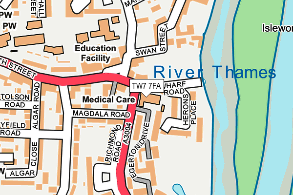
TW7 7FA is located in the Isleworth electoral ward, within the London borough of Hounslow and the English Parliamentary constituency of Brentford and Isleworth. The Sub Integrated Care Board (ICB) Location is NHS North West London ICB - W2U3Z and the police force is Metropolitan Police. This postcode has been in use since May 2017.


GetTheData
Source: OS OpenMap – Local (Ordnance Survey)
Source: OS VectorMap District (Ordnance Survey)
Licence: Open Government Licence (requires attribution)
| Easting | 516525 |
| Northing | 175690 |
| Latitude | 51.468190 |
| Longitude | -0.323806 |
GetTheData
Source: Open Postcode Geo
Licence: Open Government Licence
| Country | England |
| Postcode District | TW7 |
| ➜ TW7 open data dashboard ➜ See where TW7 is on a map ➜ Where is Isleworth? | |
GetTheData
Source: Land Registry Price Paid Data
Licence: Open Government Licence
| Ward | Isleworth |
| Constituency | Brentford And Isleworth |
GetTheData
Source: ONS Postcode Database
Licence: Open Government Licence
| December 2023 | Criminal damage and arson | On or near Algar Road | 228m |
| December 2023 | Violence and sexual offences | On or near Algar Road | 228m |
| December 2023 | Burglary | On or near Parking Area | 287m |
| ➜ Get more crime data in our Crime section | |||
GetTheData
Source: data.police.uk
Licence: Open Government Licence
| South Street (Tw7) (South Street) | Isleworth | 112m |
| Richmond Road Queens Terrace | Isleworth | 113m |
| South Street (Tw7) | Isleworth | 124m |
| Richmond Road Queens Terrace | Isleworth | 236m |
| Talbot Road St Margarets Rd (St Margarets Road) | St Margarets | 351m |
| Isleworth Station | 1.2km |
| St Margarets (London) Station | 1.5km |
| Syon Lane Station | 1.5km |
GetTheData
Source: NaPTAN
Licence: Open Government Licence
➜ Broadband speed and availability dashboard for TW7 7FA
| Percentage of properties with Next Generation Access | 100.0% |
| Percentage of properties with Superfast Broadband | 100.0% |
| Percentage of properties with Ultrafast Broadband | 0.0% |
| Percentage of properties with Full Fibre Broadband | 0.0% |
Superfast Broadband is between 30Mbps and 300Mbps
Ultrafast Broadband is > 300Mbps
| Median download speed | 47.7Mbps |
| Average download speed | 43.9Mbps |
| Maximum download speed | 80.00Mbps |
| Median upload speed | 10.6Mbps |
| Average upload speed | 10.4Mbps |
| Maximum upload speed | 20.00Mbps |
| Percentage of properties unable to receive 2Mbps | 0.0% |
| Percentage of properties unable to receive 5Mbps | 0.0% |
| Percentage of properties unable to receive 10Mbps | 0.0% |
| Percentage of properties unable to receive 30Mbps | 0.0% |
➜ Broadband speed and availability dashboard for TW7 7FA
GetTheData
Source: Ofcom
Licence: Ofcom Terms of Use (requires attribution)
GetTheData
Source: ONS Postcode Database
Licence: Open Government Licence


➜ Get more ratings from the Food Standards Agency
GetTheData
Source: Food Standards Agency
Licence: FSA terms & conditions
| Last Collection | |||
|---|---|---|---|
| Location | Mon-Fri | Sat | Distance |
| Old Isleworth | 17:30 | 12:00 | 103m |
| Twickenham Road / St John's Road | 17:30 | 11:45 | 424m |
| 385 St Margaret's Road | 17:00 | 11:00 | 446m |
GetTheData
Source: Dracos
Licence: Creative Commons Attribution-ShareAlike
| Facility | Distance |
|---|---|
| La Fitness (Isleworth) (Closed) Swan Street, Isleworth Health and Fitness Gym, Studio | 77m |
| The Blue School Cofe Primary North Street, Isleworth Sports Hall, Artificial Grass Pitch | 158m |
| Gumley House Convent School St. Johns Road, Isleworth Sports Hall, Artificial Grass Pitch, Studio, Outdoor Tennis Courts | 461m |
GetTheData
Source: Active Places
Licence: Open Government Licence
| School | Phase of Education | Distance |
|---|---|---|
| The Blue School CofE Primary North Street, Isleworth, TW7 6RQ | Primary | 158m |
| St Mary's Catholic Primary School, Isleworth South Street, Isleworth, TW7 7EE | Primary | 264m |
| Worple Primary School Queens Terrace, Isleworth, TW7 7DB | Primary | 287m |
GetTheData
Source: Edubase
Licence: Open Government Licence
The below table lists the International Territorial Level (ITL) codes (formerly Nomenclature of Territorial Units for Statistics (NUTS) codes) and Local Administrative Units (LAU) codes for TW7 7FA:
| ITL 1 Code | Name |
|---|---|
| TLI | London |
| ITL 2 Code | Name |
| TLI7 | Outer London - West and North West |
| ITL 3 Code | Name |
| TLI75 | Hounslow and Richmond upon Thames |
| LAU 1 Code | Name |
| E09000018 | Hounslow |
GetTheData
Source: ONS Postcode Directory
Licence: Open Government Licence
The below table lists the Census Output Area (OA), Lower Layer Super Output Area (LSOA), and Middle Layer Super Output Area (MSOA) for TW7 7FA:
| Code | Name | |
|---|---|---|
| OA | E00013275 | |
| LSOA | E01002667 | Hounslow 020A |
| MSOA | E02000545 | Hounslow 020 |
GetTheData
Source: ONS Postcode Directory
Licence: Open Government Licence
| TW7 7BL | Richmond Road | 44m |
| TW7 7DE | Shrewsbury Walk | 82m |
| TW7 6XA | Swan Street | 84m |
| TW7 7BE | Herons Place | 102m |
| TW7 7DD | Magdala Road | 111m |
| TW7 7BG | South Street | 114m |
| TW7 6RG | Lawrence Parade | 122m |
| TW7 6RJ | Swan Street | 140m |
| TW7 7AL | South Street | 153m |
| TW7 6XH | Lower Square | 155m |
GetTheData
Source: Open Postcode Geo; Land Registry Price Paid Data
Licence: Open Government Licence