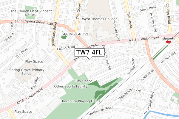
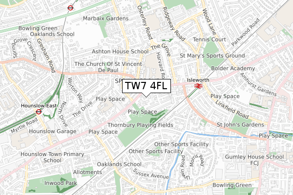
TW7 4FL is located in the Osterley & Spring Grove electoral ward, within the London borough of Hounslow and the English Parliamentary constituency of Brentford and Isleworth. The Sub Integrated Care Board (ICB) Location is NHS North West London ICB - W2U3Z and the police force is Metropolitan Police. This postcode has been in use since April 2018.


GetTheData
Source: OS Open Zoomstack (Ordnance Survey)
Licence: Open Government Licence (requires attribution)
Attribution: Contains OS data © Crown copyright and database right 2024
Source: Open Postcode Geo
Licence: Open Government Licence (requires attribution)
Attribution: Contains OS data © Crown copyright and database right 2024; Contains Royal Mail data © Royal Mail copyright and database right 2024; Source: Office for National Statistics licensed under the Open Government Licence v.3.0
| Easting | 515160 |
| Northing | 176318 |
| Latitude | 51.474114 |
| Longitude | -0.343244 |
GetTheData
Source: Open Postcode Geo
Licence: Open Government Licence
| Country | England |
| Postcode District | TW7 |
| ➜ TW7 open data dashboard ➜ See where TW7 is on a map ➜ Where is London? | |
GetTheData
Source: Land Registry Price Paid Data
Licence: Open Government Licence
| Ward | Osterley & Spring Grove |
| Constituency | Brentford And Isleworth |
GetTheData
Source: ONS Postcode Database
Licence: Open Government Licence
| January 2024 | Anti-social behaviour | On or near Star Road | 382m |
| January 2024 | Theft from the person | On or near Parking Area | 400m |
| December 2023 | Anti-social behaviour | On or near Star Road | 382m |
| ➜ Get more crime data in our Crime section | |||
GetTheData
Source: data.police.uk
Licence: Open Government Licence
| West Thames College | Spring Grove | 92m |
| Thornbury Road | Isleworth | 97m |
| West Thames College | Spring Grove | 122m |
| Witham Road | Lampton | 314m |
| Star Road London Road | Isleworth | 321m |
| Hounslow East Underground Station | Hounslow East | 923m |
| Osterley Underground Station | Osterley | 1,011m |
| Isleworth Station | 0.4km |
| Syon Lane Station | 1.5km |
| Hounslow Station | 1.9km |
GetTheData
Source: NaPTAN
Licence: Open Government Licence
➜ Broadband speed and availability dashboard for TW7 4FL
| Percentage of properties with Next Generation Access | 100.0% |
| Percentage of properties with Superfast Broadband | 100.0% |
| Percentage of properties with Ultrafast Broadband | 0.0% |
| Percentage of properties with Full Fibre Broadband | 0.0% |
Superfast Broadband is between 30Mbps and 300Mbps
Ultrafast Broadband is > 300Mbps
| Median download speed | 60.3Mbps |
| Average download speed | 53.1Mbps |
| Maximum download speed | 80.00Mbps |
| Median upload speed | 18.6Mbps |
| Average upload speed | 14.3Mbps |
| Maximum upload speed | 20.00Mbps |
| Percentage of properties unable to receive 2Mbps | 0.0% |
| Percentage of properties unable to receive 5Mbps | 0.0% |
| Percentage of properties unable to receive 10Mbps | 0.0% |
| Percentage of properties unable to receive 30Mbps | 0.0% |
➜ Broadband speed and availability dashboard for TW7 4FL
GetTheData
Source: Ofcom
Licence: Ofcom Terms of Use (requires attribution)
GetTheData
Source: ONS Postcode Database
Licence: Open Government Licence


➜ Get more ratings from the Food Standards Agency
GetTheData
Source: Food Standards Agency
Licence: FSA terms & conditions
| Last Collection | |||
|---|---|---|---|
| Location | Mon-Fri | Sat | Distance |
| Spring Grove Road | 17:00 | 11:15 | 84m |
| Woodlands Gardens | 17:30 | 11:30 | 341m |
| Post Office, 477 London Road | 18:30 | 11:45 | 378m |
GetTheData
Source: Dracos
Licence: Creative Commons Attribution-ShareAlike
| Facility | Distance |
|---|---|
| West Thames College London Road, Isleworth Health and Fitness Gym, Sports Hall, Artificial Grass Pitch, Studio, Grass Pitches | 142m |
| Oaklands School (Closed) Woodlands Road, Isleworth Sports Hall, Health and Fitness Gym, Artificial Grass Pitch | 623m |
| The Memorial Ground Wood Lane, Isleworth Grass Pitches | 684m |
GetTheData
Source: Active Places
Licence: Open Government Licence
| School | Phase of Education | Distance |
|---|---|---|
| West Thames College London Road, Isleworth, TW7 4HS | 16 plus | 142m |
| Spring Grove Primary School Star Road, Isleworth, TW7 4HB | Primary | 377m |
| Ashton House School 50-52 Eversley Crescent, Isleworth, Middlesex, TW7 4LW | Not applicable | 423m |
GetTheData
Source: Edubase
Licence: Open Government Licence
The below table lists the International Territorial Level (ITL) codes (formerly Nomenclature of Territorial Units for Statistics (NUTS) codes) and Local Administrative Units (LAU) codes for TW7 4FL:
| ITL 1 Code | Name |
|---|---|
| TLI | London |
| ITL 2 Code | Name |
| TLI7 | Outer London - West and North West |
| ITL 3 Code | Name |
| TLI75 | Hounslow and Richmond upon Thames |
| LAU 1 Code | Name |
| E09000018 | Hounslow |
GetTheData
Source: ONS Postcode Directory
Licence: Open Government Licence
The below table lists the Census Output Area (OA), Lower Layer Super Output Area (LSOA), and Middle Layer Super Output Area (MSOA) for TW7 4FL:
| Code | Name | |
|---|---|---|
| OA | E00013301 | |
| LSOA | E01002677 | Hounslow 015E |
| MSOA | E02000540 | Hounslow 015 |
GetTheData
Source: ONS Postcode Directory
Licence: Open Government Licence
| TW7 4EJ | London Road | 43m |
| TW7 4FA | London Road | 59m |
| TW7 4EP | London Road | 79m |
| TW7 4DR | Sidmouth Avenue | 98m |
| TW7 4HL | Clifton Road | 110m |
| TW7 4DN | Sidmouth Avenue | 111m |
| TW7 4HP | London Road | 124m |
| TW7 4EA | London Road | 124m |
| TW7 4HQ | Thornbury Road | 155m |
| TW7 4DW | Sidmouth Avenue | 157m |
GetTheData
Source: Open Postcode Geo; Land Registry Price Paid Data
Licence: Open Government Licence