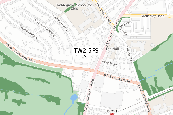
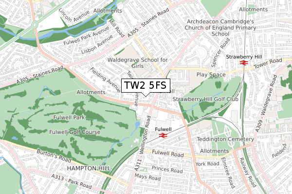
TW2 5FS is located in the West Twickenham electoral ward, within the London borough of Richmond upon Thames and the English Parliamentary constituency of Twickenham. The Sub Integrated Care Board (ICB) Location is NHS South West London ICB - 36L and the police force is Metropolitan Police. This postcode has been in use since April 2019.


GetTheData
Source: OS Open Zoomstack (Ordnance Survey)
Licence: Open Government Licence (requires attribution)
Attribution: Contains OS data © Crown copyright and database right 2024
Source: Open Postcode Geo
Licence: Open Government Licence (requires attribution)
Attribution: Contains OS data © Crown copyright and database right 2024; Contains Royal Mail data © Royal Mail copyright and database right 2024; Source: Office for National Statistics licensed under the Open Government Licence v.3.0
| Easting | 514681 |
| Northing | 172156 |
| Latitude | 51.436804 |
| Longitude | -0.351486 |
GetTheData
Source: Open Postcode Geo
Licence: Open Government Licence
| Country | England |
| Postcode District | TW2 |
| ➜ TW2 open data dashboard ➜ See where TW2 is on a map ➜ Where is Twickenham? | |
GetTheData
Source: Land Registry Price Paid Data
Licence: Open Government Licence
| Ward | West Twickenham |
| Constituency | Twickenham |
GetTheData
Source: ONS Postcode Database
Licence: Open Government Licence
| January 2024 | Anti-social behaviour | On or near Twining Avenue | 282m |
| December 2023 | Violence and sexual offences | On or near Twining Avenue | 282m |
| December 2023 | Violence and sexual offences | On or near Twining Avenue | 282m |
| ➜ Get more crime data in our Crime section | |||
GetTheData
Source: data.police.uk
Licence: Open Government Licence
| Fulwell Sixth Cross Road (Hampton Road) | Strawberry Hill | 76m |
| Fulwell Sixth Cross Road (Hampton Road) | Strawberry Hill | 97m |
| South Road Fulwell (South Road) | Fulwell | 185m |
| South Road Fulwell (South Road) | Fulwell | 185m |
| Fulwell | Fulwell | 187m |
| Fulwell Station | 0.3km |
| Strawberry Hill Station | 0.9km |
| Whitton Station | 1.5km |
GetTheData
Source: NaPTAN
Licence: Open Government Licence
| Percentage of properties with Next Generation Access | 100.0% |
| Percentage of properties with Superfast Broadband | 100.0% |
| Percentage of properties with Ultrafast Broadband | 100.0% |
| Percentage of properties with Full Fibre Broadband | 0.0% |
Superfast Broadband is between 30Mbps and 300Mbps
Ultrafast Broadband is > 300Mbps
| Percentage of properties unable to receive 2Mbps | 0.0% |
| Percentage of properties unable to receive 5Mbps | 0.0% |
| Percentage of properties unable to receive 10Mbps | 0.0% |
| Percentage of properties unable to receive 30Mbps | 0.0% |
GetTheData
Source: Ofcom
Licence: Ofcom Terms of Use (requires attribution)
GetTheData
Source: ONS Postcode Database
Licence: Open Government Licence


➜ Get more ratings from the Food Standards Agency
GetTheData
Source: Food Standards Agency
Licence: FSA terms & conditions
| Last Collection | |||
|---|---|---|---|
| Location | Mon-Fri | Sat | Distance |
| Post Office, 224 Hampton Road | 17:15 | 12:15 | 86m |
| Hampton Road | 17:15 | 11:15 | 256m |
| Sixth Cross Road | 17:00 | 11:00 | 376m |
GetTheData
Source: Dracos
Licence: Creative Commons Attribution-ShareAlike
| Facility | Distance |
|---|---|
| Twickenham Brunswick Club For Young People Clarendon Crescent, Twickenham Sports Hall, Studio | 145m |
| The Mall School Hampton Road, Twickenham Sports Hall, Swimming Pool | 155m |
| Waldegrave School Fifth Cross Road, Twickenham Health and Fitness Gym, Grass Pitches, Sports Hall, Studio, Outdoor Tennis Courts | 294m |
GetTheData
Source: Active Places
Licence: Open Government Licence
| School | Phase of Education | Distance |
|---|---|---|
| The Mall School 185 Hampton Road, Twickenham, TW2 5NQ | Not applicable | 174m |
| Waldegrave School Fifth Cross Road, Twickenham, TW2 5LH | Secondary | 295m |
| St James's Roman Catholic Primary School 260 Stanley Road, Twickenham, TW2 5NP | Primary | 358m |
GetTheData
Source: Edubase
Licence: Open Government Licence
The below table lists the International Territorial Level (ITL) codes (formerly Nomenclature of Territorial Units for Statistics (NUTS) codes) and Local Administrative Units (LAU) codes for TW2 5FS:
| ITL 1 Code | Name |
|---|---|
| TLI | London |
| ITL 2 Code | Name |
| TLI7 | Outer London - West and North West |
| ITL 3 Code | Name |
| TLI75 | Hounslow and Richmond upon Thames |
| LAU 1 Code | Name |
| E09000027 | Richmond upon Thames |
GetTheData
Source: ONS Postcode Directory
Licence: Open Government Licence
The below table lists the Census Output Area (OA), Lower Layer Super Output Area (LSOA), and Middle Layer Super Output Area (MSOA) for TW2 5FS:
| Code | Name | |
|---|---|---|
| OA | E00019637 | |
| LSOA | E01003900 | Richmond upon Thames 015C |
| MSOA | E02000798 | Richmond upon Thames 015 |
GetTheData
Source: ONS Postcode Directory
Licence: Open Government Licence
| TW2 5NJ | Hampton Road | 63m |
| TW2 5LN | Clarendon Crescent | 81m |
| TW2 5LW | Twining Avenue | 83m |
| TW2 5PB | Sixth Cross Road | 106m |
| TW2 5NG | Hampton Road | 107m |
| TW2 5PG | Natalie Mews | 145m |
| TW2 5ND | Brunswick Close | 157m |
| TW2 5NH | Grove Road | 158m |
| TW2 5LP | Twining Avenue | 161m |
| TW2 5NN | Queen Annes Close | 181m |
GetTheData
Source: Open Postcode Geo; Land Registry Price Paid Data
Licence: Open Government Licence